This hike of 28 km with 1650 ascent climbs the famous Pelister Peak (2601 m) in Pelister National Park from an unusual direction: from the village Arvati at Lake Prespa, instead using one of the more common routes starting near Bitola (which we previously did twice without a GPS).
Note that some parts of this hike not always follow a clear path, but are rather freestyle. Sometimes I was walking on what seemed like a clear small trail, then lost it for a moment, to find it back a few minutes later. With the use of a GPS this is no problem of course. I started this hike early at 06:30 h on a warm day in August 2020. It was about 1 hour driving from Ohrid to the village Arvati.

There is a monastery named Uspenie na Sveti Bogorodica (the Dormition of the Holy Mother of God) in Arvati, which was closed. There is an open building on the premises where some painted icons are displayed.
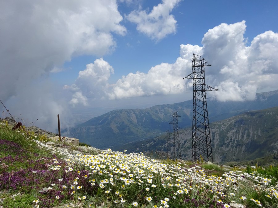
The hike starts on a clear 4×4 dirt track, then enters a forest area and takes you along a small brook. It may be difficult to get a good GPS signal during this part in the forest. Both my Fenix 1 watch and Garmin InReach Mini had problems but the Oregon 700 kept doing its job. I made a waypoint where you should keep right instead of following the more obvious 4×4 road.

Arvati to Pelister Peak 
Arvati to Pelister Peak
When you leave the forest, there is a field with large stones. A bit further it was quite difficult to find the right trail to get to the other side of a small brook, because the path was so overgrown with weeds. Sticking to the GPS track helped a lot!

After about 9 km the climbing finally stops (for a while) and the next 3 km are relatively flat. During this flat part the top of the Partizanski peak (2310 m) seems to invite you to climb it as well, but I resisted its call to save my energy for Pelister peak (2601 m) and followed the 4×4 road around it.

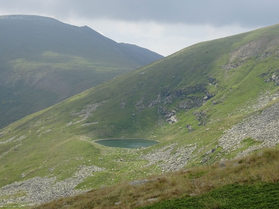
Behind the Partizanski peak you’ll get a good view of one of the so-called Pelister Eyes, Malo Ezero (Small Lake). The other glacial lake, Golemo Ezero, is on the other side of the ridge. You could try to descent to the Small Lake, but I didn’t and instead walked freestyle parallel to the marked trail that connects Peleister peak with the Small Lake, until I joined the marked trail. From there it’s another 300 m ascent to Pelister peak.
There’s a manned antenna station at the peak and there were several other hikers (all coming from direction Bitola). We had some chats and lunch, I had to decline several offers to drink rakija together.

The descent back to Arvati contains more freestyle parts without a clear trail than the ascent, but still is very good walkable. I carefully passed a flock of sheep, almost convinced that this time the feared shepherd dogs were not around. But of course the dogs were around and they suddenly came barking after me. So I speeded up and luckily they lost interest.
Close to the end you descent through a field of ferns and subsequently through forest and 4×4 dirt tracks back to Arvati.

This was a very good hike, excellent views and an interesting alternative approach to climb Pelister peak. Despite the lack of a clear trail at some places it is very well do-able and I would rate this hike with 5 out of 5 stars.
You can view and download the GPS track of this hike here: https://www.wikiloc.com/hiking-trails/arvati-pelister-peak-in-pelister-national-park-55331495

