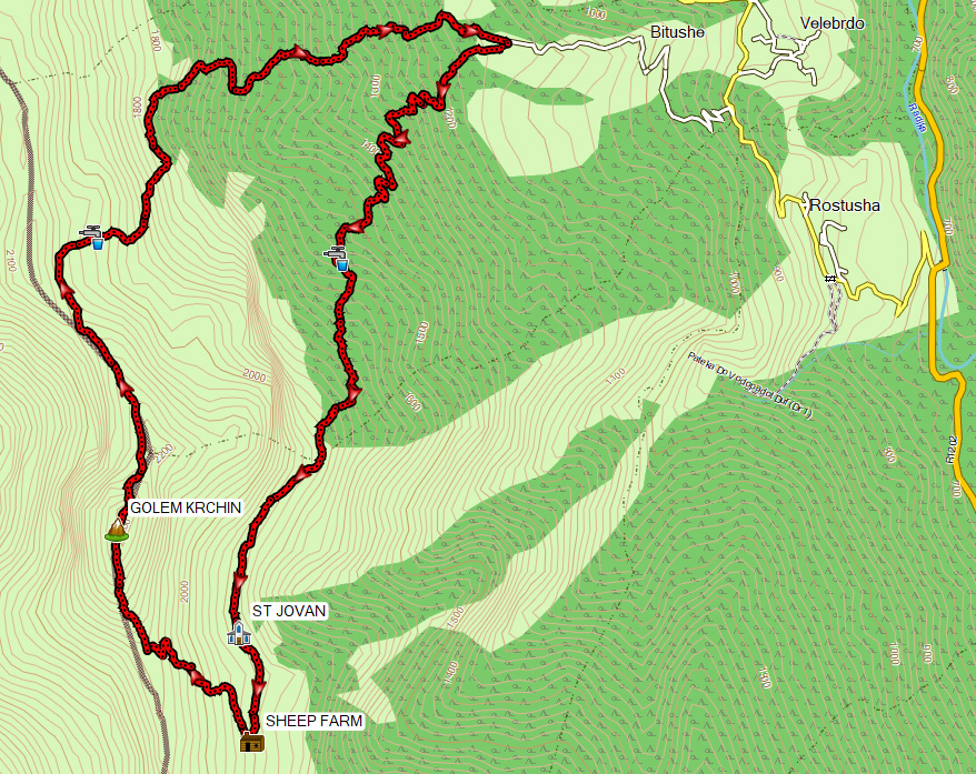
This 13 km hike starts near the village Bituse (Bitushe) in Mavrovo National Park.
The hike starts at a place called “Draga” (1130 m) above the village Bituse. There is an old military building and a football field with goals. At this place there was also a sign describing this and other trails in the neighborhood.
It first goes uphill to the Golem Krchin (Big Krchin) peak at 2343 m altitude, right at the border with Albania. The first 7.5 km you will climb about 1200 m, after that you descent again for the remaining 5.5 km.
This hike was based on the 10 km long GPS track #15 from mkdmount.org (nowadays off-line). This original GPS track can be viewed here in more detail: www.alltrails.com.

The trail to Golem Krchin Peak is well marked, the red/white marking starts at the end of the football field. Since the marking was so clear, we decided to follow the marking instead of the above mentioned GPS track from mkdmount.org. This was a good choice because the marked trail was not as steep uphill as the GPS track.
The first part of the trail goes through a cool forest. Once above the treeline there’s a very nice view. Just before to the small church of St Jovan we encountered a flock of sheep. We made sure that the shepherd saw us and could call off his dogs. Never try to approach sheep and dogs when there’s no shepherd around, the dogs may be quite dangerous!
The shepherds were very friendly and invited us to taste some fresh cheese at their farm about 10 minutes from the Church of St Jovan (due to this my GPS track deviates a bit from the official marked trail at this point).

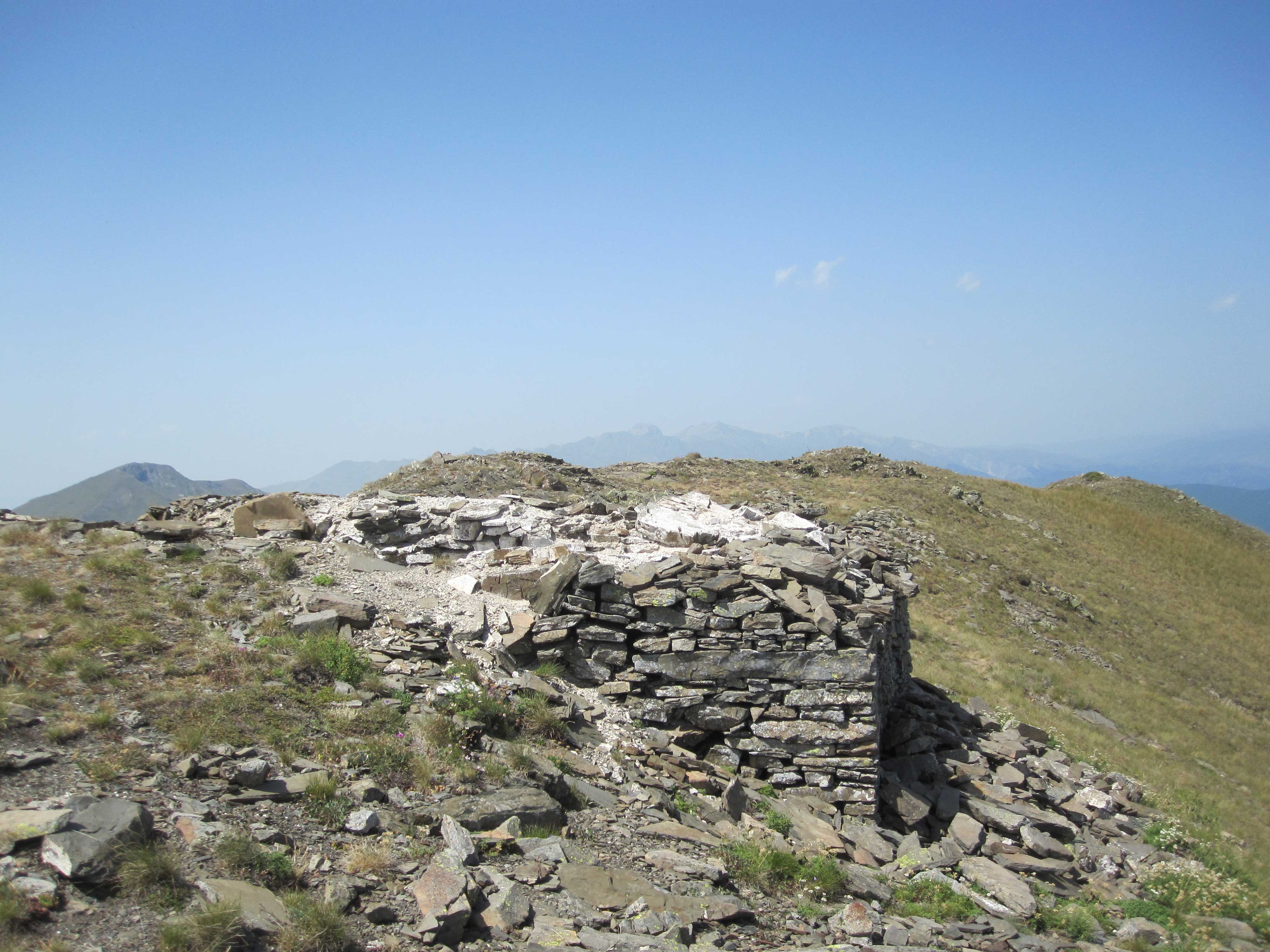
Now it was just steep uphill to the top. One of the shepherds walked a bit uphill together with us, which was nice so he could call off the dogs. At the top there are the ruins of another church that is standing half in Macedonia and half in Albania.
Downhill from the top we followed GPS track #15 from mkdmount.org again. Note that this track does not really follow a trail but goes more or less “freestyle” downhill. It was not always very clear how to walk exactly, so feel free to improvise at some points, like we had to do as well. It was quite steep at some places, and high shoes and walking sticks are therefore recommended. Also: Just after the top it was not clear to us to walk left or right along a rock formation at the ridge. We went around it left, along a steep ravine, and maybe it would have been safer to pass the rock formation at the right.
If you don’t feel like this freestyle descent, you of course can walk back the same way you came and follow the marked trail…
The complete hike took us 8 hours, including the breaks and the pleasant stop at the sheep-farm. Our base was Ohrid, which is a 2 hour drive by car from the start of the Golem Krchin hike. This hike gets 4 our of 5 points.
For hiking in Mavrovo NP you need to register and buy a ticket. Tickets can be obtained online (https://npmavrovo.mk/tickets) or at the information center just outside of Mavrovi Anovi.
At this link you can have a look at my GPS track and download it: https://www.wikiloc.com/hiking-trails/krcin-peak-in-mavrovo-national-park-7546682