
This 17 km walk with about 680 m ascent is not really intended as a hike but more like an adventure/attempt to combine a visit to two archeological sites with some hiking. As a hike, it was not the best trail around, but combined with “discovering” some ancient places it was a very interesting tour!

I found the hike from Brazda to Markov Kamen at Wikiloc.com: (https://www.wikiloc.com/hiking-trails/brazda-markov-kamen-94048288) including some pictures of the archaeological site near Brazda. Although Brazda is just 15 km from Skopje, I had never heard about this archaeological site with a tomb from the 5th or 4th century BC! You can read more about the tomb below the description of the hike.
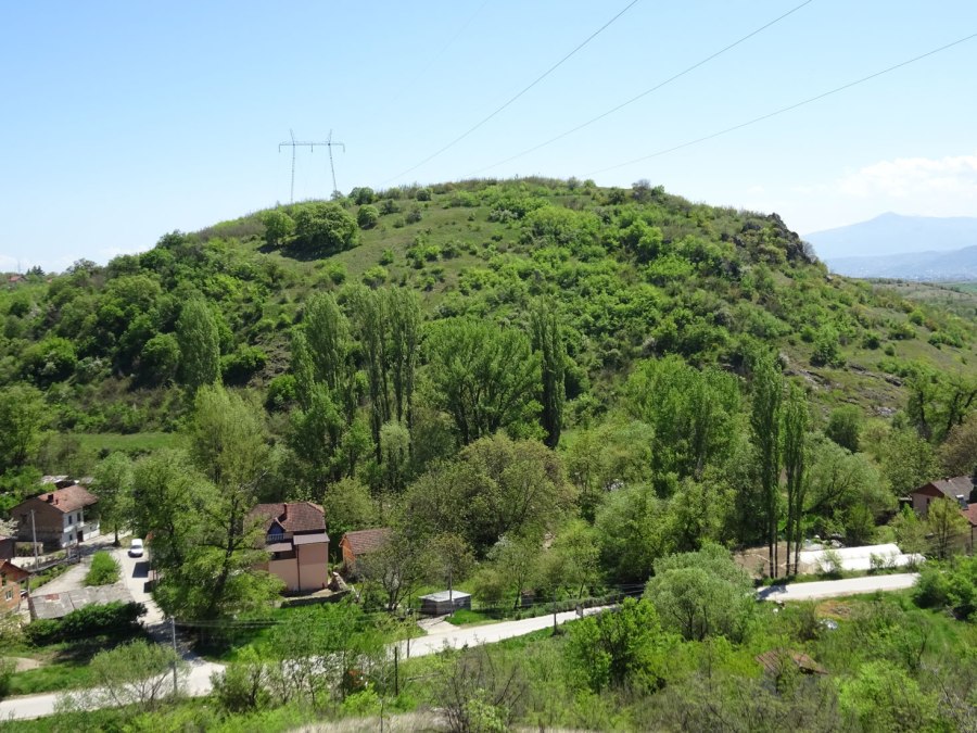
After checking out this impressive tomb I climbed the “Gradiste” hill in order to check if there still were some visible remains of a fortified early antique settlement (5th-4th century B.C. ) on the southern and western slope of the flattened top of Gradište hill, as the text on the website described (https://arheoparkbrazda.mk).
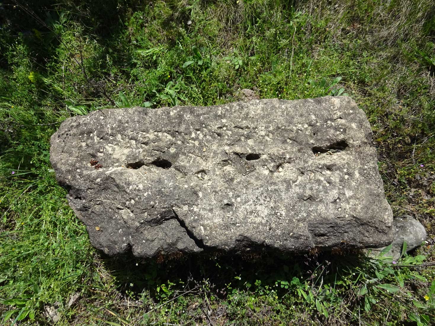
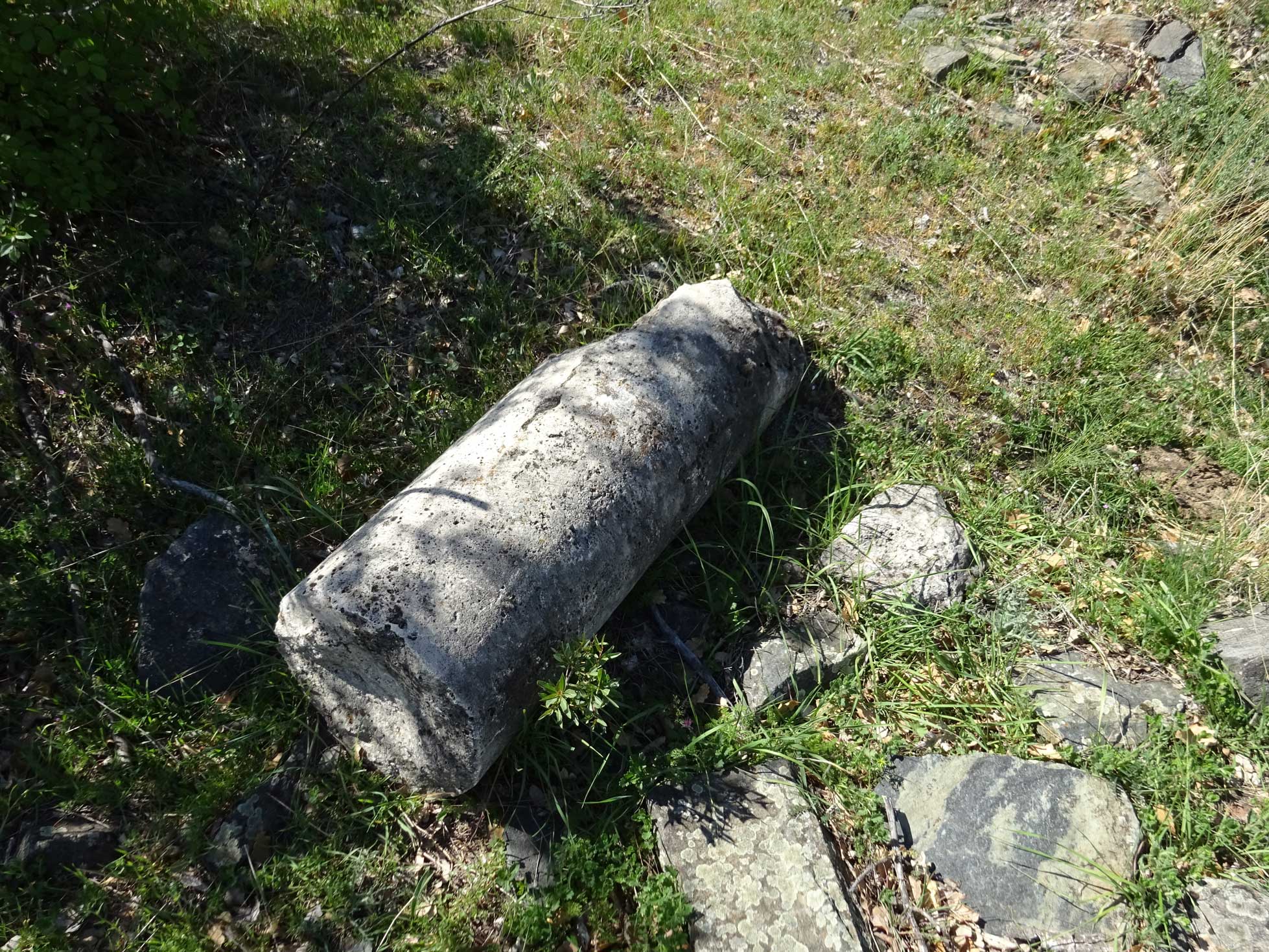
It was an overgrown and thorny path to the top of the hill. I didn’t find much more than some ruins of what may have been fortifications. Of course I couldn’t cover the whole hill and I may have missed some sites. Looking back at my GPS track on Google Earth, it seems that there may be some structures in the heart of the circle that a walked. There was a big hole (indicated as a waypoint in the GPS track), possible artificial due to some digging, where I noticed a big rock with some seemingly man-made modifications.
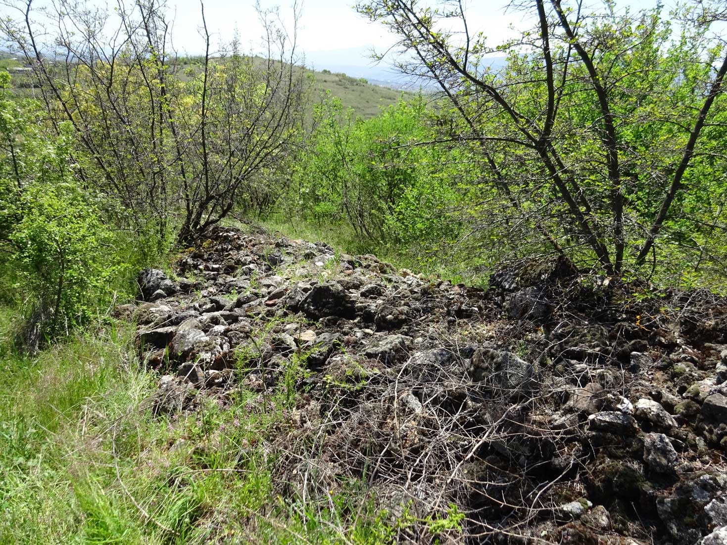

Summarized: unless you’re more lucky than I was, there’s really not much to see on this hill. The site is overgrown with thorny bushes. However, it’s still kinda cool to explore such an ancient site.

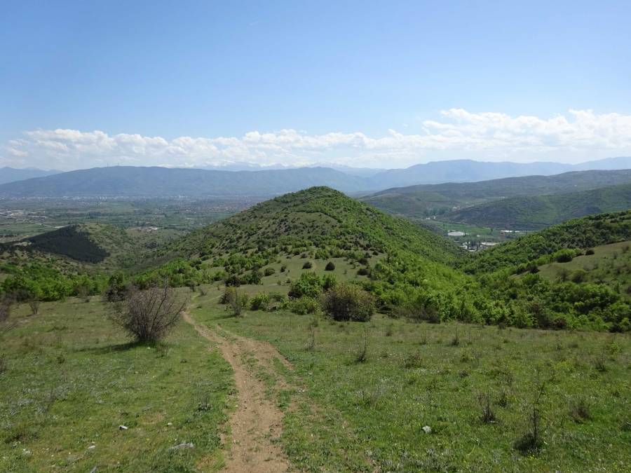
After backtracking my way back down to the tomb again, I started the 300 m climb to the Markov Kamen (Marko’s Stone) peak/ridge. It’s not the most interesting scenery. On your way to Marko’s Stone you pass another shallow peak, the huge letters “Gluvowood” near the village Gluvo (big wink to Hollywood?), several sites with what seem to be trial digs and a mining site.

The peak Markov Kamen (Marko’s Stone) is marked with a big stone as the name implies!
From there I followed the trail that I had drawn based on OpenStreetMap and GoogleEarth. This in fact turned out to be a pleasant trail. I left the obvious trail at a moment and descended more freestyle until I reached the main track again where there were some ruins. Then it went further downhill until I reached the hill with the archeological site “Davina Kula”.
I had found this site on OpenStreetMap, marked as an archeological site, and tried to find some information about if before my hike. You can read more information about the Davina Kula site below the description of the hike.
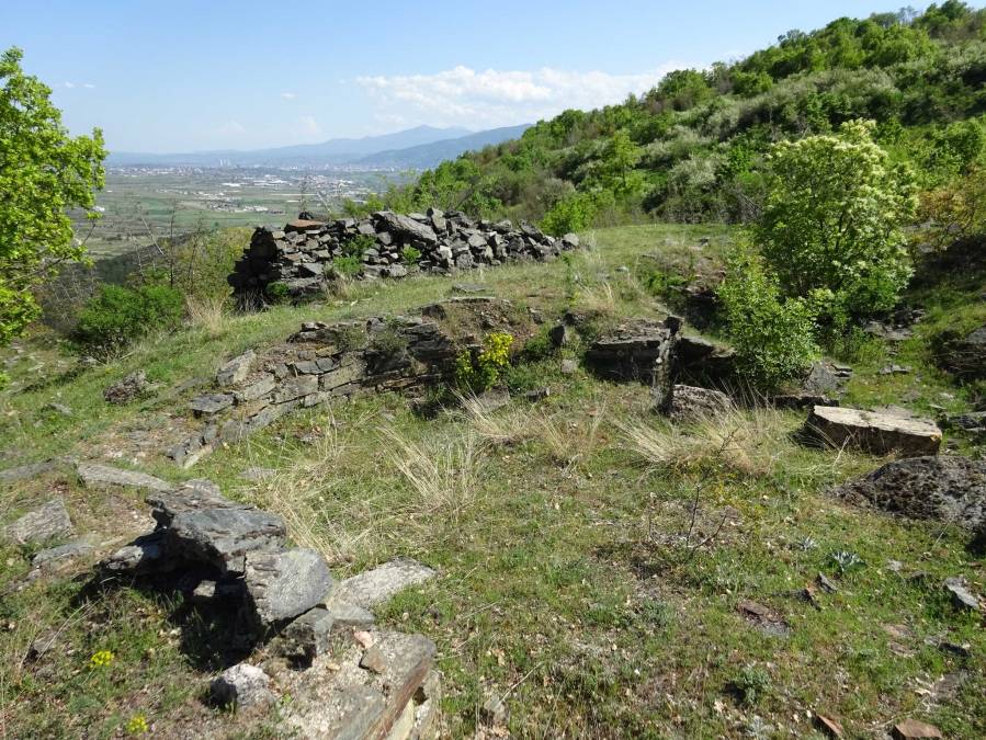
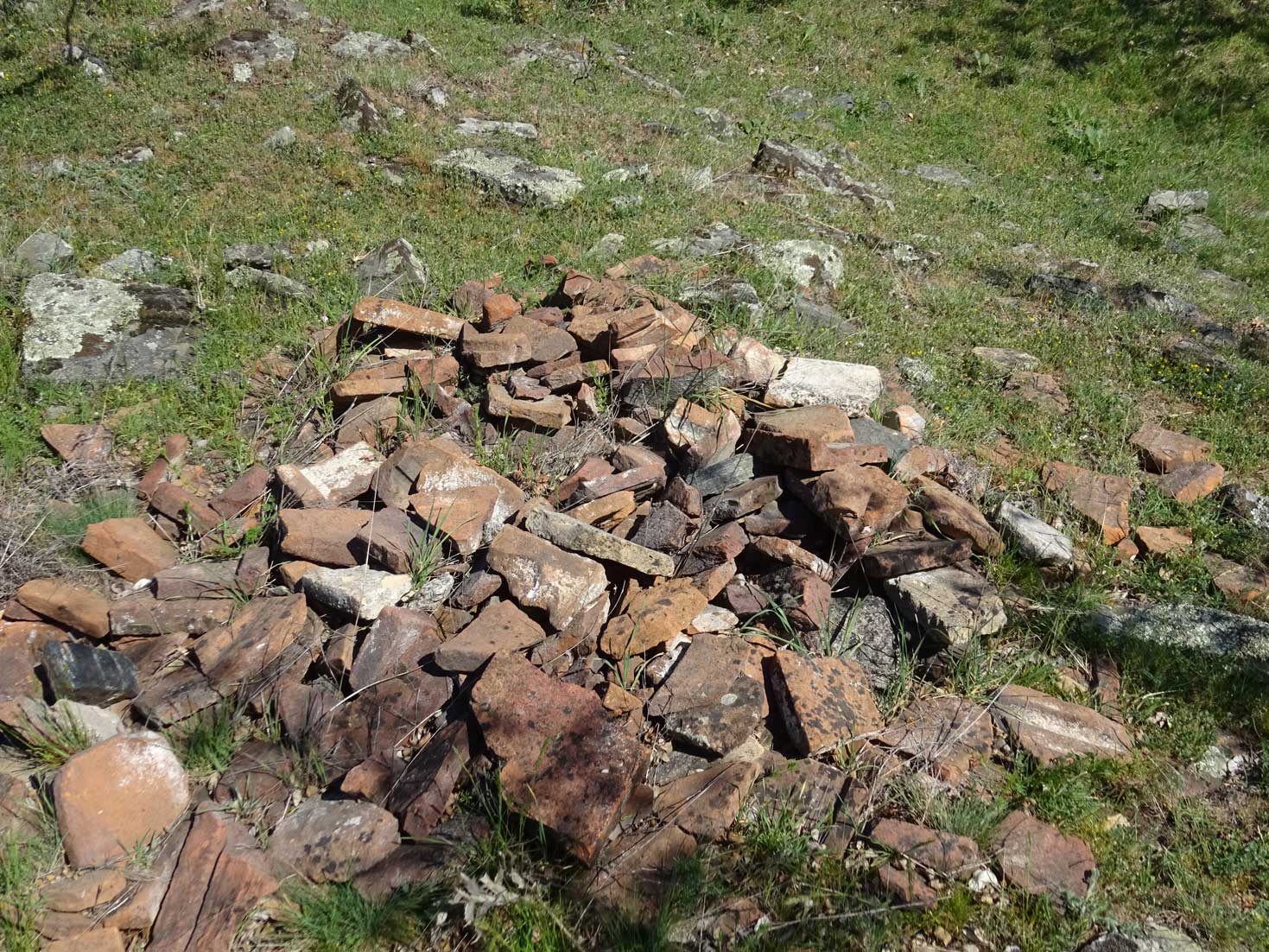
So I climbed the hill of Davina Kula, walked around and tried to find the two basilicas. I think I did find them and I marked them with waypoints in the GPS track. There are several other ruins of walls, fortifications etc. The whole site is full of ceramic roof tiles, one of them had an interesting mark on it.

I’m quite sure that also at this site I may have missed some ruins, but finding the basilicas was my goal. Although it’s mainly ruins, there’s more to see at this site than at the Gradiste near the Brazda tomb!

After spending quite some time at Davina Kula, I continued back to Brazda. Just before reaching the asphalt road back to Brazda, there is what I was told by a local an old army site dating back to Yugoslavian times.

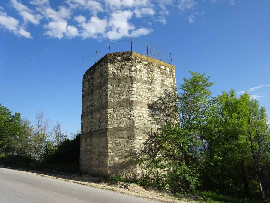
The last part on asphalt is not very interesting, but passes a large stone tower of unknown age or function (I crawled into it through a small entrance but have no clue what is the purpose of this tower…Please let me know if you do). I adapted the GPS track a bit for the last part because I initially walked wrong.
After the tower I visited the Church of St Bogorodica on a graveyard with some interesting old graves next to the church. The inscription of one of the stones seems to say “Here lies Priest…”

If you don’t feel like doing this whole hike to see the two archaeological sites, you can easily visit the Brazda tomb by car, then take the asphalt road until the old Yugoslavian military site and walk to Davina Kula from there which is a bit over 3 km and 220 m climbing. The end of the asphalt road from Brazda (near the Yugo military site) is indicated with a waypoint named “asphalt”.
From a hiking perspective, this hike gets 2.5 stars, especially the part between Markov Kamen and Davina Kula is enjoyable. As a whole, it was a great adventure exploring these archeological sites!

You can view and download the GPS track of this hike here: https://www.wikiloc.com/hiking-trails/brazda-tomb-archeo-park-markov-kamen-peak-davina-kula-archeo-site-102763267
Below follows some additional information about the archeological sites:
BRAZDA TOMB INFO:
“The archeological site Gradiste is located on the northern periphery of the Skopje valley, in the village Brazda at the foothill of the mountain Skopskoa Crna Gora. Archeological excavations that started here back in 1985 confirmed that on the hill Gradiste there was an established settlement in the 5th and 4th century BC.
It was a time when the most northern Paionian tribe Agrians lived in the region, but the type and nature of the excavated ceramic findings triggered a theory that Gradiste was populated by Athenians who explored the rich natural resources of the environment.

At the northern foothill, in 1986, the archaeologists found a unique monumental structure which, according to the researchers, represents a tomb of a local dignitary.
The tomb is dug deep in the ground, it has a rectangular room or chamber, and an entrance with six steps on the south wall. There is a long access corridor (called dromos), which steeply descends through the slope of the hill and leads to the entrance. The walls of the chamber are made of nicely shaped travertine blocks of different sizes (travertine is white or light-coloured calcareous rock deposited from mineral springs, used in building). Their estimated weight ranges from 500 to 1500 kg, and they were carried from the stone quarry in the village of Gorno Svilare which is located 23 km from this location.

The blocks are placed on top of each other in horizontal arrays. The front side of each block was relief staged and framed with smooth frame on the edges. Above the entrance of the chamber we can note a horizontal stone-free zone on the north and south wall. Transverse wooden beams which formed the roof were inserted there. Considering the fact that there were no findings in the chamber it is assumed that the tomb was raided in ancient times, when they dug even the floor tiles.”
Some more information from https://arheoparkbrazda.mk/the-site/ :
“Brazda lies 10 km north from the center of Skopje in the south-west foothill of the Skopska Crna Gora mountain. South-west of the village, a separated hill “Gradište” rises high above the surrounding area. The northern and the western slopes are very steep, and on the south and east side the terrain steeply descends downwards. At the northern foot of the hill the rivers Brazda and Gluška (Čučerska) meet. These waters were captivated in roman times and supplied the ancient city Skupi and medieval Skopje with drinking water.
The remains of a fortified early antique settlement (5th-4th century B.C. ) can be found on the southern and western slope of the flattened top of Gradište hill, it is deployed in several terraces, on the surface of 4.5 Ha. It was a time when the most northern Paionian tribe Agrians lived in the region, but the type and nature of the excavated ceramic findings triggered a theory that Gradište was populated by Athenians who explored the rich natural resources of the environment.
At the northern foothill in 1986 a monumental structure was found, which according to researchers represents a tomb of a local royalty. This is confirmed primarily by its size, also by the quality of construction and the processing of the blocks, for which the most qualified architects were engaged.
The tomb is dug deep in solid rock, it has a rectangular room or chamber and an entrance with six steps on the south wall. There is a long access corridor (dromos), which steeply descends the slope of the hill and leads to the entrance. The walls of the chamber are made of nicely shaped travertine stone blocks of different sizes. The estimated weight ranges from 500 to 1500 kg. and it is assumed that they were carried from the stone quarry in the village of Gorno Svilare which is located 23 km from this location. The blocks are placed on top of each other in horizontal arrays. The front size of each block was relief staged and framed with smooth frame on the edges. Above the entrance of the chamber we can see a horizontal stone-free zone on the north and south wall. A transverse wooden beams which formed the roof of the chamber were inserted there.
The decorative technique is the mark of the Athenian construction from the 5th and the early 4th century BC. These elements clearly differ from the characteristics of the Hellenistic period that came afterwards. The upper mentioned features, crucial for dating of the tomb have also been confirmed by the pottery findings.
The tomb in Brazda had a flat wooden ceiling. Tombs built entirely or partially out of wood are simpler and older than the ones built out of stone and they can be found throughout the 6th – 4th century BC across the vast Euro-Asian space as far the southern influences left a mark.
The tombs of the Macedonian type, from the late 4th and 3rd century BC, with vaulted stone arches, are similar to the Thracian tombs. The tomb from Tetovo was also vaulted, it is very similar to ours and built from travertine blocks in the same way, only much smaller (5,31 x 3, 51 x 1, 85) and with walls with smooth surface. The dating remains open. Judging from the manner of construction, the tomb probably was built in the 4th century BC, but the bronze statue of famous Menada, found in the tomb, confuses. It is made in the late 4th century.
The tomb from Brazda differs from the tombs of the Macedonian type, we can clearly see it the basis: there is no ante chamber and the main chamber is placed transverse to the dromos. The deceased is not laid in the tomb and the embankment on the top didn’t form a mound (tumulus), but it was merged with the environment. Also the stone shields are not known to the Macedonian region. We have analogies in the distant north in the Black Sea area in the royal Scythian tombs in Soloha and in Pazirik in the Altai. The form of this shield is common in Egypt.
The origins of the upper mentioned elements and the paths from which they reached us remain unclear.
The fate of the tomb owner also remains vague. According to the situation revealed by excavation we can conclude the following: – After the funeral rituals the chamber door was locked from the outside (with 2 large plates) and the door and the dromos were filled with yellow-brown clay, in which cremated victims were buried occasionally and broken pottery was thrown inside .
It seems that shortly after the funeral, thieves penetrated from the top, broke the door and entered the chamber. Since they didn’t find the deceased here, they dug the whole paved floor. They dug to a depth of 1.2 m below the floor and broke the excavated blocks and threw them aside. That led to the creation of a 2 m high embankment in the chamber above the floor.
The fire that was burning on the both sides of the door damaged the internal doorposts. The destruction was also accelerated by the water (rain water) which penetrated through the hole in the chamber. Several blocks from the top were pushed into the chamber and the two stone shields were among them.
In addition to this conclusion – that the deceased was not resting in the chamber – we can add the fact that not one piece was found from a possible sarcophagus (out of stone) or its base. Similar to many other older tombs, the chamber in Brazda had undoubtedly a commemorative character, while the deceased was buried somewhere beside her.”
DAVINA KULA INFO:
The Macedonian Wikipedia states the following: (https://mk.wikipedia.org/wiki/%D0%94%D0%B0%D0%B2%D0%B8%D0%BD%D0%B0_%D0%9A%D1%83%D0%BB%D0%B0):
“Davina Kula or Devina Kula – fortress and regional center 3 km southwest of Cucer and 12 km northwest of Skopje, along the highway to Kosovo, at the southern end of the Kacanica Gorge. It is an elongated hill, flattened at the top, the southern part of which falls 230 m deep in the valley of Lepenec. Through a gentle saddle in the north it continues gradually into the wreath of Skopska Crna Gora. Its slopes are steep and easily accessible only from the northeast. Above there is an overview of the highway several kilometers north (in the gorge) and south (through the Field). Old mines of iron are registered a few kilometers northeast of here.
At the southern end of the hill, which is the highest, in late antiquity, an oval-shaped castle was built , measuring 185 × 110 m (1 ha). The wall, built of limestone and fortified with a series of towers, dates from the late Roman period (IV century), was generally restored in the VI century (no doubt after the earthquake in 518 ). The interior was also restored, which can still be seen on the surface today: a series of residential buildings with several departments, embedded in rows along narrow parallel streets. The church stood on the highest position, surrounded by several auxiliary buildings.
North of the acropolis, on a narrow flat terrace that is a little lower, the core of the city was built according to a pre-determined plan. It is surrounded by a double wall, fortified with towers and a large gate at the northern end. In the center stood a small square, framed by shops. To the north of it stood larger houses, and to the south of it stood a basilica and several other large buildings.
In the south, at the foot of the acropolis, there is a weak spring that supplied water. All this was built at once and according to a pre-conceived urban plan, during the VI century. The city with the fortified escape area next to it covered an area of 8.4 ha. In addition to the mentioned two basilicas in the city, there are six other churches in the vicinity. The economic power of the inhabitants relied mainly on the exploitation of iron and metallurgy. A large number of small iron objects were found – fibulae, tools and parts of equipment and furniture, minted here (mainly in the V – VI century). A lead seal reads the name of Bishop Thomas.
The source of today’s population is called Davina; after him the whole hill is called that. The wall and the interior buildings are extremely well preserved to this day and in the Middle Ages they were practically usable, with some renovations. The findings from the VII – VIII century are remarkable: several appliqués and belt shackles made of bronze and silver alloy, or of iron alloyed with silver; they bear Byzantine -pre-Slavic features. An amulet, carved from a parish on a deer antler, there are 4 persons around at the top; it is undoubtedly the representation of Perun – Svetovid – the supreme Slavic deity (from IX – X century?). It is associated with the Slavic pre-Christian name of the place, Davina (Virgin), the main Slavic goddess who may have had her own sanctuary here.
The other findings are from the following centuries: Byzantine coins – copper skiffs from XII – XIII century. The basilica (from the 6th century ) of the acropolis was partially restored in the mature Middle Ages: a new church was built on its middle nave . A century ago, Arthur Evans (1885, 92-93) noticed parts of a stone sarcophagus from the time of Nemanjici.
There is no doubt that the late ancient acropolis, well preserved, served in the Middle Ages as a high guard at the entrance to the Kacanica Gorge, lurking on the highway from Skopje to the north – to Kosovo , Raska and Belgrade . The nearby iron ore deposits were probably re-exploited, and so the suburb, the “city of Davina”, grew according to local tradition. This important fortification point was most likely the seat of one of the parishes within the Skopje episcopate; perhaps Preamor or Prinip , mentioned in the charter of Basil II from 1019.
Macedonian archaeologists speculate that one of the possible sites for the still undiscovered city of Justiniana Prima could be this place, as Davina Kula is the only confirmed 6th century city on the territory of Skopje that has all the characteristics of an early Byzantine city.”
Some more information can be found here: https://web.archive.org/web/20190531143555/http://istoriski.com/ke-gi-otkrie-li-davina-kula-tajnite-na-justinijan-prvi/
The following was taken from: http://makedonskosonce.com/old.makedonskosonce.com/broevi/2000/sonce336/Tekst38.html
“The discovery of two early Christian basilicas on the site is especially confusing! One dates back to the fifth century, while the second was built during the reign of Justinian I (527-565). Imagine, of the possible 40 early Christian basilicas, it is assumed that there were in Skopje, two were discovered at this site. Of the others, only one was discovered in Skupi (fifth century) and one in the village of Orman (sixth century). The question arises – what are they looking for in the vicinity of Skupi (five km away), in this locality, two early Christian basilicas?
“They confirm, in front of you, the urban character of the site,” says Dr. Lil. Therefore, it is obviously a bishopric, or at least an episcopate (two basilicas, church seals of dignitaries, etc.). It is known that it was a church-administrative center in the prefecture of Illyricum. If we check Procopius, who speaks of Justinian I, where he says that he built Justinian Prima in opposition to his birthplace, which is considered the village of Taor, then the two basilicas, the size of the site (the largest discovered city in Skopje in the sixth century) and other findings … may point that Davina Kula is a city-phantom, Justinian Prima “, states Dr. Lil”
