
This hike is 20 km long with 730 m ascent.
Ravna Reka is a recreational area close to Pehchevo, with weekend houses, gazebos, a playground etc.
It is about a half an hour drive from Pehchevo, where we had our accommodation at Villa River. We earlier visited the Spikovski Waterfall and the Crnodol Waterfall which are along the same road to the start of the hike to the Chengino Kale Peak. If you still have energy after climbing Chengino Kale you could visit the waterfalls as well. The Crnodol was the better of the two, if you need to choose!
I parked the car at the end of the asphalt road, there is a what seems to be a hydropowerplant there.

After about 1.7 km there’s a similar building. Navigation may become a bit challenging here, you need to keep left at the sign.
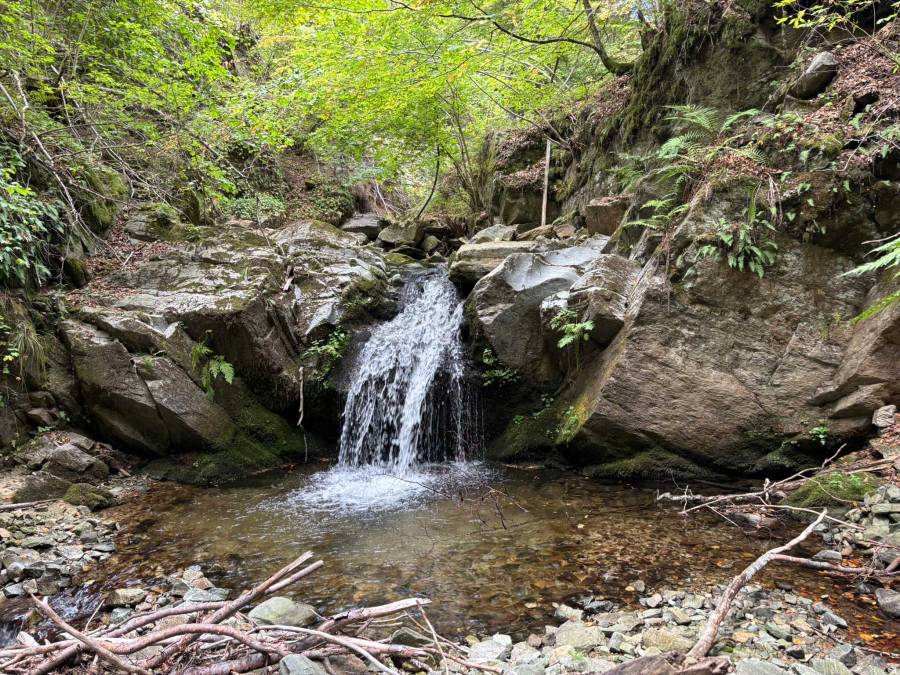
A bit further is the Ljutacki waterfall with a picnic opportunity. The waterfall was dry though, I read that all the hydropowerplants had negative impact on the waterflow.
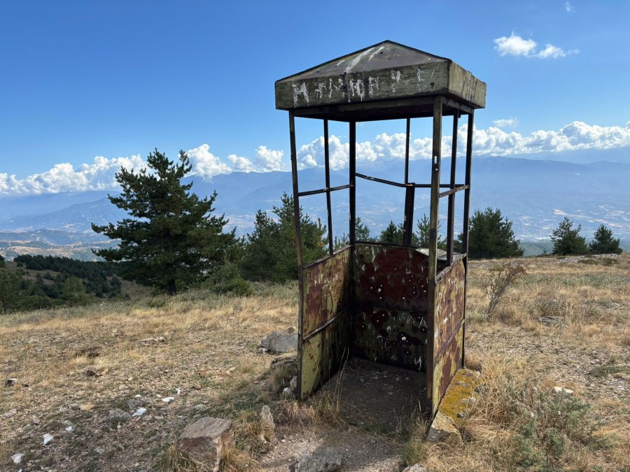
Next you’ll pass through what seems to be like an old border station.

The peak Chengino Kale (1745 m) is on the border with Bulgaria. The text “SFRJ” (in Cyrillic) on the border stone on the first picture refers to the Socialist Federal Republic of Yugoslavia, which was the official name of Yugoslavia from 1945-1991. The number “48” is the border marker number.

There also is a lake named Eagle’s Eyes Lake (Orlovi Ochi). The lake was completely dry in September 2025. Apparently it is frequently visited by eagles. I also wandered a bit into Bulgaria, to a small metal border guard post.
Instead of walking back along the same path, which most hikers seem to do at this trail, I tried to make this hike more circular. It turned out to be a good choice because the way back was more scenic this way (and about 4 km longer, but all downhill).
At a certain moment you have to make sure to leave the obvious road that you’re following in order to connect to another trail.
A winding forest road then takes you to a very nice path along a river. At a certain point you have to cross the river, which was easy because there was not much water. It may be more difficult in wetter periods?
After a while you’re back at the hydropower plant. There’s a shelter with BBQ and a path down to what according to OpenStreetMap is the Skokoto Waterfall.
However, the sign near the Skokoto Waterfall says: “The Ljutachka Reka Waterfall is located at about 1,300 m above sea level, near by the road to Chengino Kale. This waterfall is the highest in the area, with a total height of 11,8 m. It is especially fascinating in the period after the rainfall and melting of the snow, when it has a large amount of water. The waterfall can be reached from the nearby road along a path about 200m long”.
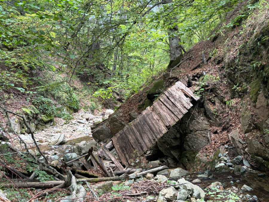
OpenStreetMap shows a trail right along the river which I had planned to take on the way back, but the bridges near the Skokoto Waterfall were broken or in a horrible state so I decided to follow the same trail back as in the beginning. I think it’s probably possible to follow the river if you take your time, but I did not want to have the risk of getting stuck further downstream.
This was a nice hike and not too demanding due to the relatively limited ascent. I enjoyed making some in-field decisions trying to make the hike circular, which worked out quite well. The hike gets 4 stars out of 5.
You can view and download the GPS track of this hike here: https://www.wikiloc.com/hiking-trails/chengino-kale-peak-from-ravna-reka-237420930\

