This 6.5 km walk with 350 m climbing describes a failed attempt to visit the Ramnishte Fortress. It may help you to find the right trail in case you plan to visit the fortress.
There are several archeological sites near Demir Kapija, and the Ramnishte Fortress site is one of them. The Ramnishte site is part of the larger archeological area names Prosek.
We also visited the archeological sites Markova Kula, Crkvishte, Manastir, and the Zwinger Fortress at Strezov Grad.
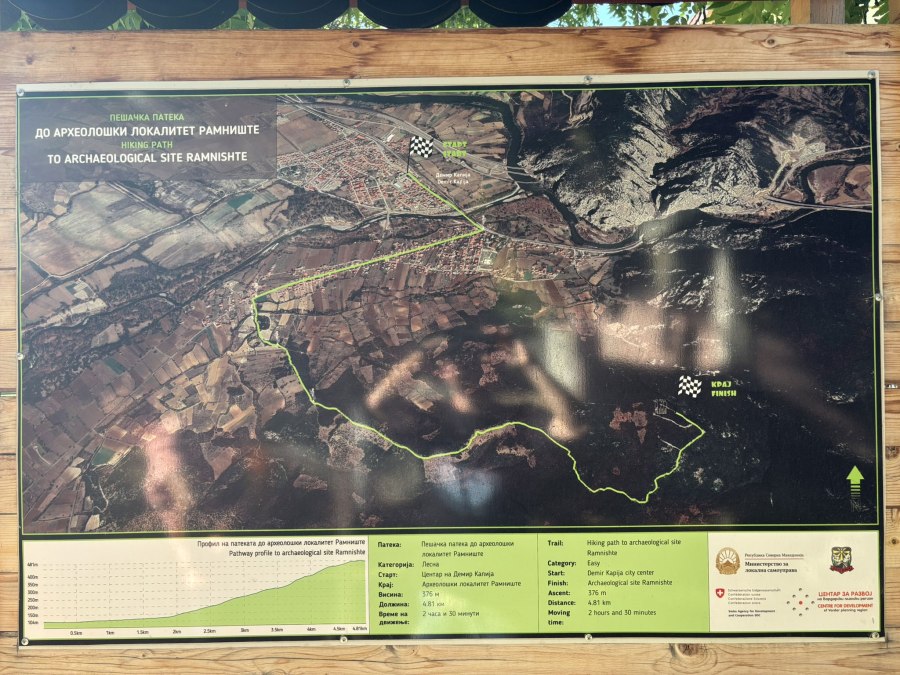
The Ramnishte Fortress in on a hill next to Demir Kapija. In the center of the town there are several info panels about Demir Kapija and surroundings, and one of the info panels describes a hike to the Ramnishte Fortress. If the municipality placed this info panel, the Ramnishte Fortress should not be too difficult to find, you would say…It turned out not to be so easy!
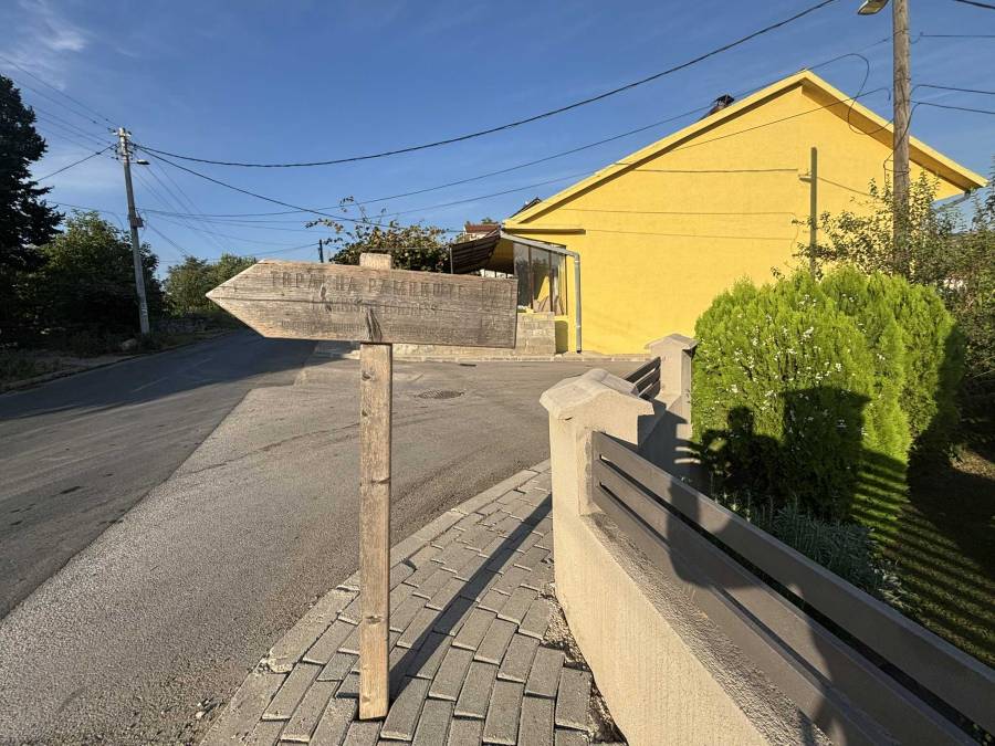
I parked the car on the road Partizanska, where a weather-worn sign was indicating the trail to the Ramnishte Fortress. I was planning to follow this trail from Wikiloc: https://www.wikiloc.com/hiking-trails/demir-kapija-155948640
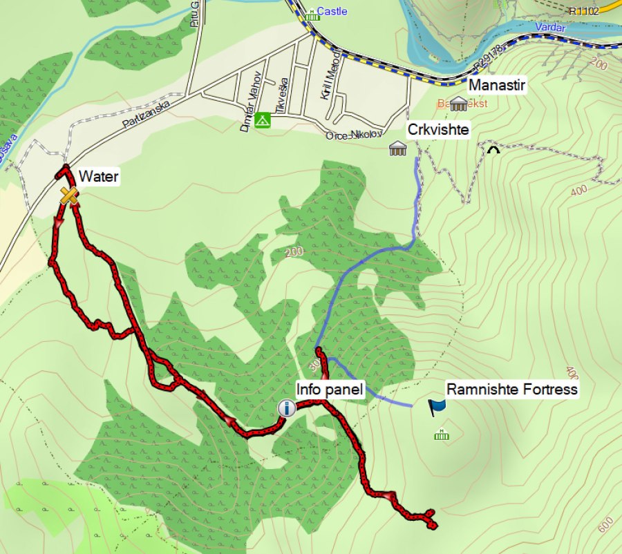
At the waypoint marked “Water”, you can go left or right. I turned right here. I later came back via the road to the left, the crossing was flooded quite a bit even during the warm summer, but still passable without getting wet feet. The trail to the left probably is the “official” trail because there’s another signpost along that trail. If the trail to the left is not accessible due to the water, you can follow the road to the right like I did.
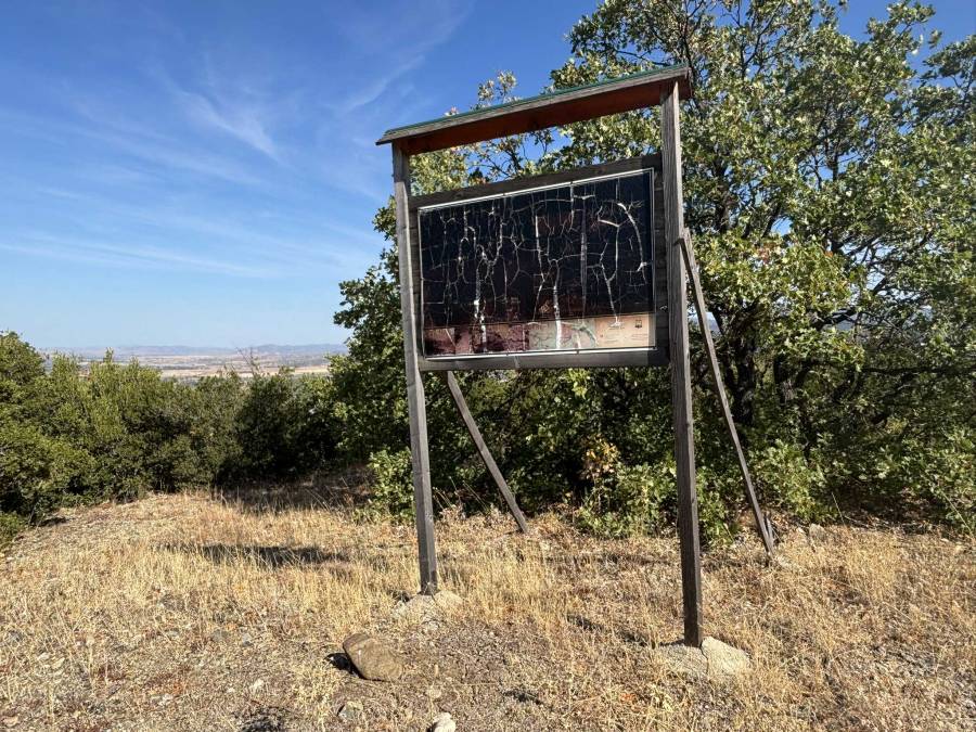
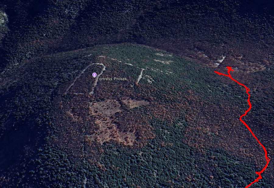
I continued following the trail to the unreadable info panel in the picture. This is also where the GPS track that I was following ended. However, as you can see on the satellite images, this is not where the Ramnishte Fortress is to be found.
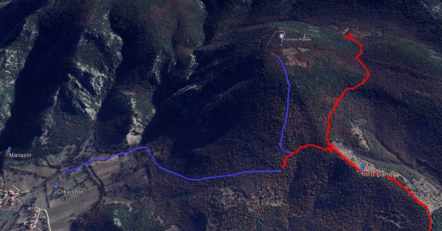
I continued following a trail (in red in the picture below), that also looked like the trail depicted on the information panels in the center of Demir Kapija. At a certain moment I completely lost the trail and the vegetation became very difficult to get through, and it was not clear at all how to get uphill to the fortress. So I gave up after a while. When comparing my trail (in red below) with the trail indicated on the info panel in Demir Kapija, it seems I should have turned left/north a bit earlier after the info panel.
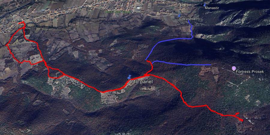
Back near the unreadable info panel I tried another trail, going north. Also this trail did not seem to lead to the fortress. So I went back without finding the fortress, because we planned to visit the Demir Kapija Hot Pools in the afternoon, and it would be getting to late for that otherwise.
Retrospectively, the my second attempt with the trail going north looks like it almost connected with a possible trail to the fortress. I indicated this trail in blue on Google Earth; I did not walk the blue part myself. This blue trail also seems to be accessible from the archeological sites Crkvishte (Church) and Manastir (Monastery) that we visited as well, in case you want to give it a try from there.
When we later asked about the Ramnishte Fortress in the museum of Demir Kapija, the employee told us that is was a protected site and forbidden to visit. A very strange thing to say if there’s an info panel next to the museum describing a trail to the fortress; I guess it’s their way of trying to prevent wild diggers finding the archeological sites. Anyway, this employee was also more interested in selling us 15 euro souvenirs and home-made rakija than to tell us something about the museum. The rakija was not bad by the way, haha.
Please let me know if you manage to visit the Ramnishte Fortress!
Wikipedia says about this site: Demir Kapija was already mentioned in Classical times under the name of Stenae (Στεναί, “gorge” in Greek). In the earlier dates to the Paeonian era, a fortress was built on the mountain Ramniste, on the foothills of the Demir Kapija settlement and it is still there. The ruins are one of only 3 known Paeonian structures in Macedonia, and date from 3000 years ago. In the Middle Ages Demir Kapija was a Slav settlement, under the name of Prosek (https://en.wikipedia.org/wiki/Prosek,_North_Macedonia), while today’s name originates from Turkish, meaning “The Iron Gate”.
And see also this Wikipedia page about Ramnishte.
More interesting reading about the Prosek site: http://www.promacedonia.org/im3/im_negotino.htm
You can view and download the GPS track of this hike here: https://www.wikiloc.com/hiking-trails/demir-kapija-ramnishte-fortress-failed-238456346