This hike is described in the Bradt Travel Guide Macedonia by Thammy Evans, second edition 2007.
Due to forest fires, there was a nation-wide ban to enter the forest in Macedonia in August 2012. The fine of 3000 euros made it not very attractive to ignore this ban! However, it is possible to obtain personal and temporary permits for individuals, although the authorities in charge most of the times were not aware of the possibilities and exact rules.
We obtained a permit for our hike without many problems from the local Forest Authorities in Demir Kapija. The people were very friendly, we were offered coffee and the permits were arranged swiftly. They did not speak English though. The Forest Office is located at Marshal Tito street (N41.41410 E22.23784) and indicated in the map below. They also told us about the nearly Bela Voda Cave (White Water Cave) and arranged a local guide (his name was Dejan) to take us there. A really cool cave!
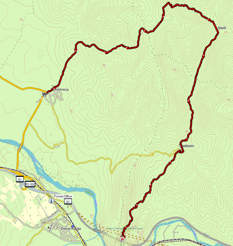
The hike starts at the parking place between the two tunnels of the M1/E-75 road near Demir Kapija. There is only place for a few cars at this parking place. If you enter the tunnel, make sure you are not driving too fast so you can stop and park safely.
From the south parking you can descend to the small river that flows through the canyon. Be careful, because this is a popular outdoor public toilet!
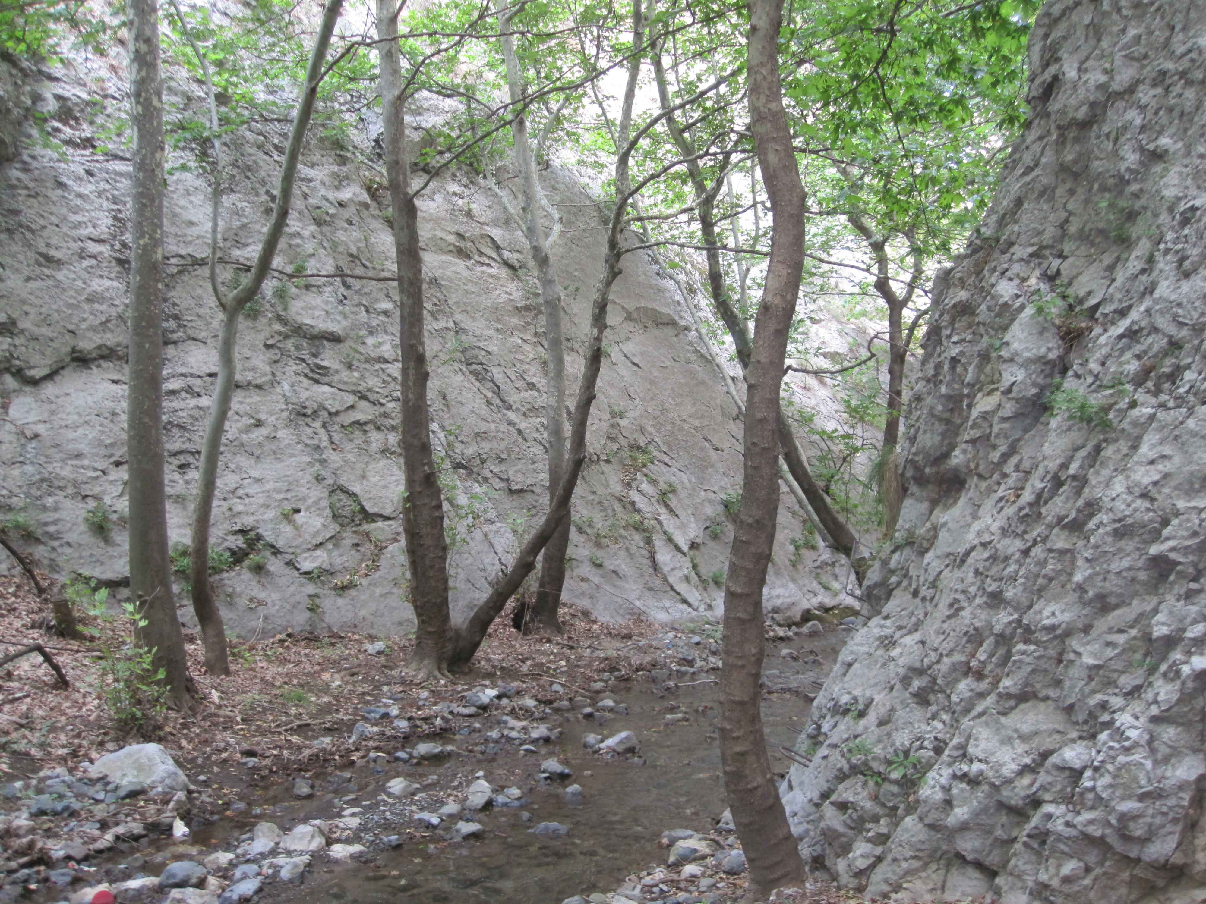
Walk north underneath the bridge and follow the water upstream. On both sides of the stream there are vertical rock formations, and this is really a special place to walk.
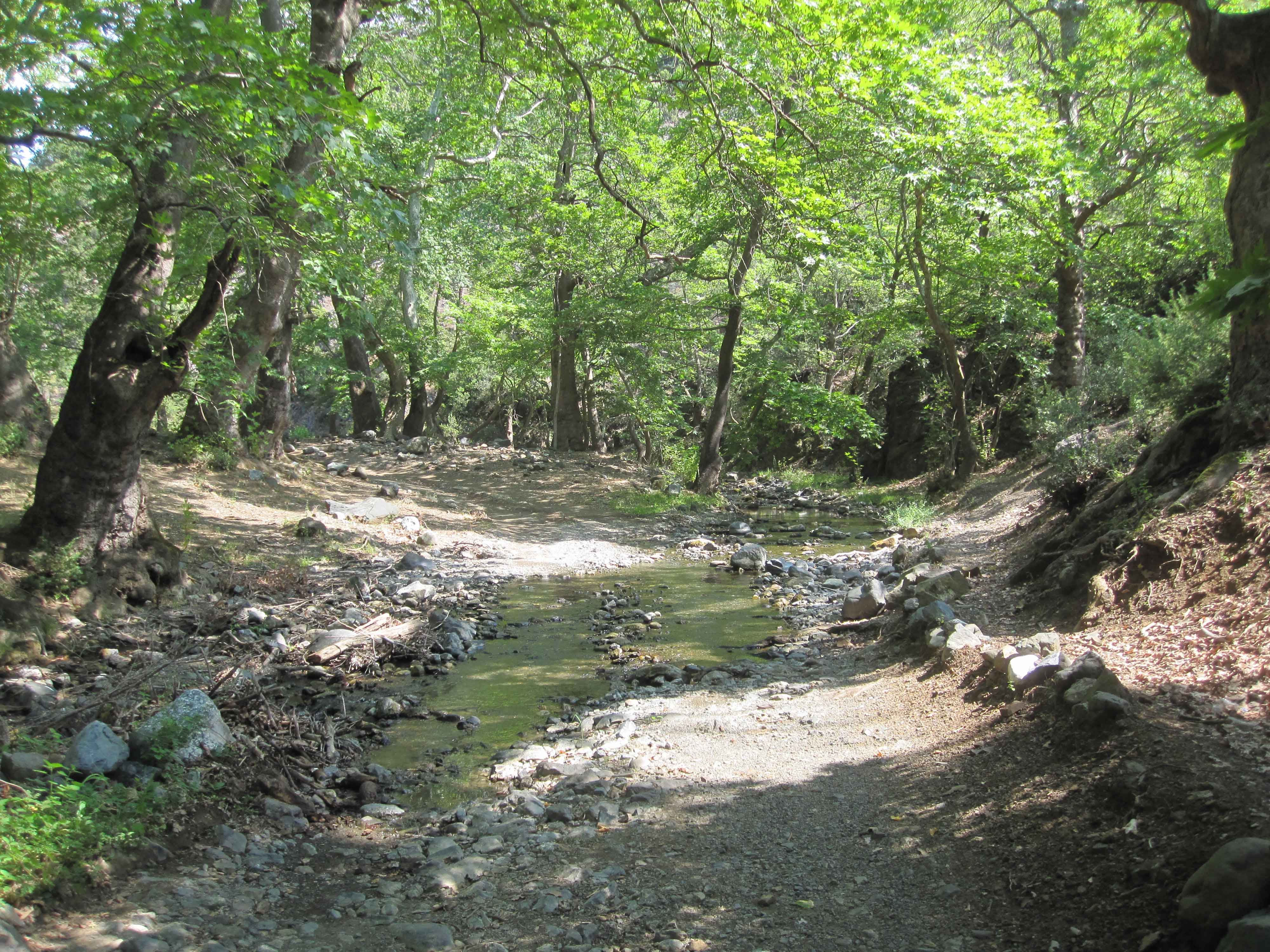
You’ll have to cross the water several times from one bank to the other. When we were there in August 2012, this was not problem at all since it was just a small stream of water, which could easily be crossed without getting wet feet.
After a bit more than an hour you reach the rural village Celevec. We didn’t visit the village but just followed the stream. You’ll pass an old Ottoman graveyard with characteristic gravestones.
After Celevec you follow an unpaved road along the creek until you reach the deserted village Iberlija two hours after the start. Just after the first building on your left hand, turn left (west) and follow the water stream. This is an easy point to take the wrong road or direction.
From Iberlija it goes uphill along the creek until the stream runs dry. Keep on going uphill until you reach an unpaved service road. Follow this road to the left (south-west, downhill) until you reach the village Koresnica.
In the village shop they can call you a taxi back to the parking at Demir Kapija. You can buy refreshments while you wait, and believe me, a cold coke and an ice cream were very welcome! The taxi should cost about 120-180 denars or 2-3 euros. This hike gets 4 out of 5 stars.
Because we initially took a wrong turn near Iberlija, I had to polish the GPS track a bit so it only contains the part of the hike which we meant to do: https://www.wikiloc.com/hiking-trails/demir-kapija-hike-7546668