This is a long hike of 27 km in one direction, with 1130 m ascent and 1300 m descent. It takes you from the village Oteshevo at Lake Prepa through Galicica National Park to Ohrid at Lake Ohrid. Despite its length, it is not a very demanding hike because most of the climbing is with a very gradual ascent.
I took a taxi from Ohrid to Oteshevo at 06.00 in the morning, it is a drive of an hour. The taxi company was Bel Mercedes and in 2022 the price was 1900 denars, approximately 31 euros.
The east part of Galicica National Park does not seem to be very popular for hiking, judging from the lack of GPS tracks that cover this region. I was unable to find a GPS track describing the first part of this trail.

The first part of the hike starting from Oteshevo is part of the official trail T6 of Galicica National Park (see http://galicica.org.mk/en/trails/our-suggestion/oteshevo-peek-goga-mountain-house-sharbojca/), so you would expect it to be well marked. However, this trail was not marked at all, except maybe from a few very sparse old and fainted red markings. Fortunately, I had anticipated this and made a hand-drawn GPS track based on the map from Galicica National Park, so it would be clear what general direction to follow on the ground.
I had walked a bit of the first part of this hike a couple of days earlier when I was searching for the archeological site with ruins of the fortress “Shurlenci Kale” near the village Sirhan. After the waypoint “crossing to Sirhan”, the T6 trail became more unclear.
Despite the handmade GPS track that I had prepared, it took me a quite lot of time and wrong turns until I made it from the waypoint “crossing to Sirhan” through the forest to waypoint “point A” (9 km from the start, see the map below), because at several places in the trail it was difficult to decide to go left or right. It is really outrageous and maybe even dangerous that Galicica National Park advertises this as an official trail. I’ve let them know but never got a reply. Good thing for the next person is that I have removed all these mistakes from the GPS track so your trip should go very smoothly!
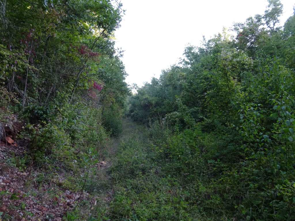
The next part, from waypoint “Point A” to “Signpost 1” was even more unclear and unmarked. Although from the GPS track that I had drawn it was clear which general direction to take, I walked a large circle for about 90 minutes trying to find if there is an official trail connection “Point A” and “Signpost 1”, because I wanted to map the official trail with the GPS. But I did not succeed in finding any marking for an official trail at all, and then tried to follow a route myself that seemed appropriate. This “freestyle” part of about 3.5 km is not difficult to follow, there just is no clear trail for most of it. All the other fruitless attempts have been removed from the GPS track.
It apparently worked out well, because my freestyle route exactly ended at “Signpost 1” which pointed into the direction “Oteshevo” from where I came. Too bad there were no signs on the opposite “Oteshevo” side of this trail!

There were some enormous mushrooms at this part of the trail.
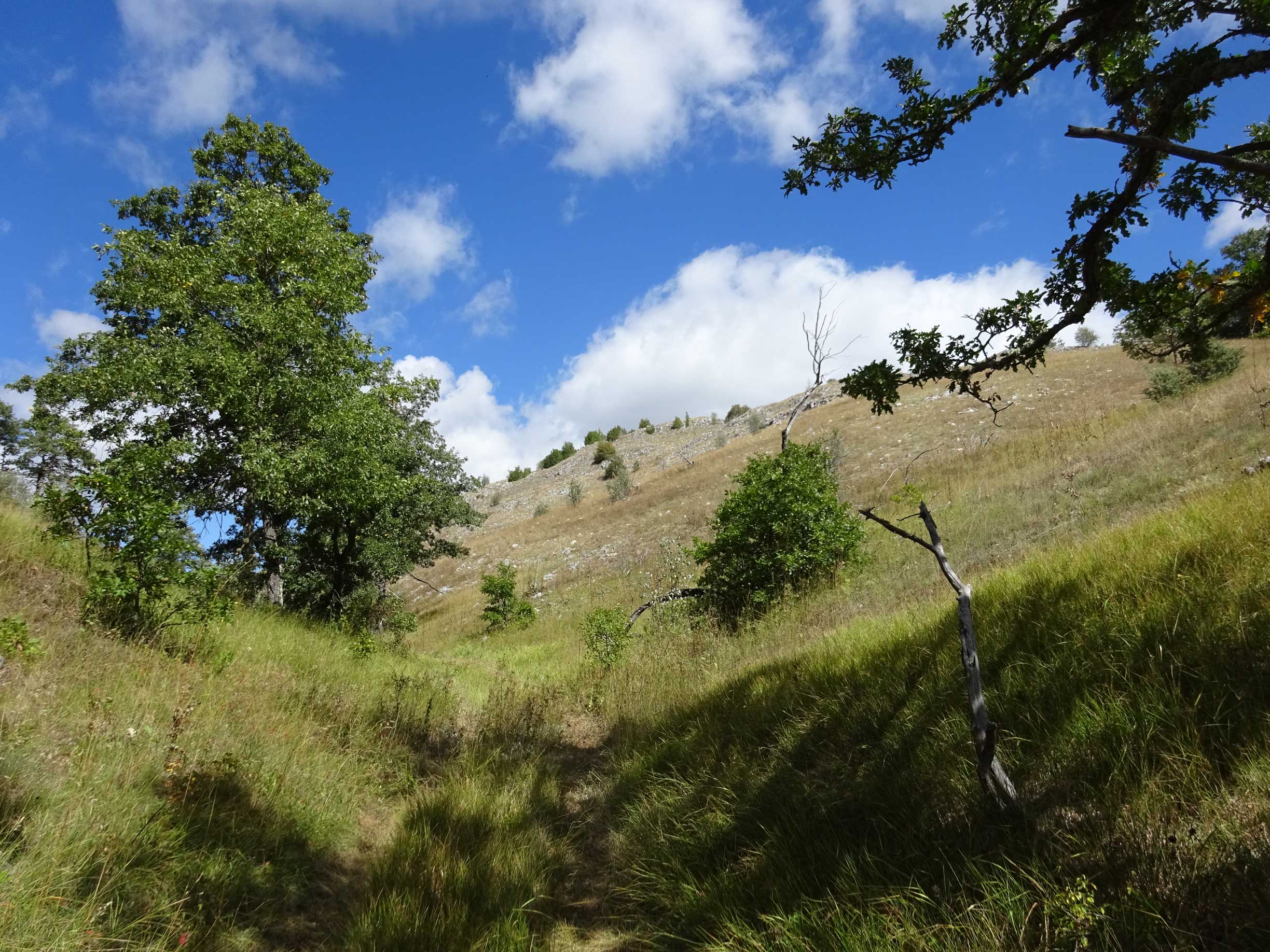
From “Signpost 1” the trail is easy to follow, mainly on 4×4 roads with nice wide views. There are even a few more signposts along the way.
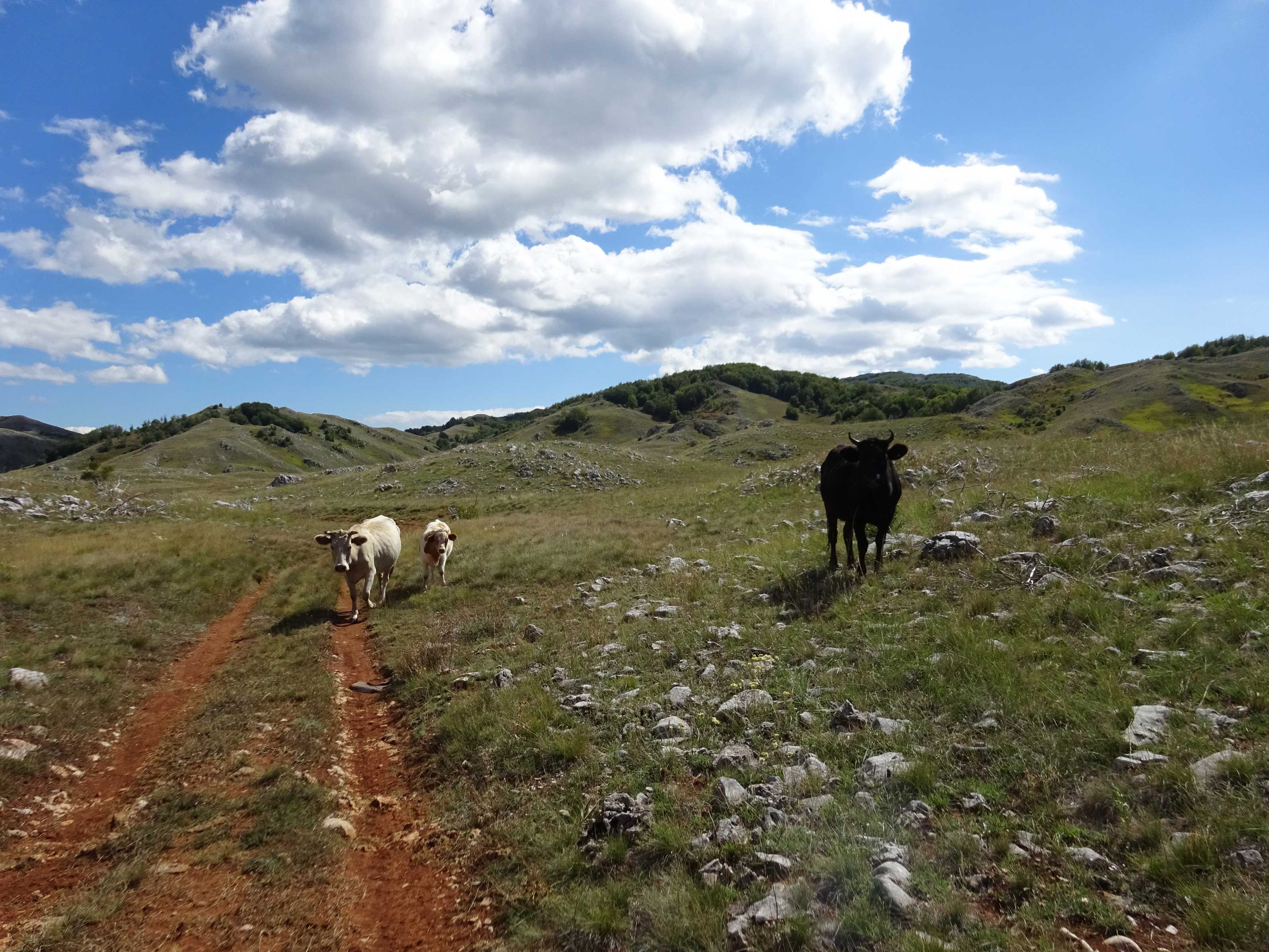
There were cows grazing in the valley, and you’ll pass a small farm in the valley as well.
When you reach the covered picnic place, you have the option to continue to Ohrid via Velestovo, which probably is the easiest and fastest way to go to Ohrid.

I decided to follow the ridge parallel with Lake Ohrid for the best views. It’s a freestyle trail again without a very clear path but the general direction is obvious.
At “signpoint 4” this trail joins “Leko’s Trail” (Pateka od Leko), which is a 6 km well-marked trail steeply going all the way down to the round-abound with the gas station at Biljana Springs in Ohrid.
Just before the end there are the ruins of an early Christian basilica.
For me this still was quite a demanding hike, because of all the detours and searching for the right trail it was over 36 km with 1650 m climbing! Hope it will be a bit easier for you with the help of the GPS track, it should not be much more than 27 km!

This attractive hike is very diverse, with the T6 trail going through an old forest, the sudden sunshine when you leave the forest and the nice slopes of Galicica National Park, combined with the ridge walk and good views over Lake Ohrid and Ohrid itself, and the descent via Leko’s trail. It gets 5 out of 5 stars.
You can view and download the GPS track of this hike, including more pictures, here: https://www.wikiloc.com/hiking-trails/galicica-national-park-traverse-from-oteshevo-to-ohrid-117895372

