
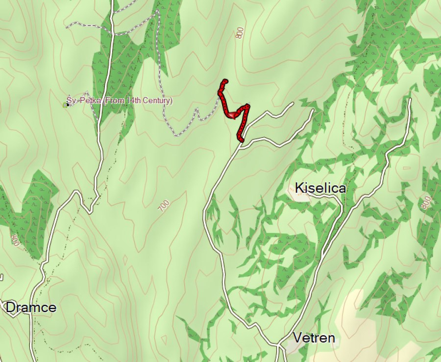
The Kiselica Cave is in the vicinity of the village Kiselica. We parked the car at the end of the asphalt road. From there it’s about 1 km to the Kiselica Cave.
There was a broken signpost for the Kiselica Cave at the end of the asphalt road where we parked.
There is another info panel where you have to leave the dirt road and follow the trail to the cave. The info panel was not readable anymore.
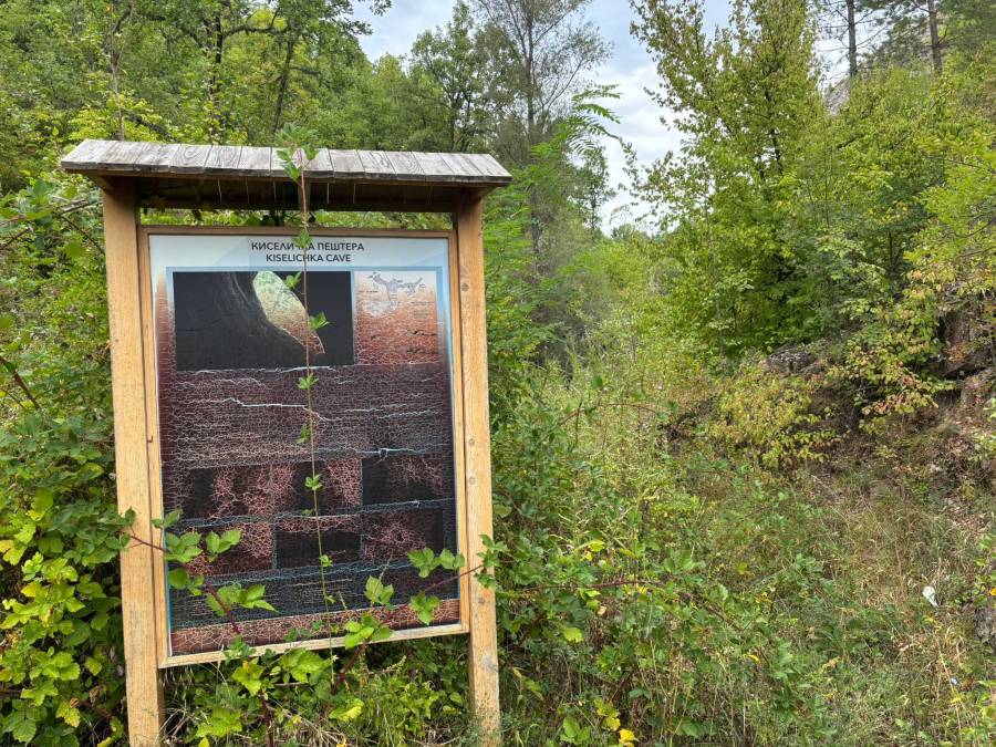
We followed the trail at the RIGHT of the info panel, through the “valley”. This trail was completely overgrown with thorny bushes and almost impossible to get through. After quite some searching and scratches, I found another info panel near the cave itself. The info panel says:
“The Kiselichka Cave is a natural uniqueness of Pijanec and with its length of 108m, it is the longest cave in this easternmost part of the Republic of Macedonia. Here one can see the two entries that lead to the underground labyrinth of cave canals. The larger or upper entrance is in a steep rocky section, at a height of 5m above the access path. The smaller, lower entrance section, is situated 15m to the right (southwest) and 4m lower than the upper entrance. There are various interesting insects in the cave, and bats from the endangered species, the greater horseshoe bat (Rhinolophus ferrumequinum) can be seen”.
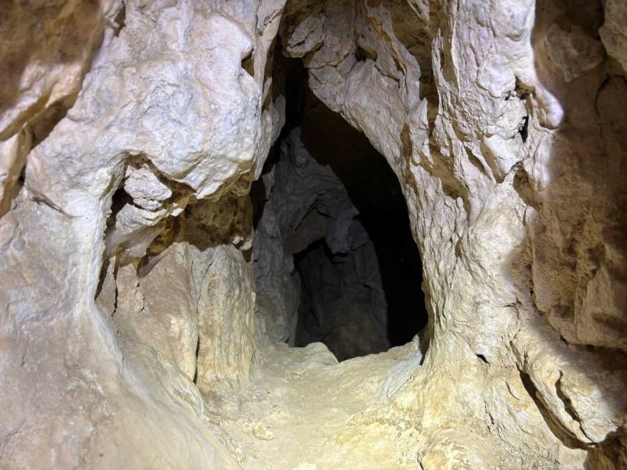
It was pretty difficult to get to the cave from the info sign, I had to improvise a makeshift ladder with a large branch from a tree that I found to climb to the upper, elliptical shaped entrance. It probably is not completely save to do this without proper equipment!
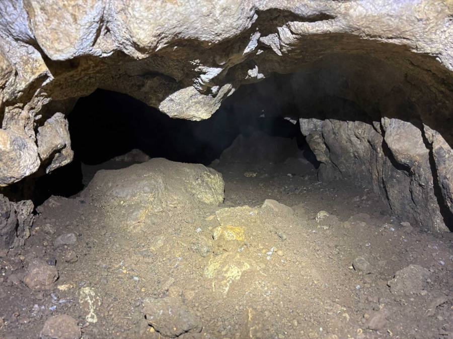
After making it back down from the cave I unfortunately did not look for the other entrance. I am not even sure if it would have been possible to find the other entrance due to all the vegetation.
When trying to walk back to the dirt road I noticed another trail, a bit higher than the “valley” and going parallel to the valley. It turned out that this trail was almost not overgrown at all.
So make sure you look for a trail LEFT from the info panel when going from the dirt road to the cave, this trail may not be very obvious!
The picture with the map below of the cave is taken from the paper “Archeological research of Kiselicka Pestera, village of Kiselica, Delchevo, Journal Arheoloski Informator, 2018” may help you to be better prepared than I was and find both entrances!
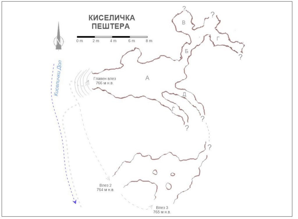
Translated text for the cave map:
- КИСЕЛИЧКА ПЕШТЕРА Kiselichka Cave
- Главен влез 766 м н.в. Main entrance – 766 m a.s.l. (above sea level)
- Влез 2 764 м н.в. Entrance 2 – 764 m a.s.l.
- Влез 3 765 м н.в. Entrance 3 – 765 m a.s.l.
- Киселички Дол Kiselichki Dol (Kiselica Ravine or Valley)
- The letters on the map (А, Б, В, Г, Д, Ѓ) are section labels, typically used to indicate different chambers or segments of the cave in Macedonian mapping conventions.
You can view and download the GPP track for the cave here: https://www.wikiloc.com/hiking-trails/kiselica-cave-237315471
We combined our visit to the Kiselica cave with the following other sights:
- The village Grad with the Gradishte Fortress and the Konjska Dupka Cave
- Church of St Archangel Michael in the village Dramche
- Church of St Petka (14th century) near Selnik (probably closed and therefore not worth the effort; we were told that the caretaker of the church lives in Delchevo). The church is shown on the map above, it should be possible to get there by foot from the Kiselica Cave; However, we went there by car via the asphalt road.
- Ochipala Cave and Tunnel (I visited them another day but they are in the vicinity of the other sights)
Some additional information about the Kiselica Cave that we got from our host at Villa River in Pehchevo says the following:
“It is also called Kiselica Hole, located near the village of Kiselica 10 km northeast of Delchevo at the foot of Kiselica Hill. The cave has two entrances, upper and lower, which are located on a vertical section 10-15 m above the riverbed. The upper entrance is elliptical, like a longitudinal crack, 4 m wide and 3.7 m high, with a northwestern exposure. Immediately below the upper entrance there are larger limestone blocks torn off from the section. The access is difficult, you have to carefully climb the rock 5-6 m, which requires ropes or ladders. Through a short corridor of several meters, you can enter the first gallery with an irregular circular shape. Several corridors of varying sizes extend from it. Through the central and largest corridor, the cave penetrates more than 100 m into the interior of the hill.
The lower entrance is 12 m southwest and 4 m lower than the upper one, and is easier to reach. There are two entrances, a smaller one (1 x 0.8 m) and a larger one (2.7 x 1.1 m), which were discovered by erosion of the section, they are narrow and can be entered for about 10 m. From the entrance, which is 1. 5 m wide, one passes through a short channel that widens into a cave hall with a diameter of 3.4 m. In the extreme parts of the hall, 3 more channels continue. The widest one leads to the east along a small circular gallery and ends with an almost impassable crack. The other two channels are narrow gaps that can only be entered for 2-3 m. There is strong air circulation in almost all channels. The explored channels in this section are almost horizontal. Mapped cave channels have a total length of 108 m. The height of the channels is less than 1 m, and in the parts with domes up to 1.5 m. It is the largest at the upper entrance – up to 3 m.
Kiselicka Cave is dry, with slightly more intense dripping in the end parts of the channels, where quite small stalactites are formed. No other cave decorations have been observed. In the central part there is a basin that, after descending from the wall, ends up almost hanging, i.e. the sediments under it have been eroded. Several smaller decorations (stalagmites, stalactites, columns and basins) are found in the narrow part of the southern vadose channel.
The cave is home to many bats, birds, insects, etc., including the rare species of bat Rhinolophus ferrumequinum. Geologically, the cave is “young”, probably no older than 20–40 thousand years. There are no attractive contents (except for the greenish color of the channels and the initial stalactites).
Fragments of ceramics have been found in the first gallery and on the surface deeper in the cave. Despite the difficult access, it was used in several periods, starting from the end of the Bronze Age, and especially in the Iron Age. In late antiquity, when a settlement existed on the plateau of the hill above the cave, the local residents used it for various purposes, according to the pits that contain Late Antique ceramics and disturb the older layers. The archaeological objects and layers are disturbed by animal holes, but also by modern pits and hearths in some of the pits, as well as inscriptions on the walls. A floor made of compacted clay with three phases of restoration was also discovered, which is evidence of the use of the cave.
There are many legends about this cave – from the fact that there is a lake in the innermost part (there are no indications of such a thing), to the fact that one can exit to Bulgaria through one of the channels. Locals even have a story that a dog was released into the cave and came out on the Bulgarian side, near the border, almost 3 km away! Of course, there is no basis or possibility for this claim, since the limestone block is small, with a diameter of about 100–150 m”
