This is a hike to a summit in in the south of Galicica National Park. It is a climb of about 400 meters uphill, 1.5 hours to the top, and back via the same way.
At certain points of this hike you can see Lake Prespa and Lake Ohrid from the same location.
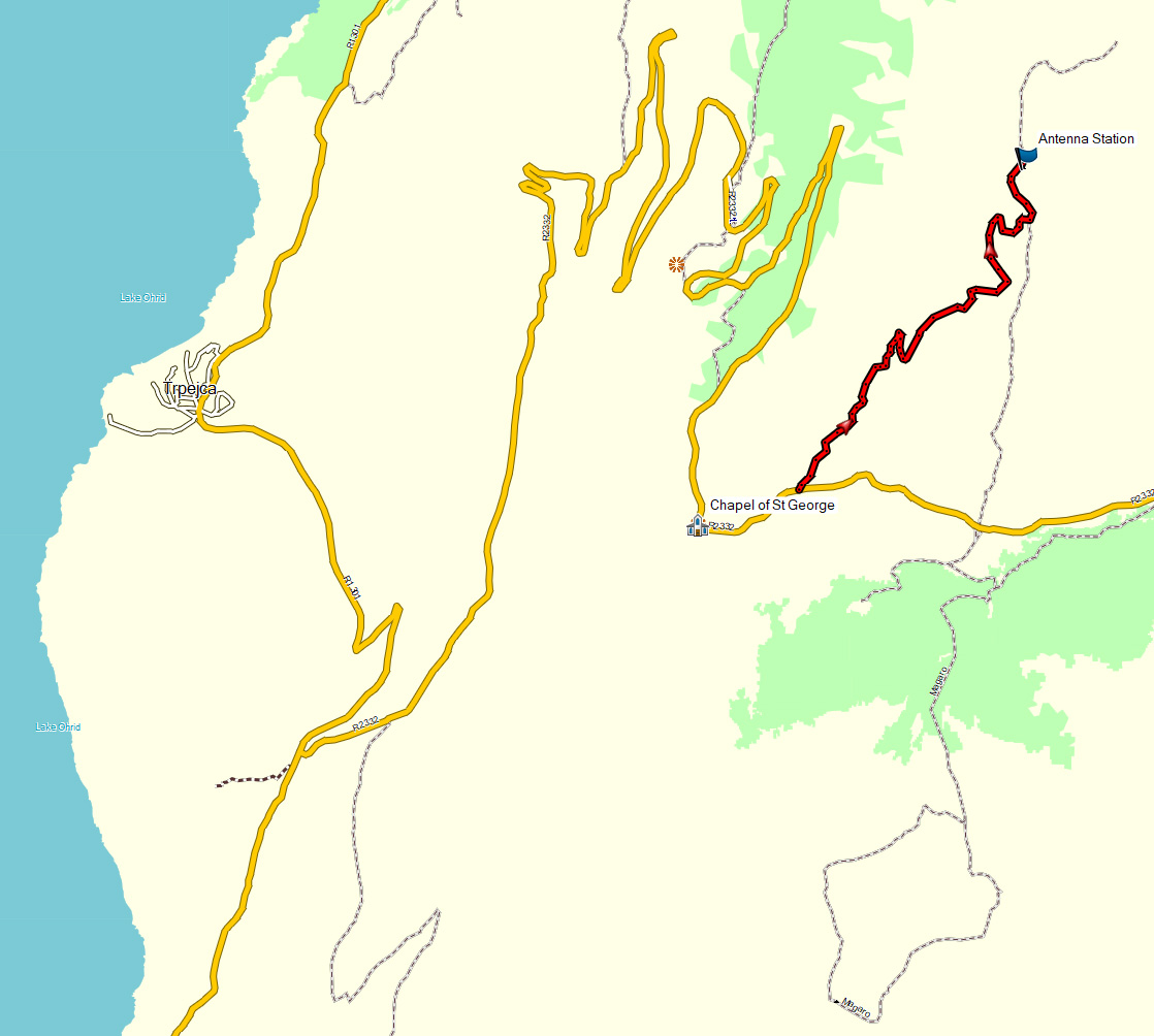
The Livada Pass is on the highest point on the road that connects Lake Ohrid and Lake Prespa, close to St Naum. On your way from Ohrid to St Naum, take this road to the left after the village Trpejca into Galicica National Park. It’s a bout 45 minutes driving from Ohrid.
The hike starts about 500 meters from the small Chapel of St Gorgi (St George), from where you have a great view over Lake Ohrid. You can park your car at the small parking place at St Gorgi, or drive a bit further towards Lake Prespa and park at the starting point of the hike, a 4WD track to the left (north) that leads uphill into the park.
Just follow this track, along some (broken) electricity pylons to the top.

On your right you can see some caves at a certain moment. These caves are probably man-made and used to store ammunition during the war. Be careful if you want to have a look inside the caves, I found the skin of a snake there…
Higher on the mountain, you will pass some trenches, also from the first world war.
There are antennas on the top. From here, you could wander a bit further into the park if you would like.
Warning: Do not try to do this walk if there is fog. First, you will not have a good view at the two lakes. Second, you might not have any view at all. I did this hike with some friends, in the fog, and on the top (Lako Signoj) we could not see more than 20 m ahead, it was even hard to see the trenches while we were standing next to them…

If you do not have a car to reach the Livada Pass (Lipova Livada), you can take a bus to the village Trpejca or St Naum and take a taxi from there (and asked to be picked up after 3-4 hours later).
This hike is also described in the second edition of the Bradt Travel Guide Macedonia. I do not have a recorded GPS track for this hike, but you can have a look at the map below. As you can see there is an alternative route to the top which starts about 1 km further towards Lake Prespa. This is also the starting point of the hike back to Ohrid over the ridge of Galicica National Park that also passes the Antenna Station. This route to the Antenna Station may even be more interesting than following the 4×4 road described here. On the other site of the road the hike to Magaro peak starts.