
With 14 km in length and 850 m ascent this hike is longer than the official hike from the Lipova Livada pass to peak Magaro (about 8 km with 700 m climbing) but not with too much more climbing. In contrast to the official hike, this hike also goes to the highest peak of Galicica National Park, the peak Kota F10.
I think this hike is probably the best possible route to visit Magaro peak and surroundings. The official trail only goes up to peak Magaro and directly down again. The hike described here additionally includes a relatively flat walk over the ridge to the Kota F10 peak and a relaxing walk back though a valley.
The map below shows in red the other hikes that I did in the surroundings, the hike described here is shown in blue.

I did not actually walk this version myself, but generated it by copy/pasting parts of 3 other hikes that I did, in order to create the perfect route:
- Magaro Peak from the Lipova Livada pass (8.5km/700 m), more or less the official route, although it follows the ridge for better views, instead of the official trail once you’re almost at the Magaro peak.
- Magaro and Kota F10 peaks from Ljubanishta (22km/1800 m)
- Magaro and Kota F10 peaks from Trpejca (30km/1600 m)
As you can see it would also possible to get to Magaro via the Lipova Livada pass from Stenje or Leskoec from the side of Lake Prespa.
Mount Magaro is the second highest peak of Galicica National Park and probably the most visited peak near Ohrid or even in Macedonia. It is so popular that it apparently is lucrative for the National Park to make you pay to climb it. At the entrance to Galicica National Park near Trpejca there is a toll booth were you have to pay to enter Galicica National Park by car (50 denars/1 euro for the car and 30 denars/0.5 euro per person). And at the start of the trail to Mount Magaro there is another toll booth where you have to pay 200 denars (3.30 euro) to climb the peak (See here how this ridiculous fee is disputed by the UIAA (international climbing and mountaineering foundation: https://www.theuiaa.org/access/access-restrictions-in-the-galicica-national-park/).
The hike described here starts at the toll booth at the start of the official trail at Lipova Livada (Linden Tree Pass).
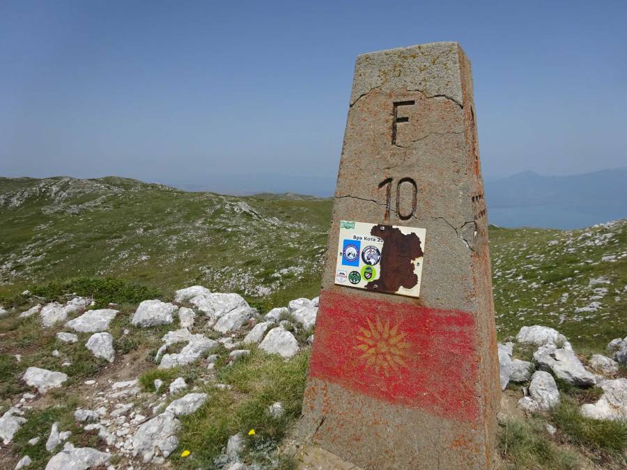
Usually people want to visit the highest peak of a mountain range. It is funny that the highest peak of Galicica National Park, peak Kota F10 (2265 m), is less well known and less visited than the Magaro peak (2255 m), although they are just 3 km apart. The Kota F10 peak is on the border with Albania. This hike visits both peaks.
On a clear day you’ll have excellent views of both Lake Ohrid and Lake Prespa during this hike. You can even see the island Golem Grad in Lake Prespa.
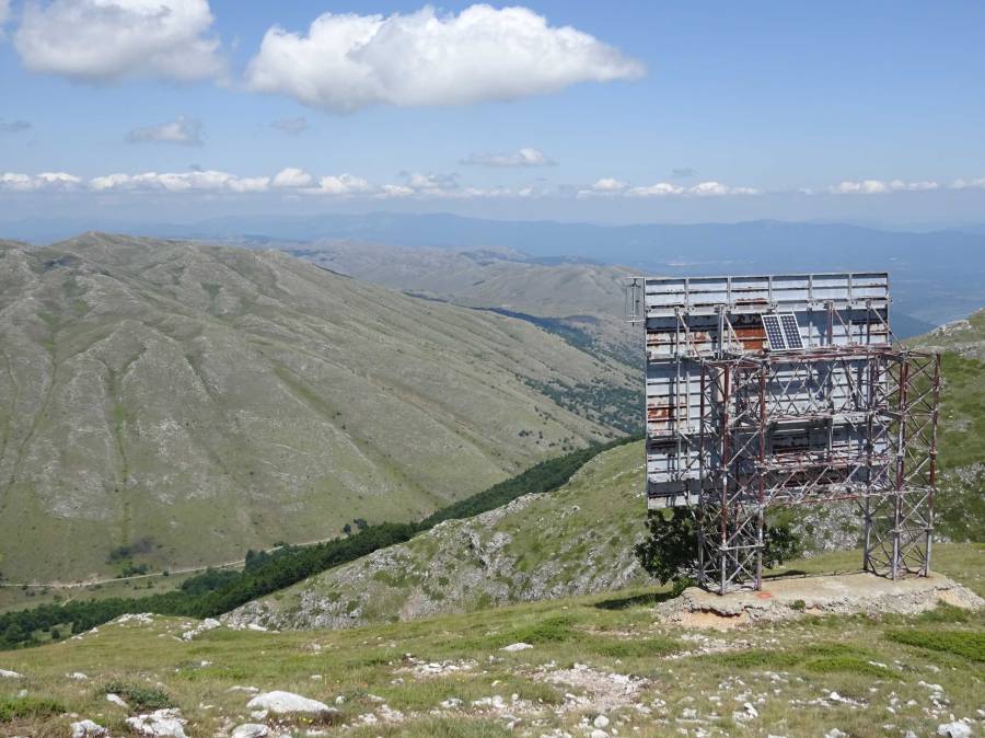
The trail first goes through forest area until you get above the tree-line in a valley. From there, the official direction that most people take is a right turn for the trail towards the huge metal radio reflector on the mountain. The reflector looks like a bill board and I must admit I thought that was exactly what it was for a long time. A bill board in the mountains, what was I thinking? You can of course also decide to walk to the Kota F10 peak through the valley first, this is a less steep option.
After peak Magaro you don’t follow the official trail that goes directly downhill, but walk on the mountain ridge to the Kota F10 peak. There’s not a clear trail although I noticed some green marking here and there.
The Kota F10 peak is marked with a concrete marker saying F10 and there are ruins of an old stone shelter. Just below the peak there are the ruins of an old military building, probably from the first Word War, just like the many trenches that can be found scattered all over the mountains.

After the Kota F10 peak, you follow the same trail back for about 1 km and you continue to follow this clear trail to the right where it zig-zags its way down into a valley. From there you follow the trail back to the start.

Overall the hike would get 5 or of 5 stars, just like I rated the official but shorter version.
You can view and download the GPS track of this hike here: https://www.wikiloc.com/hiking-trails/magaro-and-kota-f10-peaks-in-galicica-national-park-from-lipova-livada-84666573
