
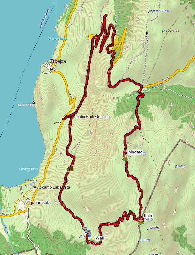
With 30 km in length and 1600 m ascent this is a long and demanding hike to the famous Magaro peak in Galicica National Park. Note that this is not the standard and official trail, which starts at the Lipova Livada (Linden Tree Valley) pass and which is just 8 km in length with 700 m climbing!
Mount Magaro (2255 m) is the second highest peak of Galicica National Park and probably the most visited peak near Ohrid or even in Macedonia. It is so popular that it apparently is lucrative to ask for a fee to climb it. At the entrance to Galicica National Park near Trpejca there is a toll booth were you have to pay to enter Galicica National Park by car, and at the start of the trail to Mount Magaro there is another toll booth where you have to pay 200 denars (3.30 euro) to climb the peak (See here how this ridiculous fee is disputed by the UIAA (international climbing and mountaineering foundation: https://www.theuiaa.org/access/access-restrictions-in-the-galicica-national-park/)
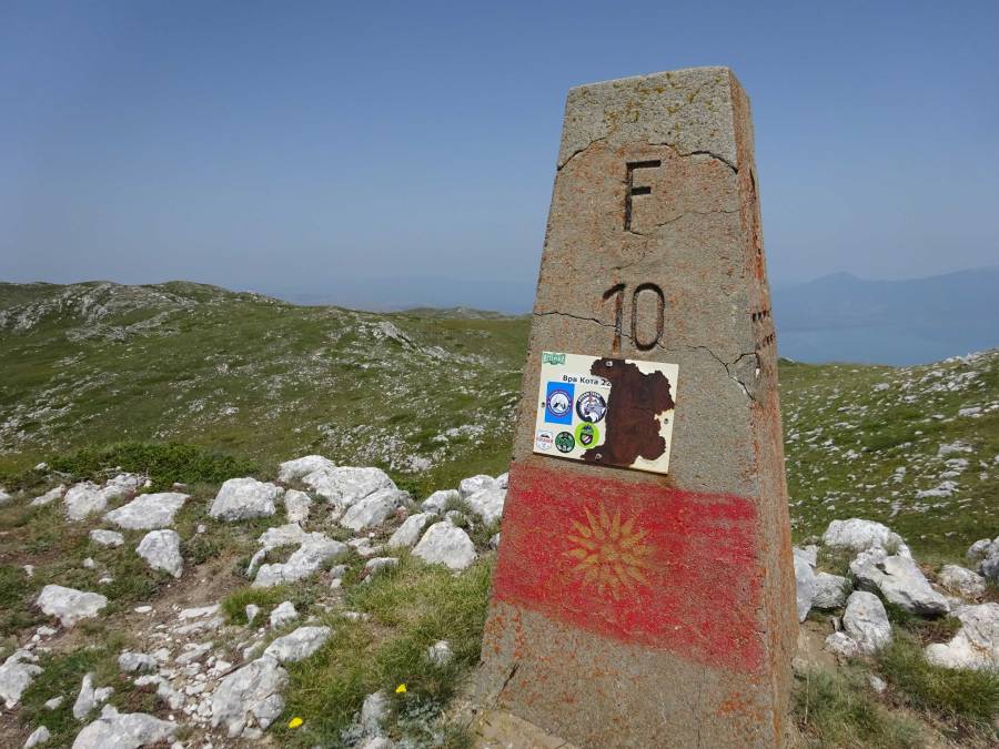
Usually people want to visit the highest peak of a mountain range. It is funny that the highest peak of Galicica National Park, peak Kota F10 (2265 m), is less well known and less visited than the Magaro peak (2255 m), although they are just 3 km apart. The Kota F10 peak is on the border with Albania.
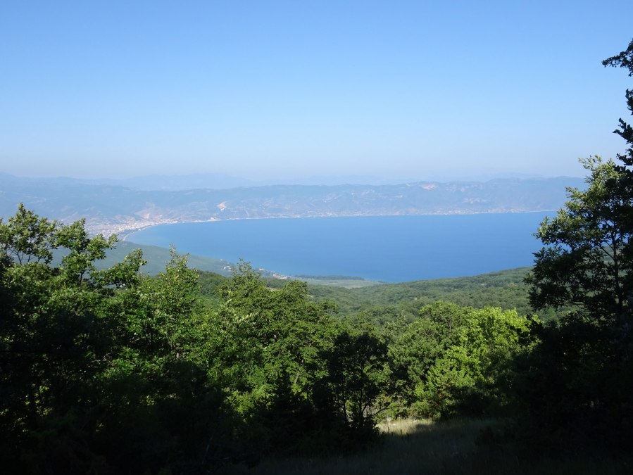
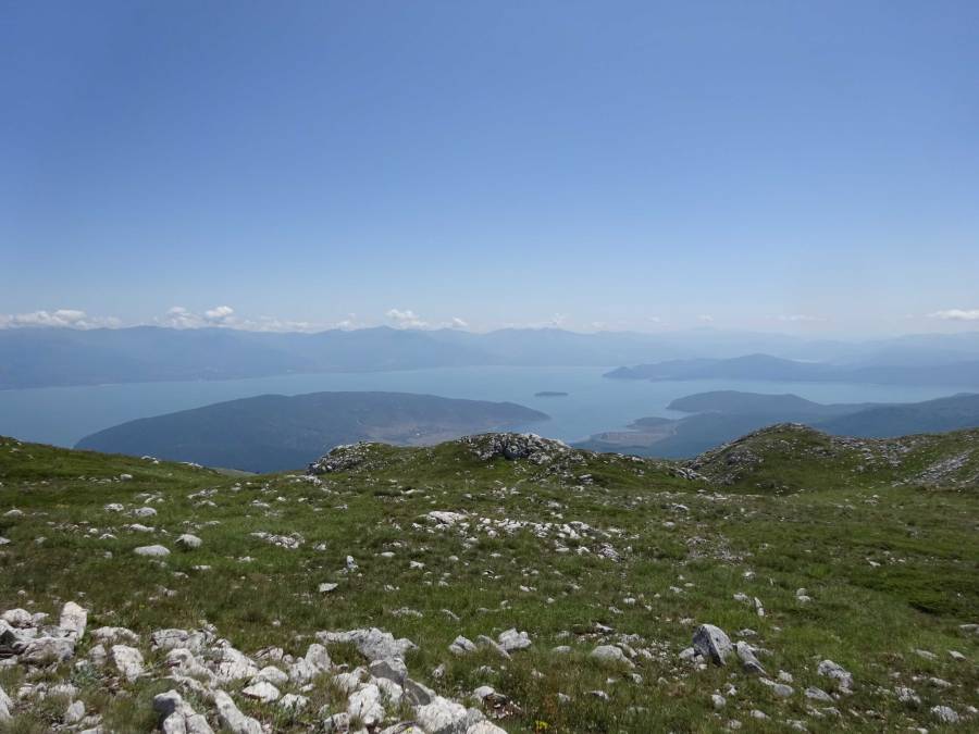
On a clear day you’ll have excellent views of both Lake Ohrid and Lake Prespa during this hike. You can even see the island Golem Grad in Lake Prespa.
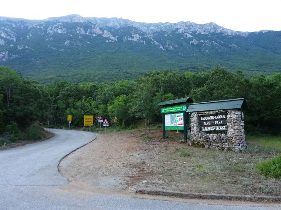
The hike I describe here begins at the entrance to Galicica National Park, about 3 km from the village Trpejca. Here the asphalt road through the park starts, which connects Lake Ohrid and Lake Prespa. I parked the car at 06:30 in the morning just before the entrance to the park. The toll booth was not occupied at that time (haha).
A large part of this hike is based on the 66 km trail from the Galicica Ultra Trail run from St Naum to Ohrid (https://ohridultratrail.com/), which for me was a good indication that this would be an unusual but safe approach to the Kota F10 and Magaro peaks. Here and there you could see forgotten little orange flags marking the trail.
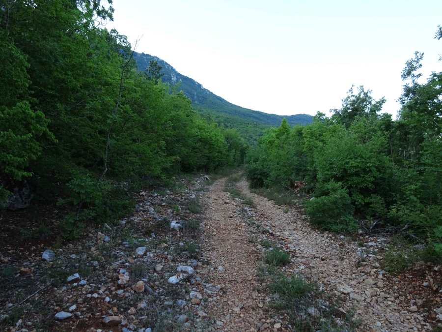
After 500 m you leave the asphalt road for a dirt road to the right, signposted to the village Ljubanishta. Actually, another hike that I did to peaks Magaro and Kota starts at the village Ljubanishta.
Instead of following the signposted trail to Ljubanishta to the right you continue on the dirt-road.
About 2 km into the walk you have the opportunity for a shortcut if you leave the dirt-road for a steeper trail through the forest.

At 4 km you arrive at a Y-junction, where you follow the road to the right which will take you to the Kota F10 peak. The trail to the left is part of a more difficult and partially overgrown route to peak Magaro.
At 6 km you arrive at an area with a spring, where you temporarily leave the dirt road for a smaller trail.
At 6.5 km you can find the remains of stone walls, I don’t know what their purpose was. Maybe dating back to the first Word War, from which time also the trenches on the top of the mountain date?

Just after those walls, at 6.8 km, make sure you don’t miss the not-so-obvious trail to the left that leads into the vegetation.
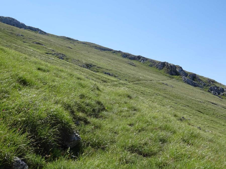
After this shaded trail through the vegetation, it’s a lot of climbing without a clear trail until you reach the trail that zig-zags all the way up to the Kota F10 peak.
Just below the peak there are the ruins of an old military building, probably from the first Word War, just like the many trenches that can be found scattered all over the mountains.
The peak itself is marked with a concrete marker saying F10 and there are ruins of an old stone shelter.
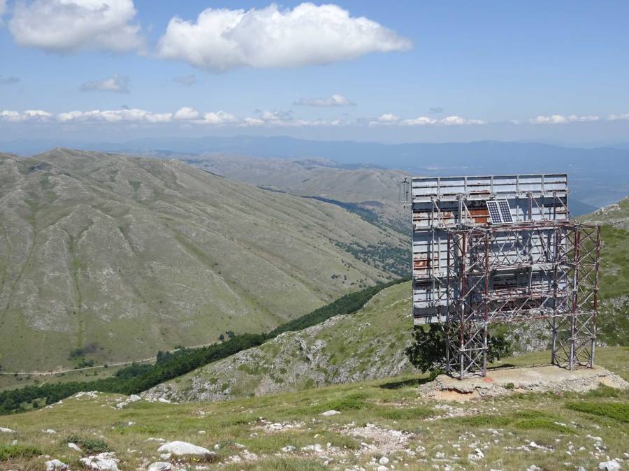
From the Kota F10 peak it’s a pleasant almost flat walk to peak Magaro. During the 6 hours that it took me to get to Magaro peak I had not met a single soul, but now the trail was getting more busy, as expected. I met several people on the Magaro peak, and also on my way down to the Lipova Livada pass. I went down using the trail that is usually used for the ascent, passing the huge metal radio reflector that looks like a panel for advertisements.
At the Lipova Livada pass, I made sure to quietly pass the information/toll booth at the back in order to avoid paying the mandatory fee (haha).
Most of the descent back to the start is via the asphalt road. In the beginning that’s not that bad and it even feels nice to have some solid ground under your feet again. Just after the viewpoint at the chapel of St George you leave the asphalt for a shortcut, then some asphalt again, followed by another shortcut until you reach a recreational area.

The last 8 km are only on asphalt, except for a 200 m easy-to-miss shortcut in a bend of the road. This part is quite boring and monotonous and makes you really long for that cold beer waiting at home!
Once I reached the toll booth at the entrance of the park, I kindly waved at the park ranger who probably did not understand why on earth somebody would come out of the park by foot, and as a consequence didn’t ask me for an entrance/exit fee (haha again).
This is really a nice alternative and safe approach to the Magaro Peak, but also a lot tougher than the official trail to Peak Magaro because of the length and climbing. The last 8 km on asphalt definitely took away some of the good feeling that I had about this hike. Maybe it’s not such a bad idea to call a taxi when you’re at the chapel of St George or the recreational area after the first 2 shortcuts. On the other hand, if you mentally prepare for the asphalt at the end you know what to expect!
The hike gets 3.5 out of 5 stars, but know what you start when you embark on this 30 km monster hike!
A few days later I tried another alternative approach of peak Magaro, starting in the village Ljubanishta. This trail also visits peak Magaro and Kota F10, but was even more challenging because parts of the trail were overgrown and hard to find. See here: Magaro and Kota F10 peaks in Galicica National Park from Ljubanishta (22 km / 1800 m).
I digitally combined my three hikes to peak Magaro and think I’ve come up with the nicest route that takes the best part of each trail: Peaks Magaro and Kota F10 from Lipova Livada in Galicica National Park (14 km / 800 m). This would be a 5 star walk, just as the official Magaro trail itself!
You can view and download the GPS track of this hike here: https://www.wikiloc.com/hiking-trails/magaro-and-kota-f10-peaks-in-galicica-np-from-trpejca-84559911
