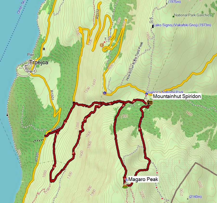
This hike is 17 km long with 1400 m ascent and describes an unusual approach of the Magaro Peak (2255 m). While most people will start the hike to Magaro Peak at the Lipova Livada pass (at about 1580 m), this hike starts at the entrance of Galicica National Park near Trpejca at about 900 m and therefore involves a lot more climbing.
NOTE: Part of the descent is pretty steep (grade 35-40%) through a narrow ravine with a lot of leaves, so good hiking shoes and sticks are recommended. Maybe this trail is not suitable during wet periods – in that case follow the same trail back as you came.
On a previous hike to the Magaro and Kota F10 peaks I also started at the entrance of Galicica National Park, but took a different ascent via the Kota F10 peak, and I descended via the asphalt road. The descent from the Lipova Livada Pass back to the entrance of the park through the ravine, which I describe here is so much more attractive and better than the asphalt road!
This hike is based on the GPS track by Tanche Lambevski. I wanted to do this hike already for a couple of years but never got to it, until the summer of 2025. To make this trail even more attractive, I included peak Magaro and the descent via the official Magaro trail and the mountain hut Spiridon.
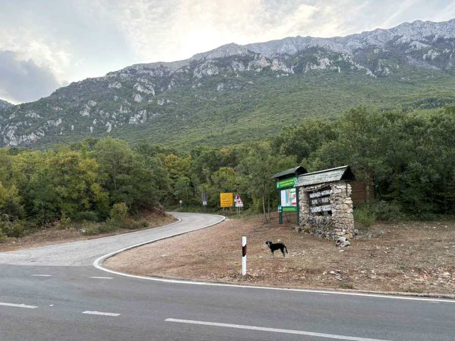
I parked the car at the entrance of Galicica National Park. Note that you need to buy entrance tickets to the park and to climb peak Magaro. I started early at 07:00 h and there was nobody at the entrance to check for tickets – But I had already bought a ticket online though to register myself, since this hike was during the ban for movement in the forest because of forest fires. See here for more information about this yearly recurring ban.
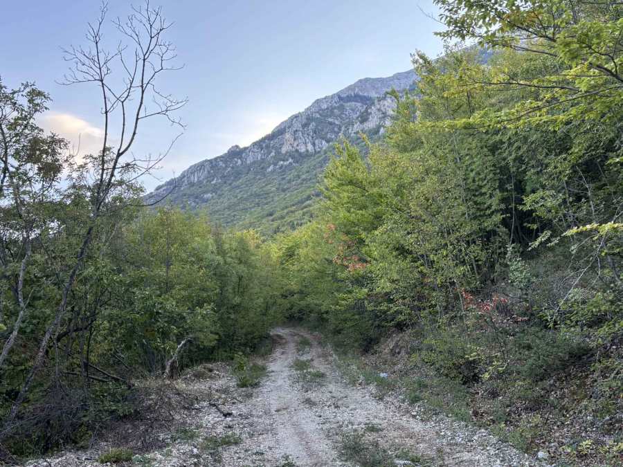
After about 2.5 km you leave the 4×4 dirt road when it bends to the south, and you continue on a much more attractive forest trail. You can easily miss this trail if you don’t actively look for it.
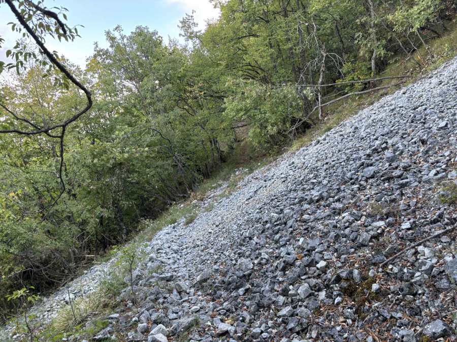
A bit further the is a small “stone river”, these are much more common in Pelister National park than Galicica National Park.
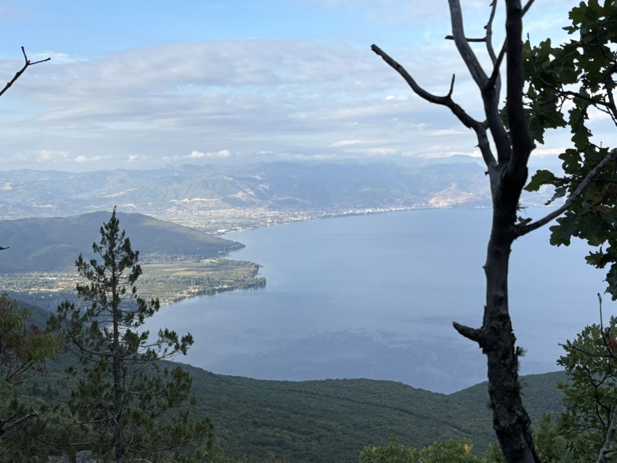
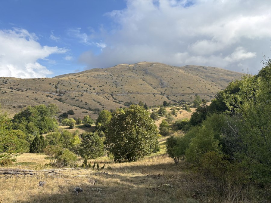
There are several good viewpoints along this trail.
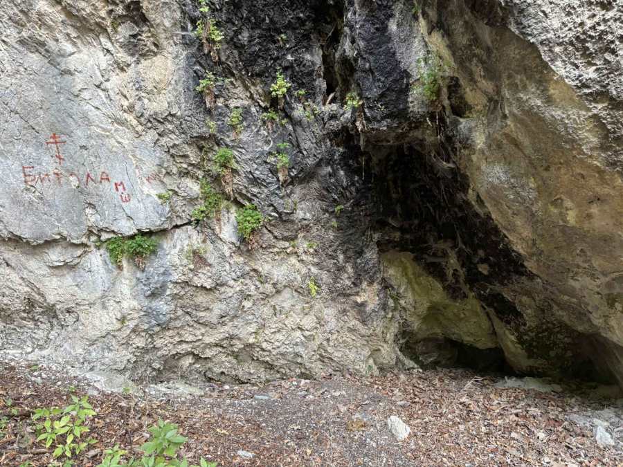
Interestingly, there are two places where there is something painted on the rocks, the painting looks relatively recent. The first painting says “Bitola”, I don’t know why but also Tanche Lambevski who’s GPS track I used named his track “Bitolski Pat” so it probably has some historical reason?
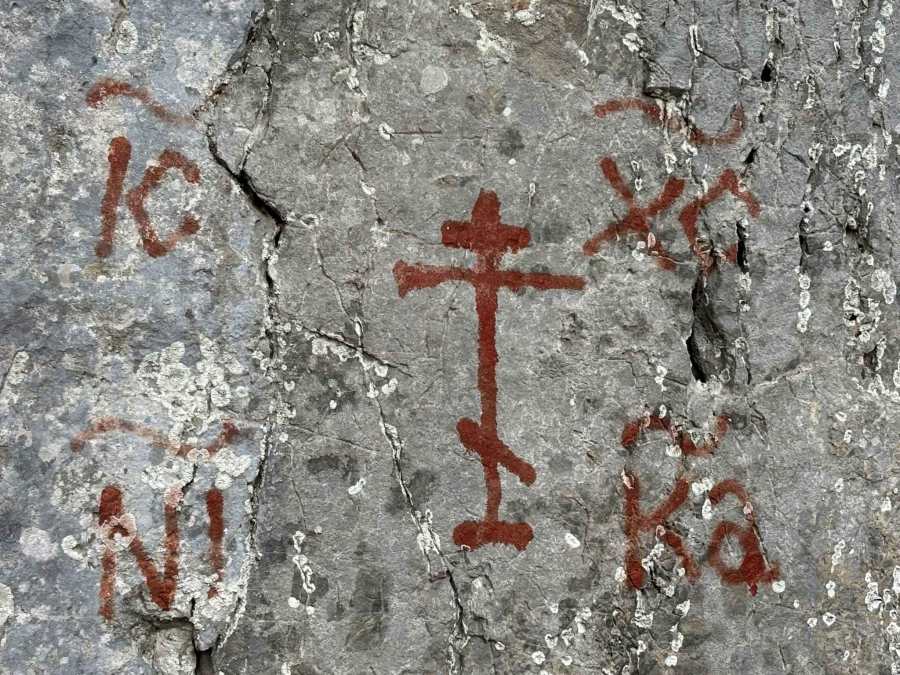
The other painting seems more religious, with a cross and the text should be read as IC → short for Jesus, XC → short for Christ, NI → part of NIKA (conquers) and KA → completing NIKA, so spelling “Jesus Christ Conquers”. There also is a small cave here and I wonder if the painting and the cave have to do something with each other? Please let me know if you know more about the meaning of these rock paintings!
A bit further there is a viewpoint with a shrine for St Naum of Ohrid the Miracle-worker with a plaque saying (according to ChatGPT):
Uniting yourself with Christ, O blessed father Naum,
you lived with a pure soul.
Striving to overcome the desires of the flesh and the sin of the world,
you showed yourself as an angel in the flesh.
By your faith you conquered the devil,
and now, with your prayers, protect us
and save us from temptation.
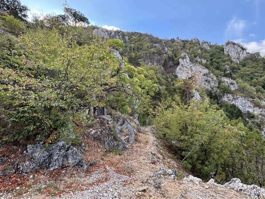
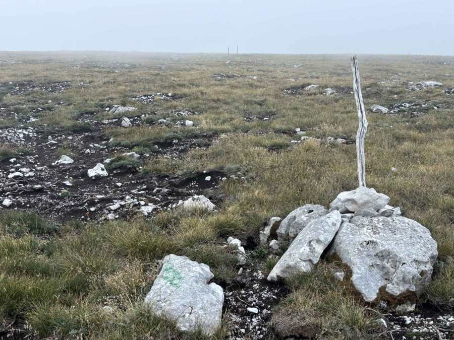
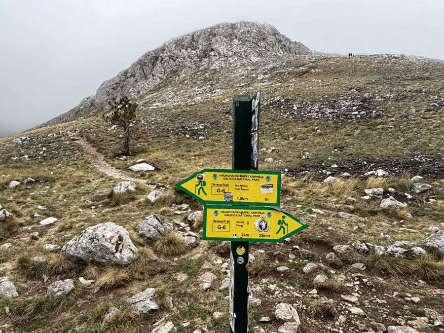
When you exit the forest, you will come across sparse green markings that make it easier to follow the trail. From this point on it is a very steep (grade 40-50%) climb to the peak, first though a forest area and later more exposed. The whole area around peak Magaro has been burned badly in 2024 and the devastation was still very well visible. There are some stone markers to show you the way to the top.
Looking for a less steep ascent to the top? Follow the official trail via the mountain hut Spiridon and follow the GPS track clockwise.
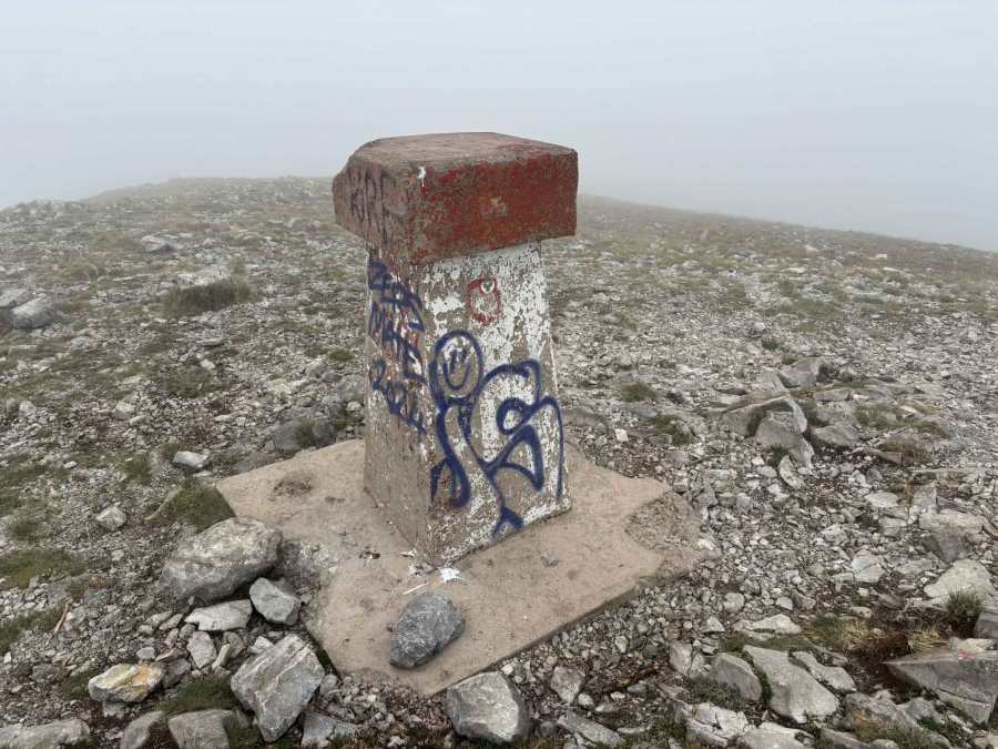
Meanwhile, the weather changed quickly and it became very foggy and cold, the temperature dropped more than 10 degrees Celsius on the way to the top. So I did not spend much time at the top but quickly descended again.
I met a mountain guide with a disappointed tourist, who had been looking forward to see the beautiful views of Lake Ohrid and Lake Presa from the peak. But there was so much fog that you could hardly see 10 meters ahead! Take home message: Plan this hike on a clear day! I did not mind so much because I had climbed peak Magaro several times before and enjoyed the view.
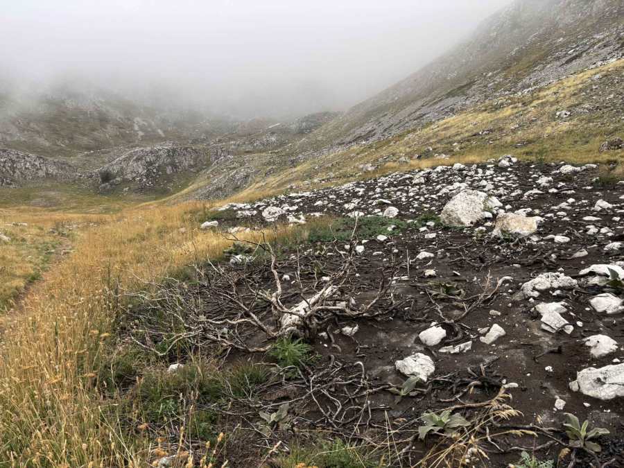
During the descent to the mountain hut Spiridon it became even more clear how much damage the fires had done in 2024.
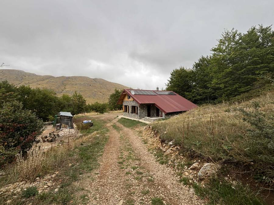
The mountain hut Spiridon offers accommodation for 17 people in a shared space. In the mountain hut they could confirm that the planned steep way down (grade 35-40%) was safe and do-able. Contact: https://www.facebook.com/mountainhutspiridon; spiridon.hut@gmail.com.
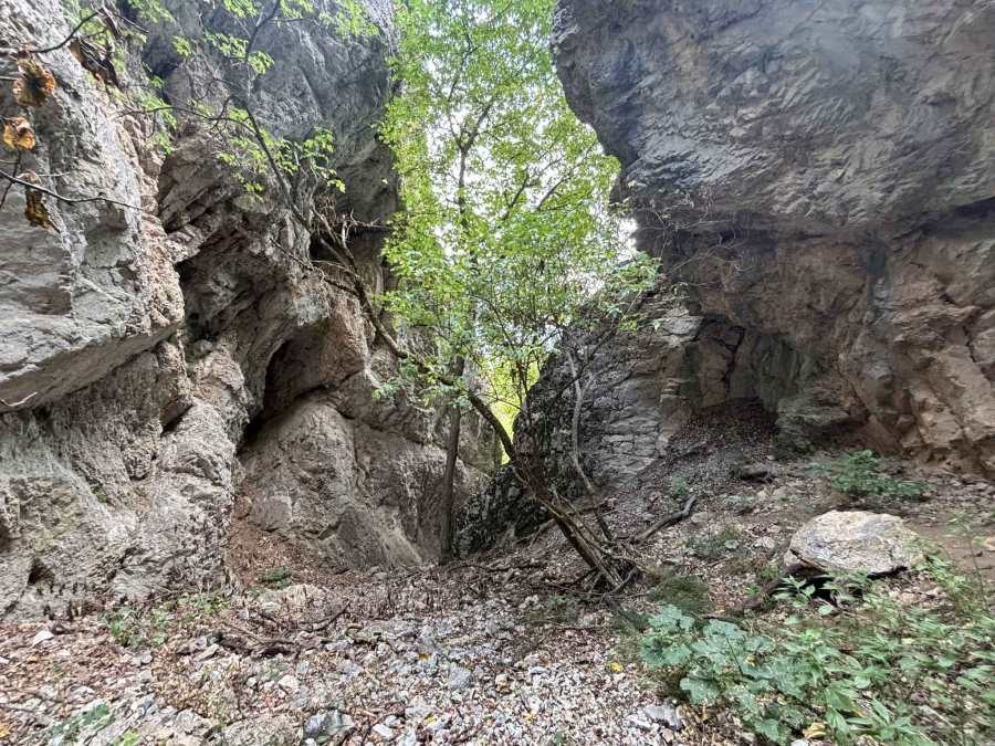
After the mountain hut you re-connect with the forest trail. Here you can choose to take the same way back as you came (about 6 km) or the steep way back though a ravine (less than 3 km). I took the way through the ravine, which was steep but better do-able than I expected.
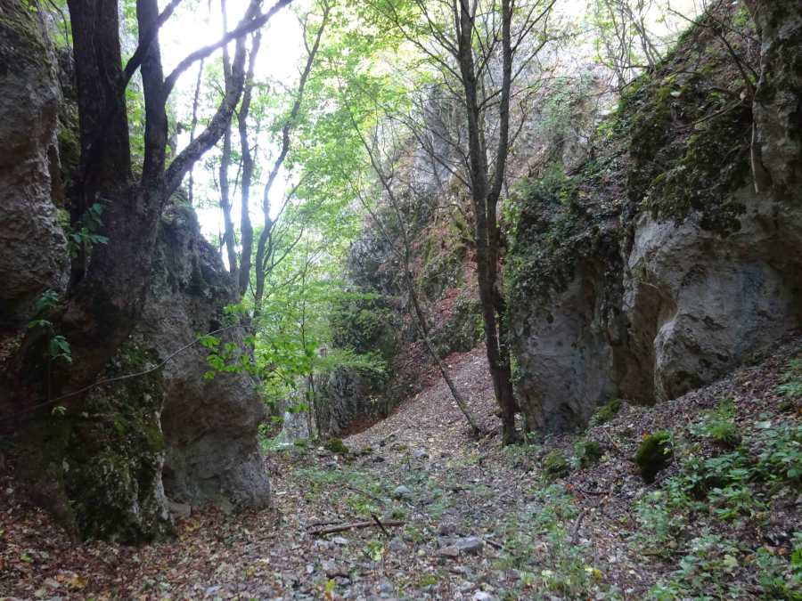
Walking through this ravine has a very special scenery and feel, that you don’t find anywhere else in Galicica National Park. Near the end there seemed to be an area for rock climbing. Like I mentioned before, hiking boots and sticks are recommended for this part, and be careful when the ground is wet. But this descent is so much better and faster than taking the asphalt road back from the Lipova Livada Pass (12 km!).
This interesting approach and descent to Magaro Peak gets 5 out of 5 stars. It is also interesting for people who do not have a car to drive up to the Lipova Livada Pass, since there is not public transport taking you there. You can simply have the bus from Ohrid to St Naum drop you of at the entrance of Galicica National Park and start hiking!
After this hike I still had enough energy to search for the recently discovered Alpinistička Peštera (Alpinist Cave or Mountaineering Cave) near the picnic site Korita and the Via Ferrata at the site “Dobroya”. And I managed to find it with some help from the local mountaineers!
You can view and download the GPS track of this hike here: https://www.wikiloc.com/hiking-trails/magaro-peak-from-the-entrance-of-galicica-national-park-240889184