
This is not really a hike but the track shows you how to reach the archeological site Vajtos Kale (Vajtos Fortress) near the village Oktisi. The trail is 5 km in total length (about 2.5 km in one direction) with 350 m climbing. The height difference does not make this a typical walk in the park!
There is a large square at the start of the hike where you can park.

We had already tried to find the site Vajtos many years ago, based on the description in the Bradt Travel Guide Macedonia by Thammy Evans. However, although this is an excellent guidebook, the descriptions of the hikes are not always very clear. So at the time, we gave up when we could not find the site Vajtos based on the description in the guide.
Luckily, in the meantime I had found the coordinates of the site in a scientific paper by Barbora Weissova named “The Frontier Studies. Survey of the Northern Part of the Lake Ohrid Basin, Preliminary Report on the Season 2017” in Studia Hercynia XXII/1, 99-133. This paper has a wealth of information about archeological sites around Ohrid.

The paper by Weissova describes Vajtos as follows:
“A fortified settlement from the Hellenistic and Roman periods known as Gradishte Vajtos, located about 2 km south‑west of the village of Oktisi. The site is situated on one of the many hills placed in the second ‘line’ of the Jablanica mountain range, not directly connected to the Struga plain. The position is ideal for guarding the four‑kilometre long pass indirectly connecting the area today represented by the villages of Vishne and Oktisi. The fortification long axis is oriented in the east‑west direction and its length reaches about 160 m, the width is about 50 m. The northern fortification wall is made of big rectangular stones, in a pseudo‑isodomos technique (varying between 125–180×45–95×40–45 cm). The remains in the south, identified as a part of the defensive architecture, are made of considerably smaller stones (max. 80x40x30 cm), possibly representing the remains of a watchtower. The eastern entrance to the rocky spur of the fortification (based on the terrain possibly the main entrance) is heavily damaged by several robbers’ trenches which uncovered stone walls – some bound by mortar, some not. The walls can be attributed to several different phases of the settlement as they were built over each other in different directions. The height of some of them exceeds 1 m, their width is about 40–50 cm. The eastern area yields the highest amount of surface material – architectural ceramics (roof tiles, one with an imprint of a pig hoof), three different rims of dolia and several pieces of Hellenistic (black glaze) and Late Antique pottery.”
Having the coordinates of Vajtos made it a bit easier to know in which direction to go, but it still took quite some walking back and forth until I finally had found the right trail leading up to the site. Once you have found it, it is obvious! My other fruitless attempts have been erased from the GPS track.

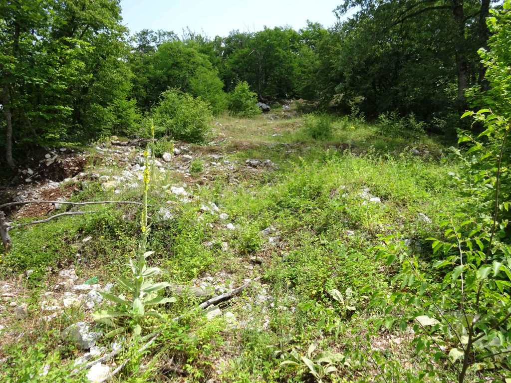
Before you reach Vajtos, there are clear remains of an old road. Actually, this is probably the most interesting thing that there is to see, because Vajtos itself is largely overgrown and there really is almost nothing to see!
The Bradt Travel Guide North Macedonia (6th edition) mentions that “some say that Vajtos is the 8th stopping place on the Via Egnatia, and the last stop before Ohrid, but it is much more likely that this was a stop on the Crni Drim raod to Northern Albania”.
The remains of pavement near the village Radozda are probably more likely and accepted to be part of the Via Egnatia.
The paper by Weissova describes the remains of the road as follows:
An old stone pavement of road situated about 240 m north‑west of the Vajtos Gradishte. The road runs in a north‑east direction and its southern end turns west. The preserved width is 1.5 m, the length about 10 m, with a scatter of single stones, possibly originally part of the road, going further to the north.
Vajtos 
Vajtos
Like I mentioned before, there is really not much to see at the Vajtos site and it was a bit of a disappointment. I also did not manage to find the “big rectangular stones” that should be part of the northern fortification. That was mainly because I did not have sufficient time to look around because of a thunderstorm that was approaching, and I did not want to get caught on top of the hill when it arrived. I made it back to the car in time before the bad weather started…
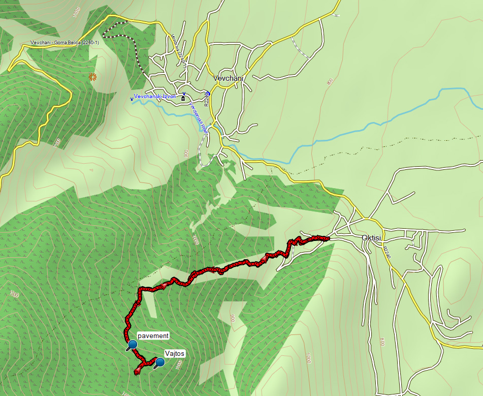
The Bradt Guide North Macedonia describes this as a circular walk Oktisi-Vajtos-Vevchani-Oktisi of 7 km, but I went back to Oktisi along the same trail.
You can view and download the GPS track of this hike here: https://www.wikiloc.com/hiking-trails/oktisi-archeological-site-vajtos-82470996
