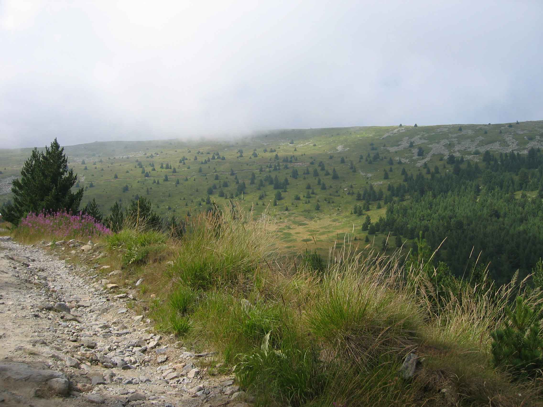
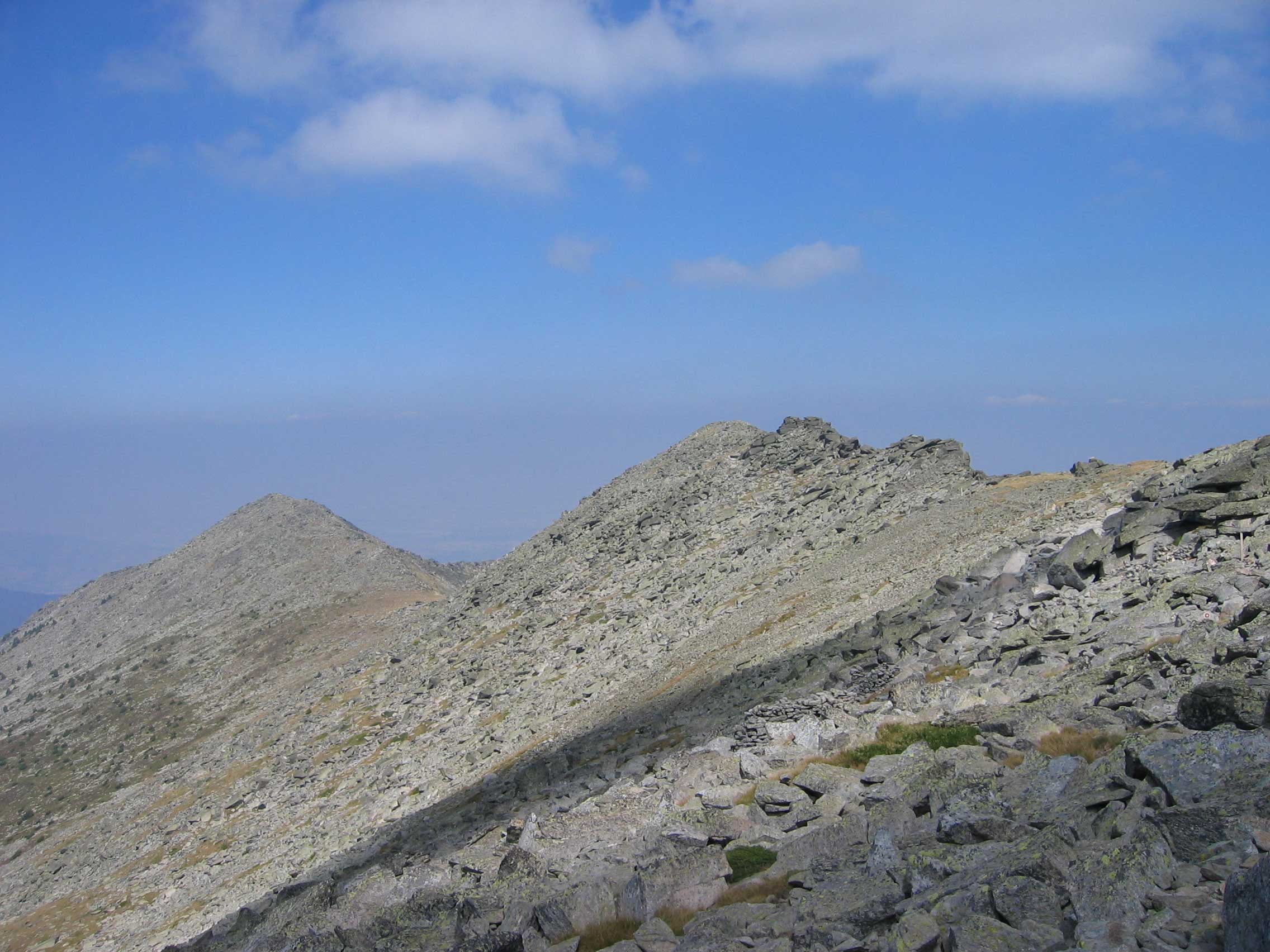
The Pelister National park is a very beautiful national reserve that is perfect for hiking. It is close to Bitola in the south-west of Macedonia. You can for instance hike to the highest peak of the park, Pelister peak at 2601m. Along the way you will have magnificent panoramas of the park.
Some of the hikes that we have done in Pelister National Park were in 2005 and 2007, before I had an outdoor GPS, so no tracks were recorded. You can easily find GPS tracks of others on Wikiloc or Alltrails.
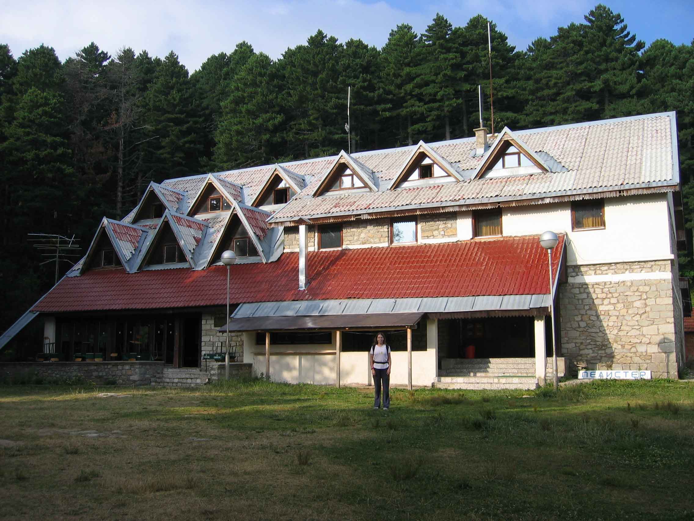
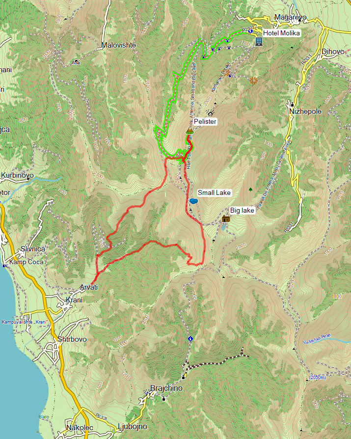
Many hikes starts at Hotel Molika in Bitola. From the parking in front of the hotel there is an unpaved trail. Follow the trail and after 30-45 min you will reach the Kopanki mountain hut. The Kopanki mountain hut burned down in 2013, I do not know its current condition.
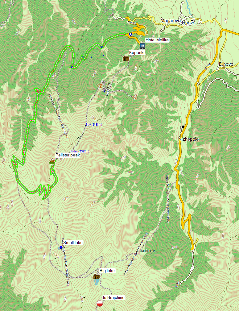
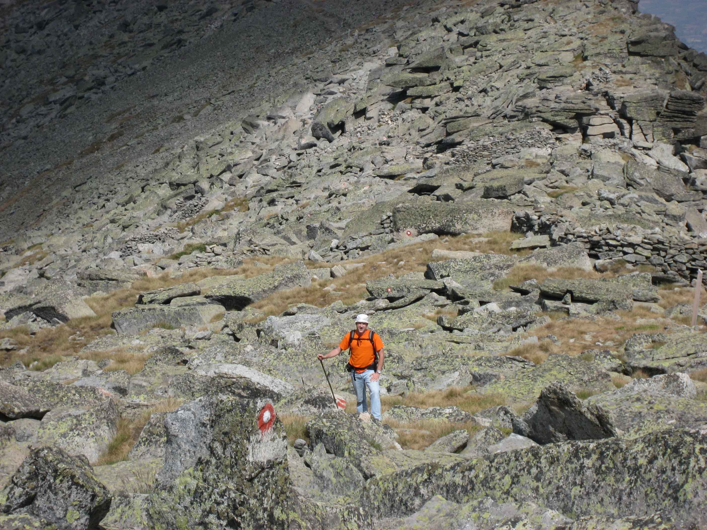
There are several trails leading to Pelister Peak: the unpaved service road to Pelister Peak (green on the map) or the more interesting hiking trail starting at Hotel Molika and the Kopanki Mountain hut (a.k.a the Rocky trail). Another hiking trail connects the service road and Pelister Peak (Pateka do Antena, path to Antenna).
The service road also leads to trails in the south that will take you to the two glacial lakes called the Pelister Eyes, Malo Ezero (Small Lake) and Golem Ezero (Big Lake).
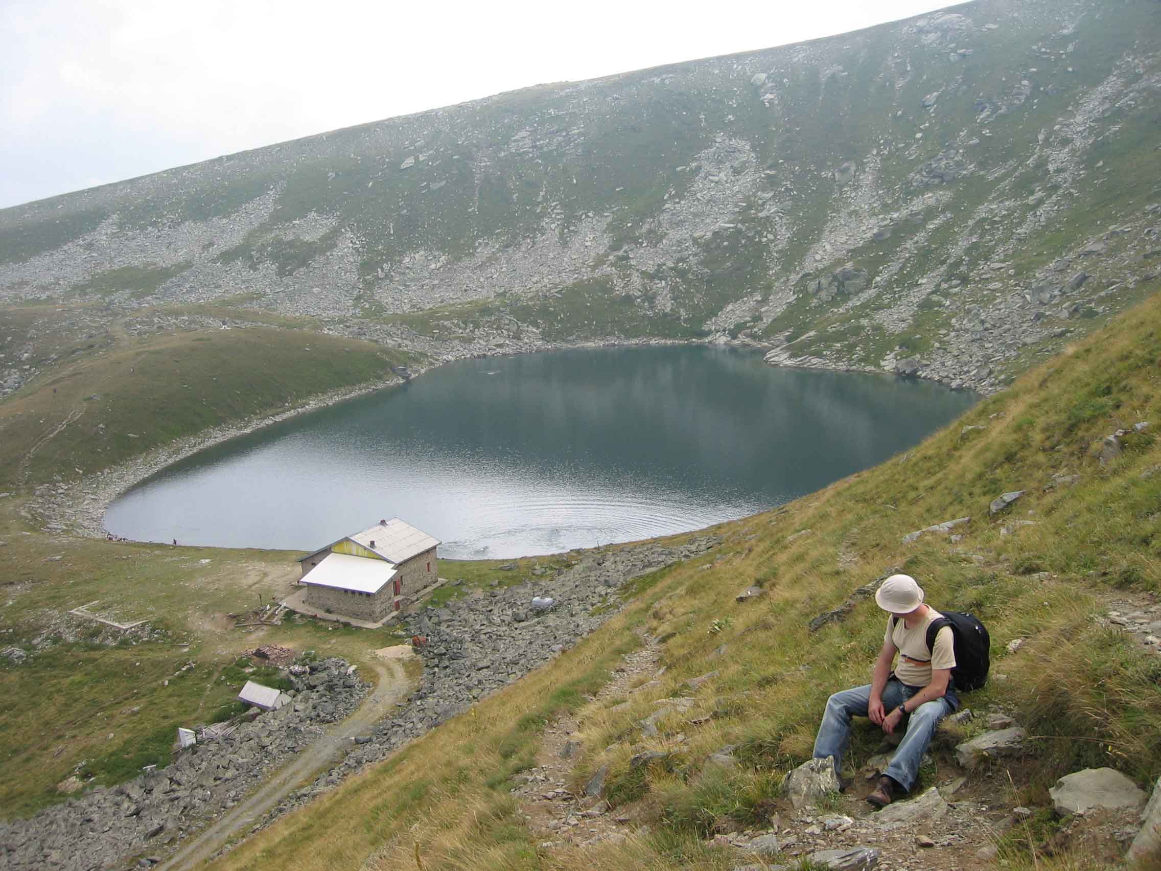
If you plan to spend the night in the Mountain hut at the Big Lake, make sure it is open! When we arrived there during a hike it was unfortunately closed! I do not know if the contact details are still accurate: Golemo Ezero mountain hut (45 beds), telephone (afternoons only) 047 221 605. You have to bring your own food, toilet paper etc.
From the Mountain Hut at the Big Lake, trails are leading to the villages Nizhepole and Brajcino. I have not walked these trails myself so i cannot comment on their condition or marking.
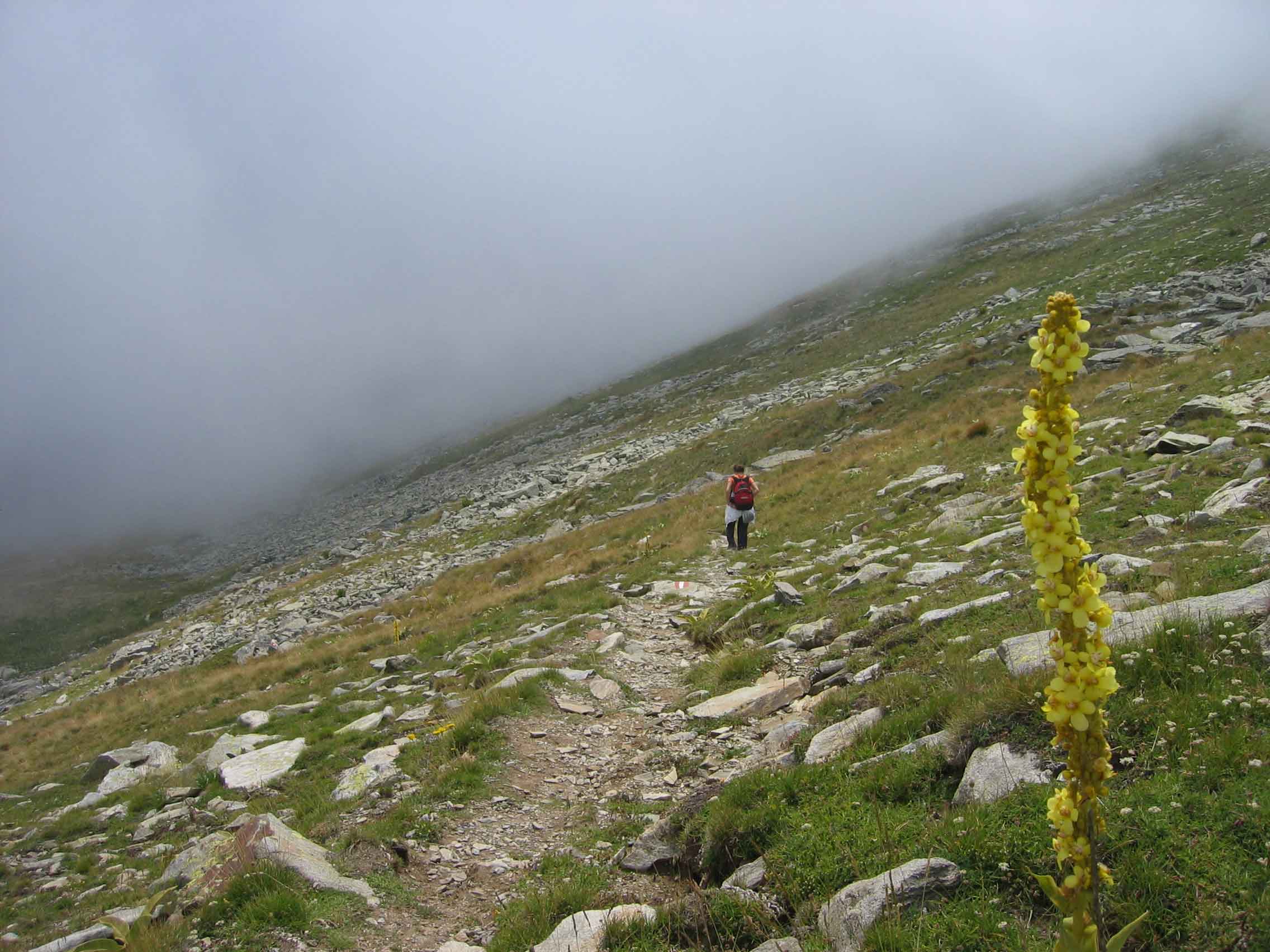
In 2020 I did the less common approach of the Pelister Peak from the village Arvati at Lake Prespa, instead of coming from the Bitola side (indicated in red on the map below). This trail is not clearly marked but easy to follow with a GPS.
The views in Pelister National Park are very diverse, making it in my opinion the most beautiful National Park of Macedonia
See also these links for more info about hiking in Pelsiter National Park:
