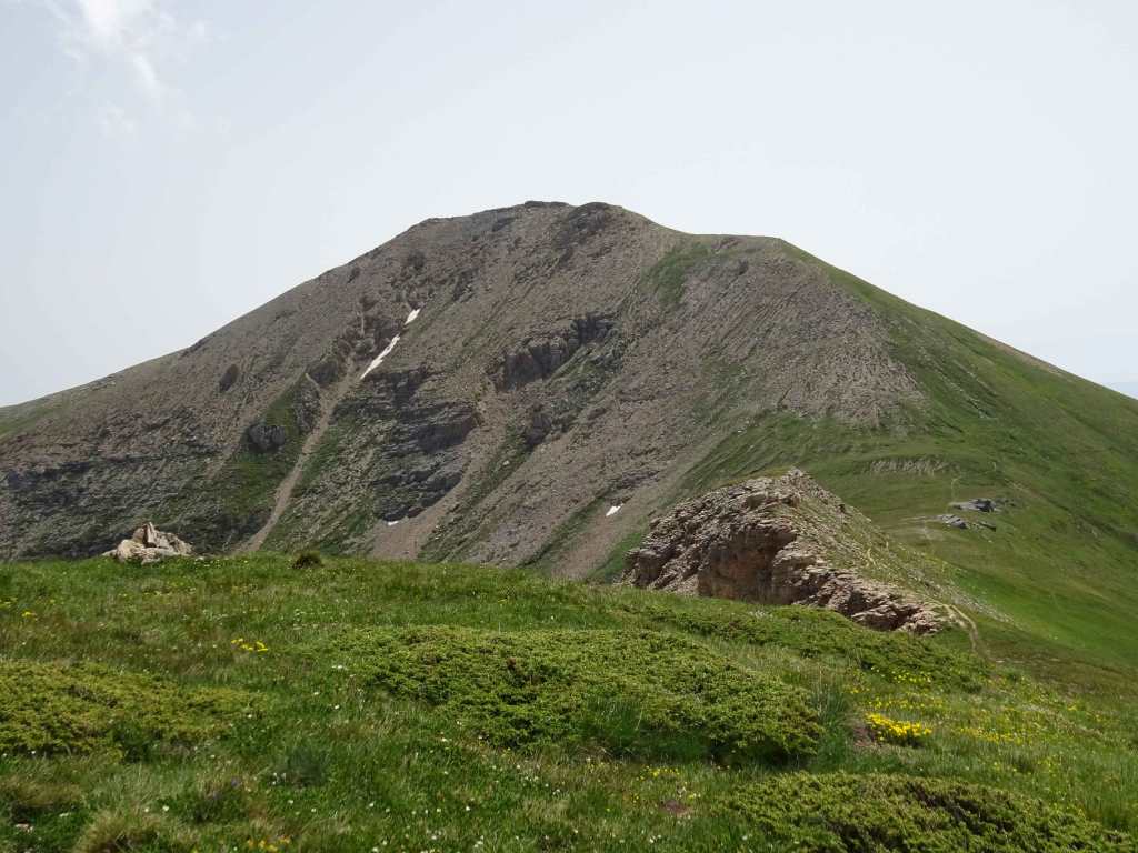
This hike of 22 km and 1130 m ascent to Titov Vrv (Titov Peak) has long be on my wish-list. With 2748 m Titov peak is the second highest mountain of Macedonia. And the highest mountain that is completely in Macedonia, because the highest peak Korab (2764 m) is on the border with Albania.
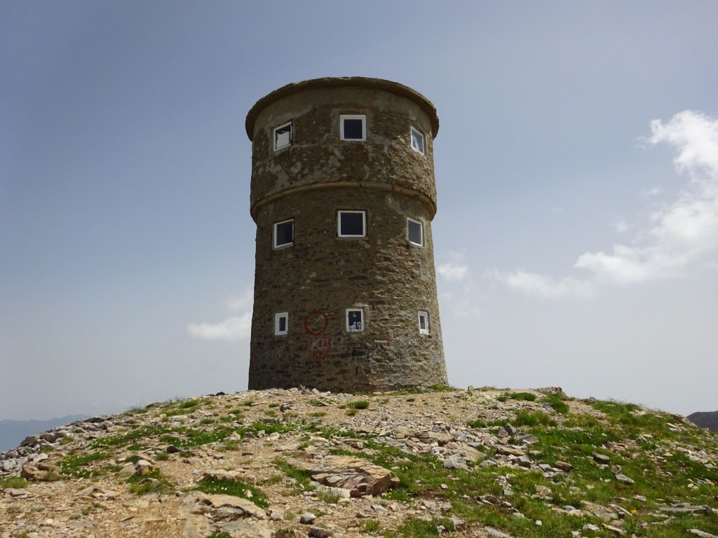
The peak was named after former Yugoslav communist leader Josip Broz Tito. You can easily recognize Titov peak from far away, because of the characteristic high tower that was built on its top.
The hike starts in the ski-resort Popova Shapka, 30 minutes driving from Tetovo. We stayed a week in Popova Shapka, because it is a great base for hiking in the Sharr Planina mountains.
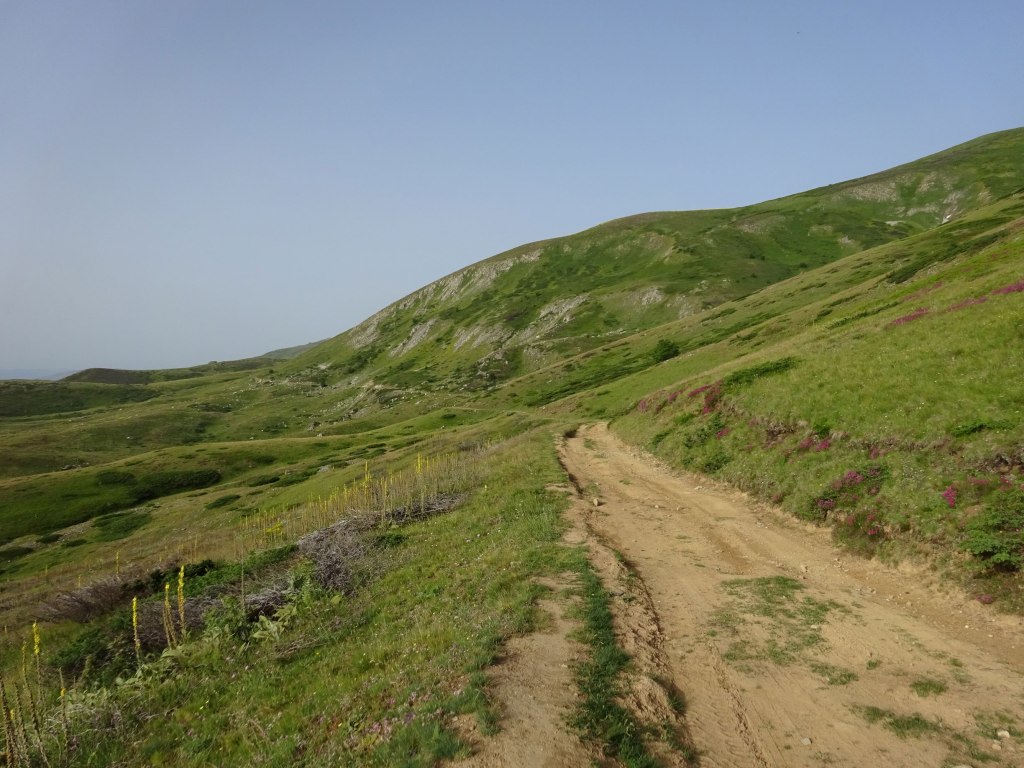
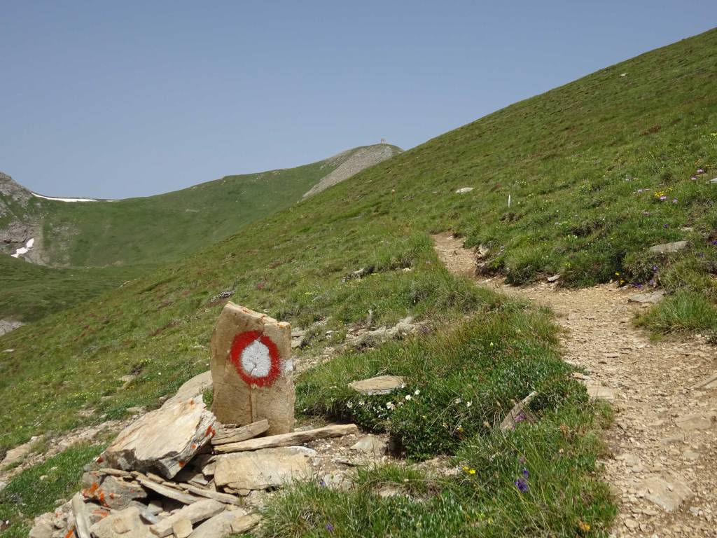
The first part of the hike follows the ski lifts, until you join a dirt-road.
Make sure you leave the dirt-road again for a smaller hiking trail at the right moment in a curve in the road.
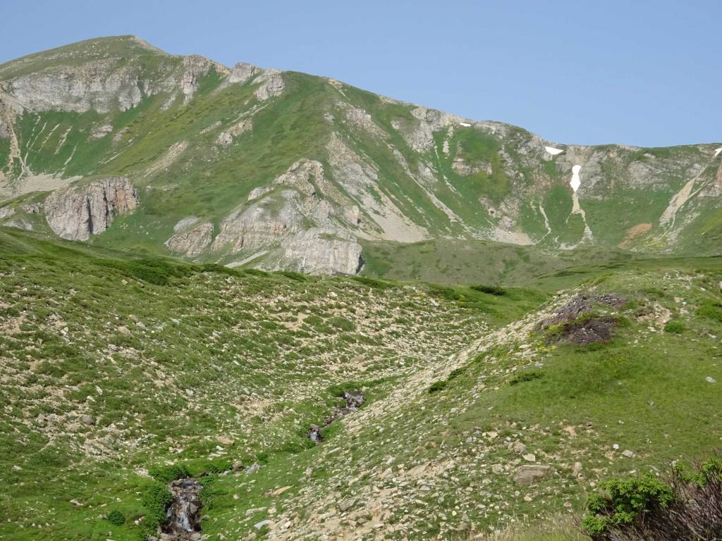
From here on the views are very nice.
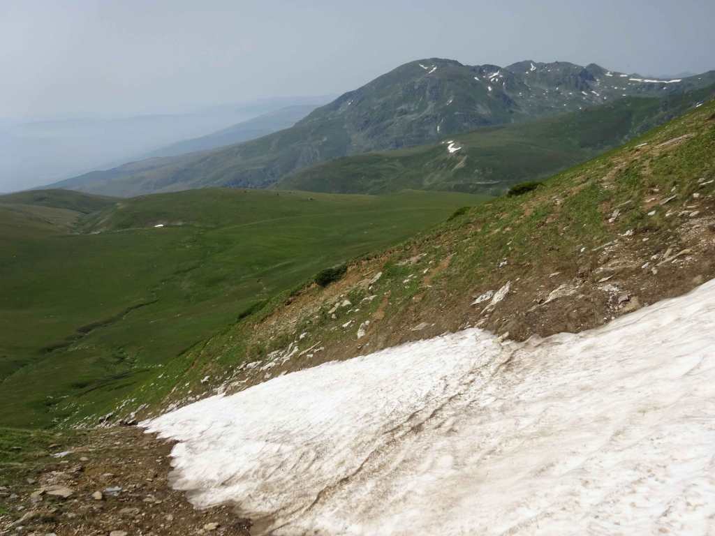
Even in July 2021 there was still a slippery patch of snow/ice that we carefully had to cross.
The last part to the top was quite steep and took some energy to climb! But the better is the reward of reaching the tower and enjoying the views!
The tower on top of Titov Vrv is quite something. There’s an information panel inside the tower that tells you about it’s history. I took the liberty of copying the text here:
The mountaineering Tower on Titov Vrv, Shar Mountain, Republic of Northern Macedonia from the past to the present
- The mountain tower is a mountaineering shelter fully owned by the Mountaineering Federation of Northern Macedonia
- The mountaineering tower on Titov Vrv originated in 1951 by the then Union of Mountaineering of FNR Macedonia
- This initiative was followed by a new initiative to change the name of the peak which became official on April 21, 1953, when the then Assembly of FNR Macedonia made a decision to change the name of the highest peak of the Shar Mountain from “Aleksandrov Vrv” to “Titov Vrv”.
- After the initiative of the Mountaineering Association of FNRM a unique project according to its shape and size was made by the engineer-architect Kosta Popovic, director of the Design Bureau “Sport-Project” from Belgrade.
- The coordination of the construction was entrusted to the Mountaineering Association “Ljuboten” from Tetovo, through which the complate financial construction was realized.
- MA “Ljuboten” hired the construction company “Beton” with a construction operation from Tetovo. Their construction workers transporting materials with masks and horses successfully realized the project within two years of work from the summer of 1954 to the end of the summer 1956.
- Based on information and documents from the MC “Ljuboten”, the company “Beton” for the construction of the tower, has engaged the following masons: Slave Kochevski-Buchko from Tetovo, Xhemal Aliu-Vela from village Gajre, Tetovo, Mejdin Elmazi from village Boletin, Reka region and others. For the transportation of construction materials, they have engaged Isak Hamza from village Shipkovica, Tetovo region.
- The tower was officially put into use on May 25, 1957 when the first ascent to the Tower was organized in honor of the holiday “Youth Day” which from this date began to be celebrated in the SFRY.
- The tower is built in a cylindrical shape, 10 m high stone wall made of cement mortar with a thickness of 70 to 100 cm, with an external radius of 7 m and an internal radius of 5.5. m. The tower has a conical concrete roof, basement, ground floor and two floors, three built-in chimneys on each floor, one front door and 22 windows. A wind turbine was also installed on the roof to generate electricity. Inside, the walls and ceilings were lined with pine boards.
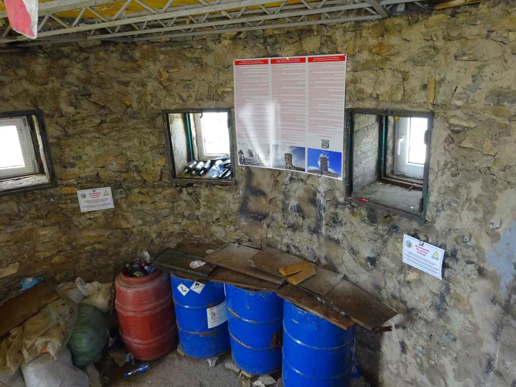
Ground floor 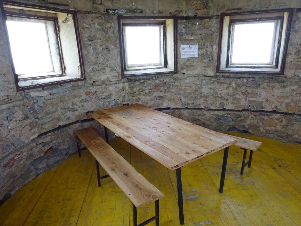
First Floor
- After the opening, the ground floor was used by mountaineers, while the first and second floors from the summer of 1956 until the end of 1957 were used by the Meteorological Service – The metrologist Halit Haliti and one of his assistants, both from the village of Veshala.
- After the withdrawal of the metrologist from Titov Vrv at the end of 1957, the Tower was in full use of the Mountaineering Union but without an all-day host, and was occasionally used by the mountaineers who stayed at the peak.
- In the period from 1969 to 1979, the Tower was set on fire three times, buring all the wooden elements inside the Tower and destroying all the windows and doors.
- MA “Ljuboten” Tetovo after the three fires organized rehabilitation so that after eighty years the tower is neglected and left to the ravages of time
- Due to the damages windows, door and the concrete roof, water and snow entered the interior for years, which caused the destruction of several parts of the stone wall on the outside and inside. The Tower was dangerous to stay in and therefore no one stayed because of danger of injuries.
- At the initiative of the newly formed Mountaineering Club from experienced mountaineers “Argentus Mount” Tetovo with the authorization of FPSM since 2014 thorough reconstruction has begun.
- As of 2020, all major damage to the walls has been repaired in the interior, the window edges have been plastered, 6 steel beams have been installed on the second floor, a wooden floor made of waterproof plywood boards has been installed on both floors, dining tables and benches have been installed on each floor as well as automatic solar lighting inside the Tower.
- With the reconstruction so far, The Tower is completely protected from further erosion, damage and demolition. It has been brought into a dignified form and enabled for a safe mountaineering shelter that is used for mountaineering stays and overnight stays at any time and in all seasons.
- There is no heating in the Tower while the solar supply lighting depends on the weather conditions.
- The door of the Mountaineering Tower is always open, never locked.
- The ground and the first floor are always available for shelter and overnight stay of the mountaineers at any time of the day and at any time of the year without any fee.
- The second floor is used with announcement and agreement with the host MC “Argentus Mount”, Tetovo.
After having lunch outside the tower and meeting several other people who climbed Titov Peak from a different direction, we went back to Popova Shapka via the same trail.
For the very last part we tried an alternative descend by following the dirt-road a bit further and walking parallel with the new ski lift, but the trail became rather difficult in the end. I adjusted the GPS trail afterwards just to follow the same descent as you started the hike.
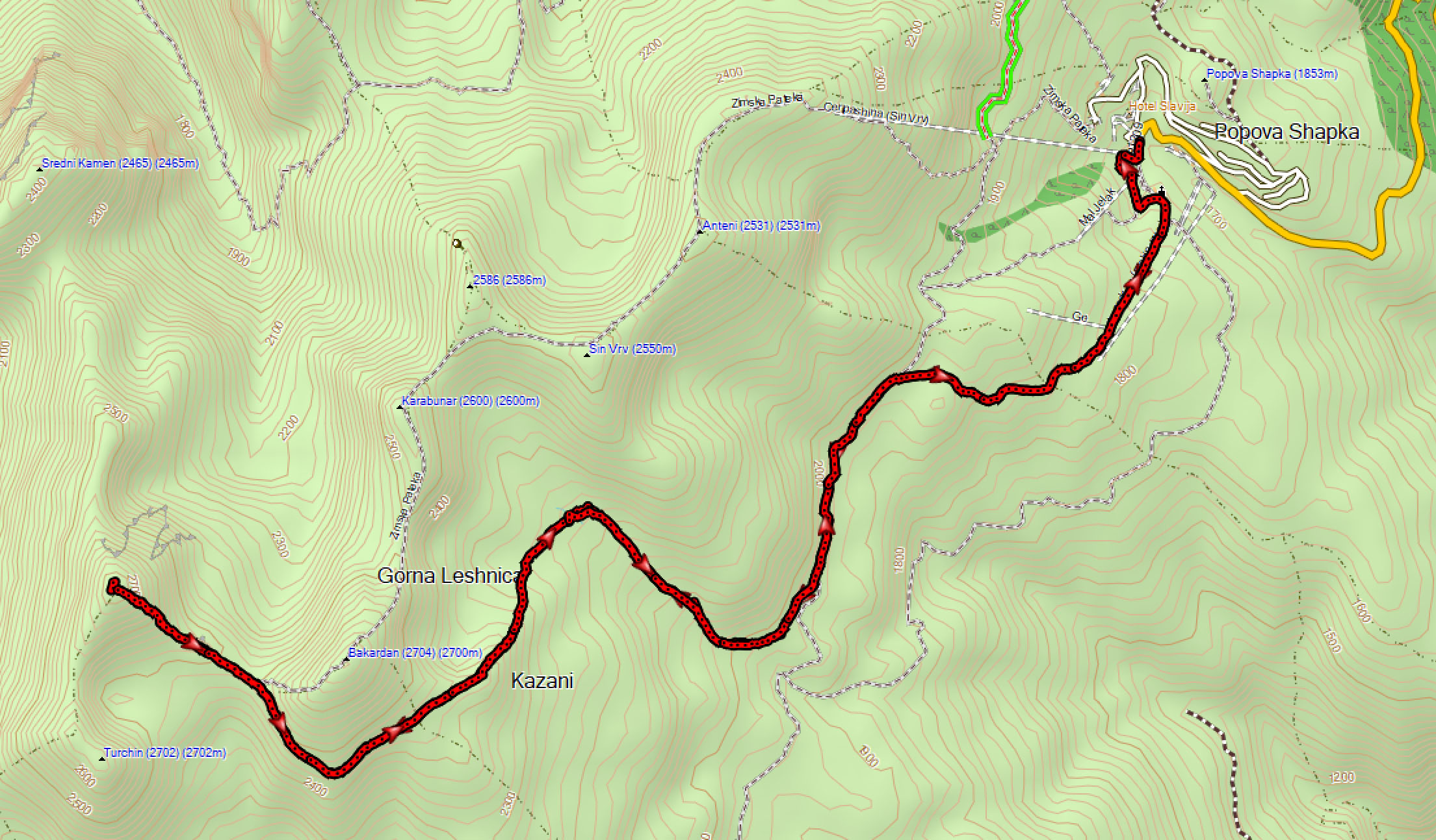
As you can see on the map, there is the possibility to follow a different trail back as well. On the map it is indicated as Zimska Pateka, or Winter Trail, see also the picture above. This trail adds about 400 m extra climbing, see for instance this trail: https://www.wikiloc.com/hiking-trails/titov-vrv-shar-planina-macedonia-10427648 (disclaimer: I did not walk this trail myself and cannot guarantee its safety!).
A great hike with good views and nice nature. Walking the same way uphill and downhill is not a punishment in this case. 5 stars for climbing one of the highest peaks of Macedonia!
You can view and download the GPS track of our hike here: https://www.wikiloc.com/hiking-trails/popova-shapka-titov-peak-82085825
