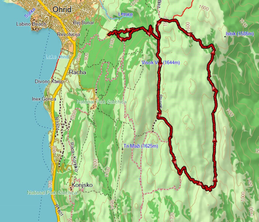
This is a hike of 29 km with almost 1000 m ascent in the unexplored northeast part of Galicica National Park, starting in the village Ramne.
I think the northeast part of Galicica NP is “unexplored” because there are no trails on OpenStreetMap at the time of writing (2025) and there are even no GPS tracks to be found on websites such as Wikiloc. During a previous hike from Oteshevo to Ohrid I noticed that this would be an interesting area to further explore. Using Google Earth I tried to map the 4×4 dirt roads that I could see, and came up with the idea for the current hike.
It turned out the be a long but very nice hike, especially because of the brilliant height profile: Most of the climbing is done in the first 5 km, after that it is flat or with a very gradual ascent, making this hike more easy than the stats would make you think.
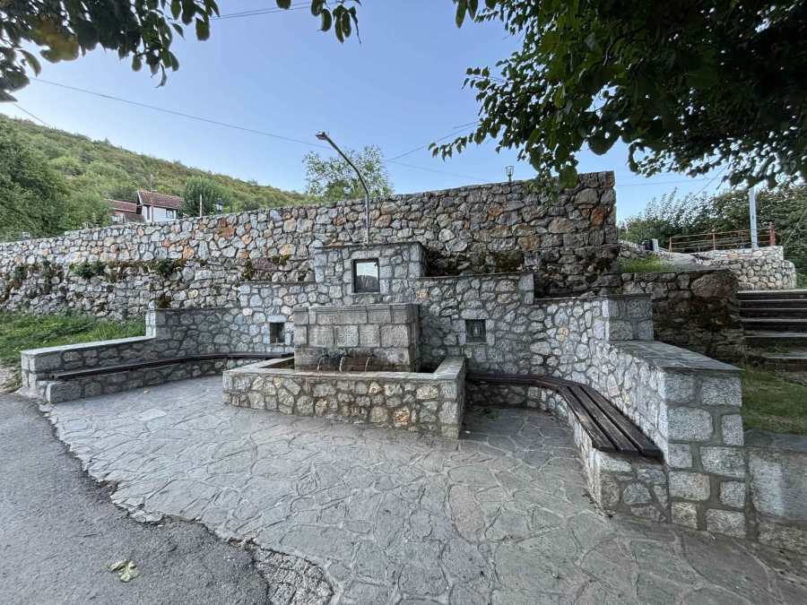
The hike starts in the village Ramne near the fountain. The trail splits up soon after Ramne, I took the slightly shorter and steeper trail to the left for the ascent, and the 500 m longer trail on the way back.
There was a sign pointing for a church St Blagoveštenie Blagoec (Church of the Holy Annunciation in Blagoec) but I did not see the church or other signs.
Soon there is another small split in the trail, the trail to the left follows a little stream and the trail to the right goes to a building of the water company Vodovod, with signs saying “no entry” and “video surveillance”. It seems to be abandoned though. There’s a spring as well. I visited the building on my way back.
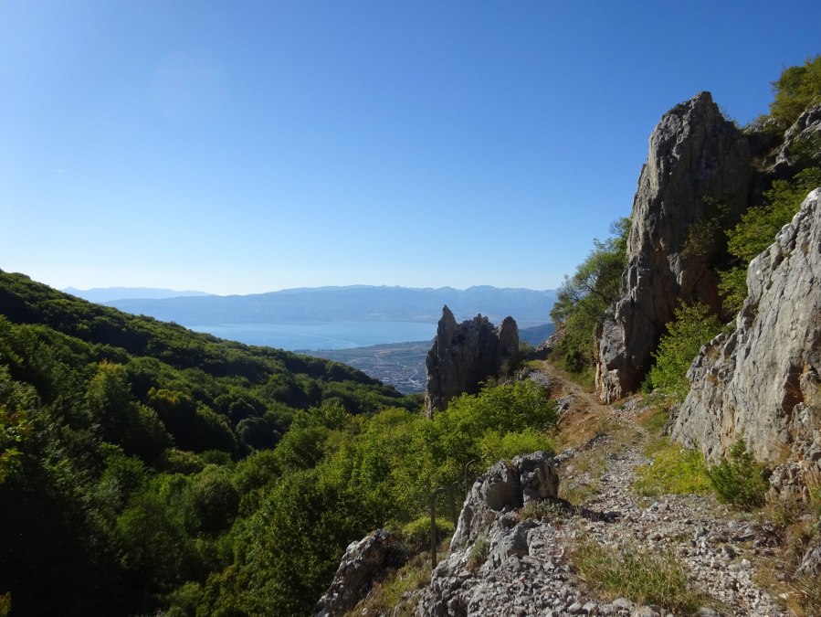
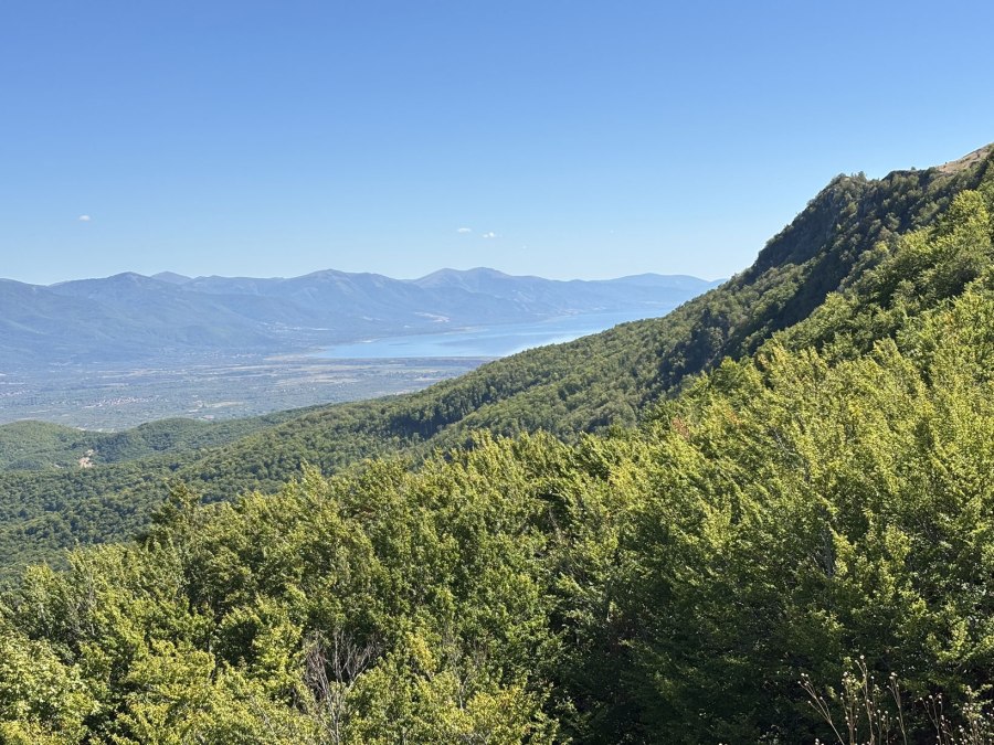
The first part is through forest, until you reach a very characteristic “rock gate” from where you have a good view of Lake Ohrid.
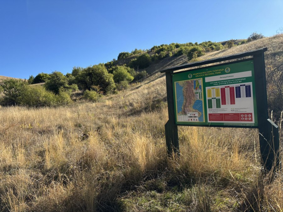
Soon after the “rock gate” there is an information panel at the crossroads where I went right. There were a lot of birds in this area.
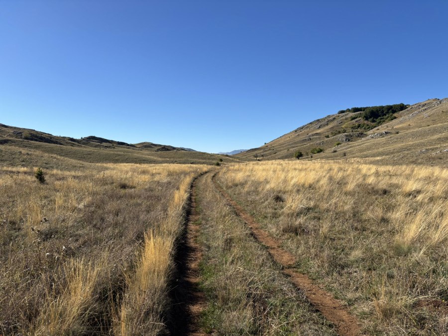
You’re following 4×4 dirt roads for a large part of the hike, so it is easy to navigate. Waypoints in the GPS track indicate where to leave the “main” 4×4 dirt road to follow less used paths.
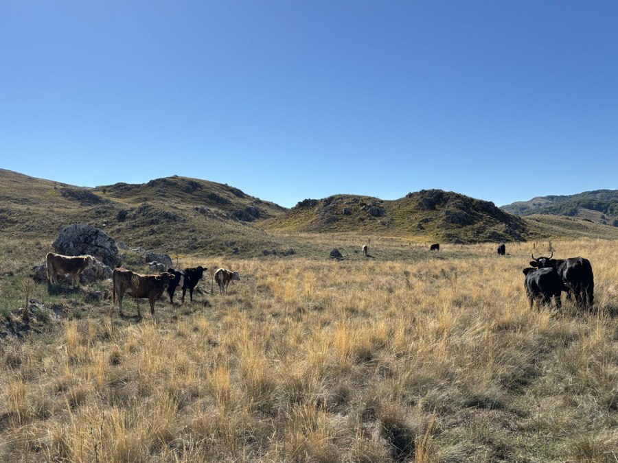
At several points there were cows grazing, but I did not see single shepherd or other person during the entire hike.
The grass was yellow and dry in September 2025, but it must be so beautifully green in spring!
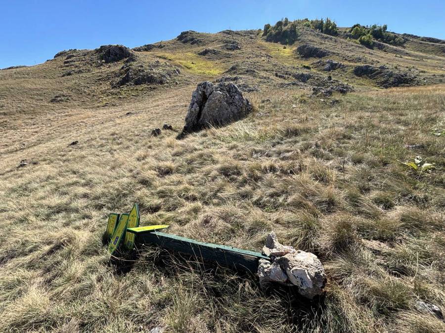
It was difficult to find the best path between the two waypoints named “To Oteshevo”, basically the south part of the hike, from west to east. The first waypoint is at the broken signpost that should point east towards Oteshevo. I had already had troubles finding the official trail at this location before during my hike from Oteshevo to Ohrid, and was hoping it would be easier to find the official trail coming from the Ohrid side. Unfortunately, that was not the case and I spend quite some time looking for the best option. In the end, when I finally made it to the east part of the hike, I noticed faded marking and decided to follow that trail back again to the west part in an effort to map the official route. I think that the GPS track now should -more or less- follow the official trail (I have deleted all the unnecessary walking around while searching for the trail from the GPS file).
At the second waypoint named “To Oteshevo”, this trail connects with the path to Oteshevo at Lake Prespa (to the south).
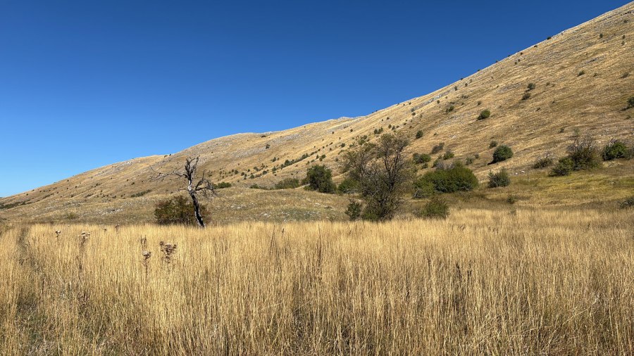
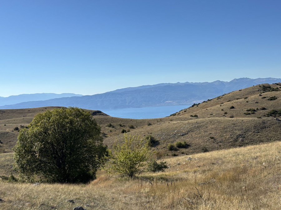
You’ll now walk north with an interesting mountain ridge on your right. This area has been burned a few years ago, the dead trees are a reminder of this.
I made a mental note to design a route that follows the ridge instead of the valley for another trip, because views over Lake Prespa must be good from the ridge. Indeed, the good views were later conformed by a viewpoint from where you can see the Prespa Valley.
Soon after this viewpoint the 4×4 dirt road became a bit less obvious but I found it again.
At the indicated waypoint “Leave 4×4” I left the 4×4 dirt road to follow a smaller trail. This trail was not part of my original plan but seemed to go in the right direction, and it did.
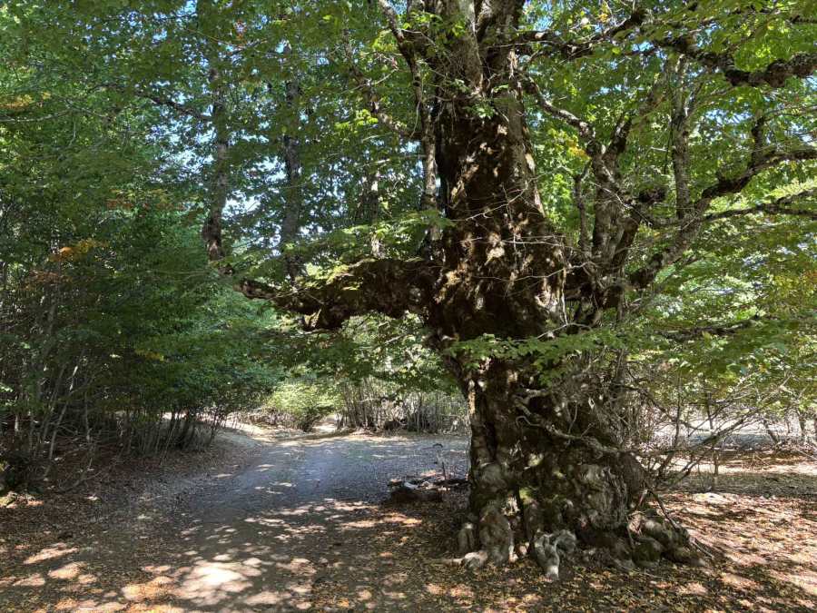
At a certain point the trail connects again with a 4×4 dirt road, where there were some large old trees.
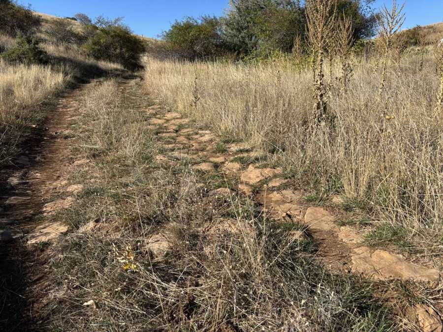
Just before reaching the crossroad back to Ramne, there were remains of an old stone road. It is known that there are old Roman roads in this area of Macedonia, for instance the Via Egnatia and I wonder if these remains were part of such an old Roman road network? Let me know if you know more!
This was a very good hike, also thanks to the favorable height profile. I always find it exciting to make a new route, instead of following a downloaded GPS track. It is a long hike though, most of it without any shadow, so bring sufficient water. The landscape is beautiful but may become a bit monotonous. This hike gets 4 out of 5 stars.
You can view and download the GPS track of this hike here: https://www.wikiloc.com/hiking-trails/ramne-the-unexplored-northeast-of-galicica-national-park-240522163