
This walk starts near Restaurant Loven Dom (Neretva Street) in Strumica and goes via the Monastery of St Ilija to the ruins of the fortress called Carevi Kuli (Czar’s Towers).
At the crossing near Loven Dom, go right for the path to St Ilija.
The first part is 2.5 km on a well kept footpath to the Monastery of St Ilija in the mountains above Strumica. This path is popular for jogging, and people taking a stroll to the monastery. It offers nice views of Strumica as well.

The next part is about 3.5 km from the Monastery of St Ilija to the Czar’s Towers or Carevi Kuli. First you walk on a 4×4 dirt track, the last part you follow the asphalt road to the Czar’s Towers.
The Czar’s Towers are located on the hill overlooking Strumica. They are the remains of a medieval fortress from the 11th-12th century, that was extended during the 12th-14th century. Life on this hill is thought to go back to 4750 BC, and many artifacts from different time periods have been found at this location.
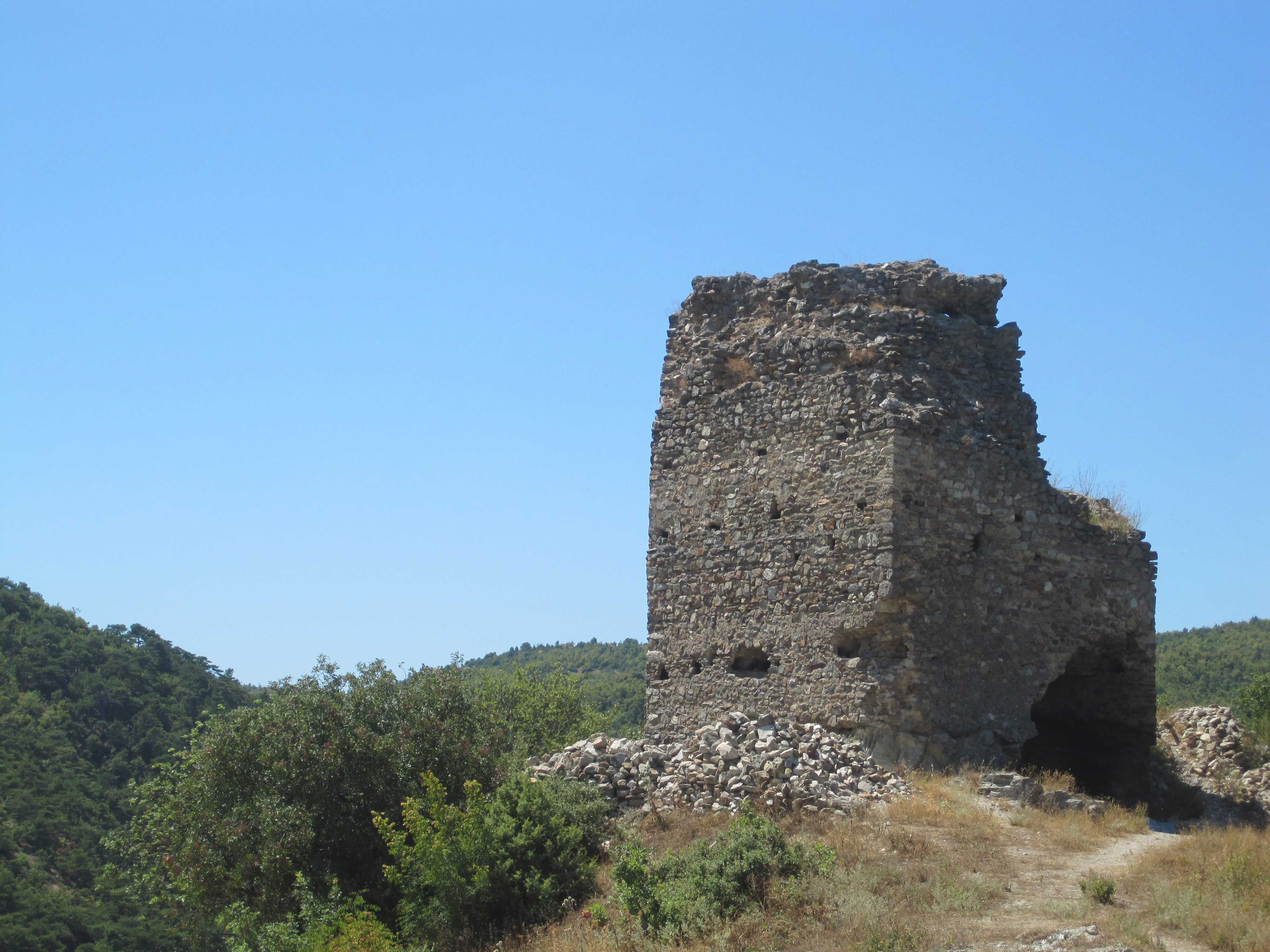
There is not much left from this once so powerful fortress. The only well visible remains are the so-called Pirg Tower, the main tower of the fortress where the commander of the fortress stayed. The lower floor was a water tanker filled with atmospheric water. You can see the holes in the walls that were used to make wooden floors above the water tanker. The Pirg Tower has a hexagonal shape, but was originally build as a rectangle.
The other major remains are from the west entrance tower or gate, and another huge water tanker in the middle of the fortress. At the moment of visiting (2011) this tanker was completely covered with a roof and not well visible or accessible.
Structures of a church that was probably dedicated to St George, and graves from the 12th-14th centuries can be seen next to the antenna on top of the hill.
Just before you enter the Czar’s Towers from the asphalt road, there are also several graves dug in the white rocks.
At the City Hall of Strumica (Sando Masev 1, N41.43715 E22.63727) we got an interesting booklet called “One the way of ancestors” describing the Czar’s Towers in very much detail.
From the antenna on the top of the hill of Czar’s Towers, you can go steeply downhill, back to the path near restaurant Loven Dom. This trail starts left from the antenna, when facing Strumica, and goes straight on after another antenna halfway the hill.
We took another trail, starting right from the first antenna, and with a right turn at the second antenna halfway the hill. This is the trail shown on the map below. This trail was really steep at some places, and you’re probably better off taking the first trail, that is more obvious when seen on e.g. Google Earth.
It’s a nice walk, not a lot of wild nature, but the sights make it worth while. 4 out of 5 stars. Here is a link to the GPS file: https://www.wikiloc.com/hiking-trails/strumica-to-st-ilija-and-czars-towers-7546874

