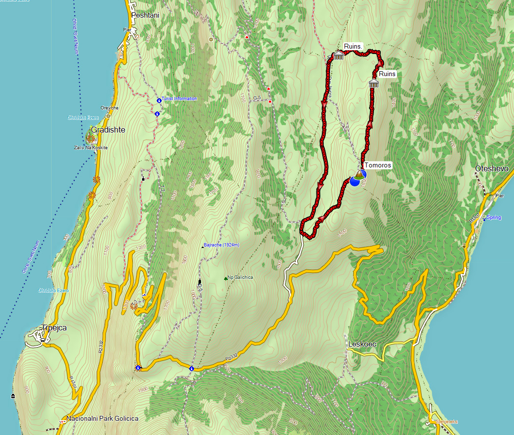
This hike in the south of Galicica National Park is about 12 km with 500 m climbing. The start of the hike is about 40 km from Ohrid and it will take you about 1 hour to get there by car from Ohrid.
The road to the start of the hike is asphalted. To our surprise we saw two startled deer when we were driving there. Usually we hardly see any animals during our hikes and now we spotted them from a noisy car! Also the hike that traverses Galicica National Park all the way back to Ohrid through the valley starts here.
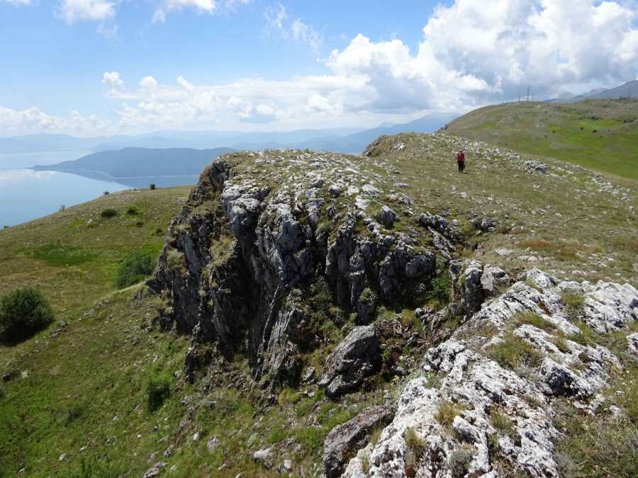
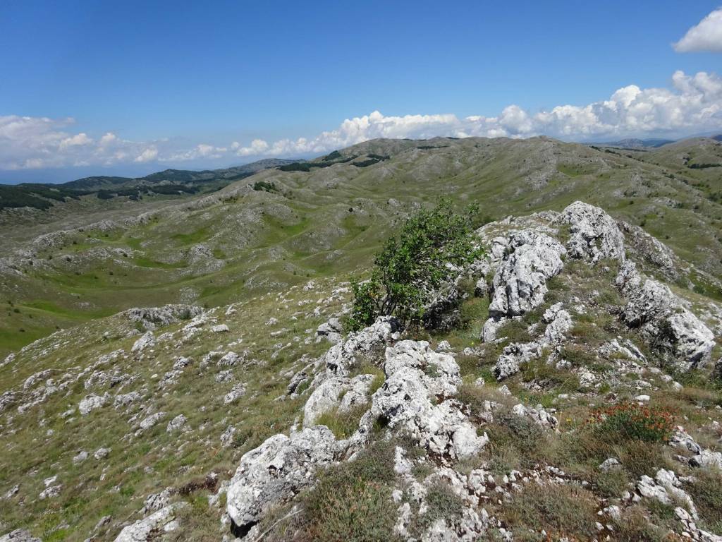
It’s an easy-going hike that is basically freestyle climbing the Tomoros peak without a clear trail and follows the ridge for a while.
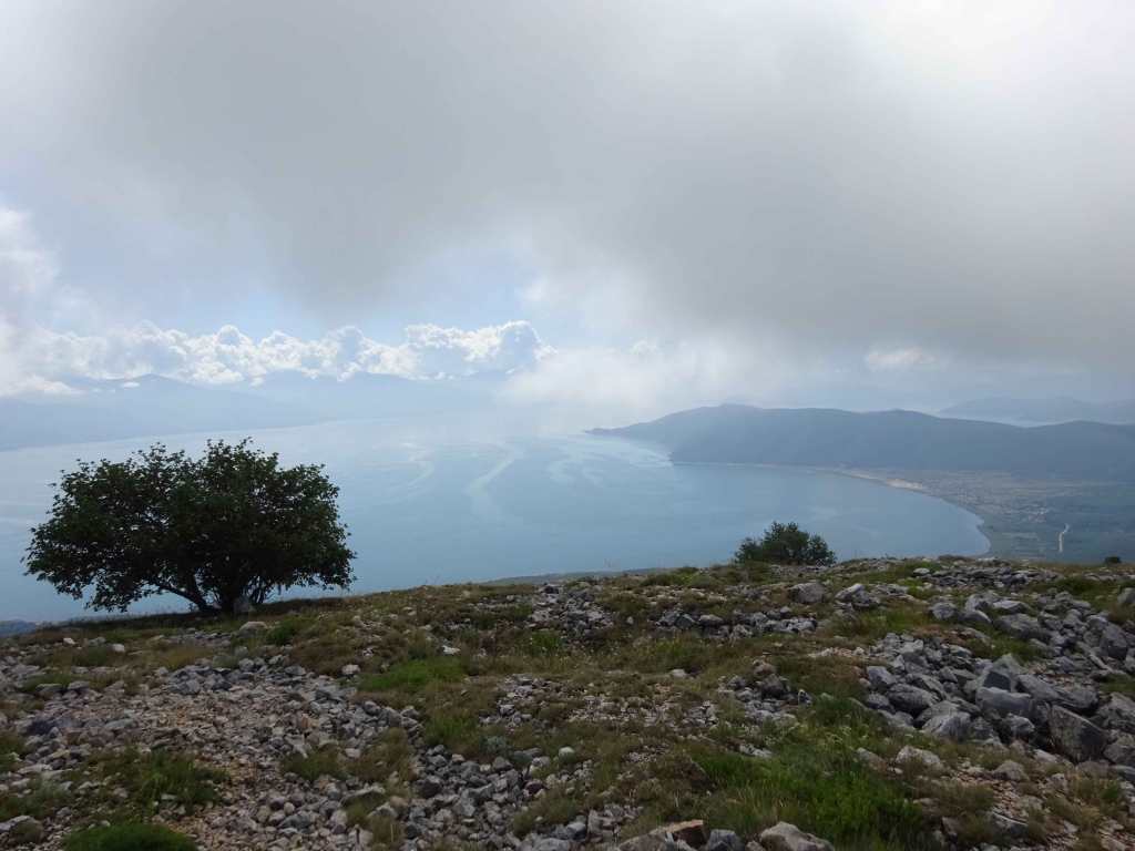
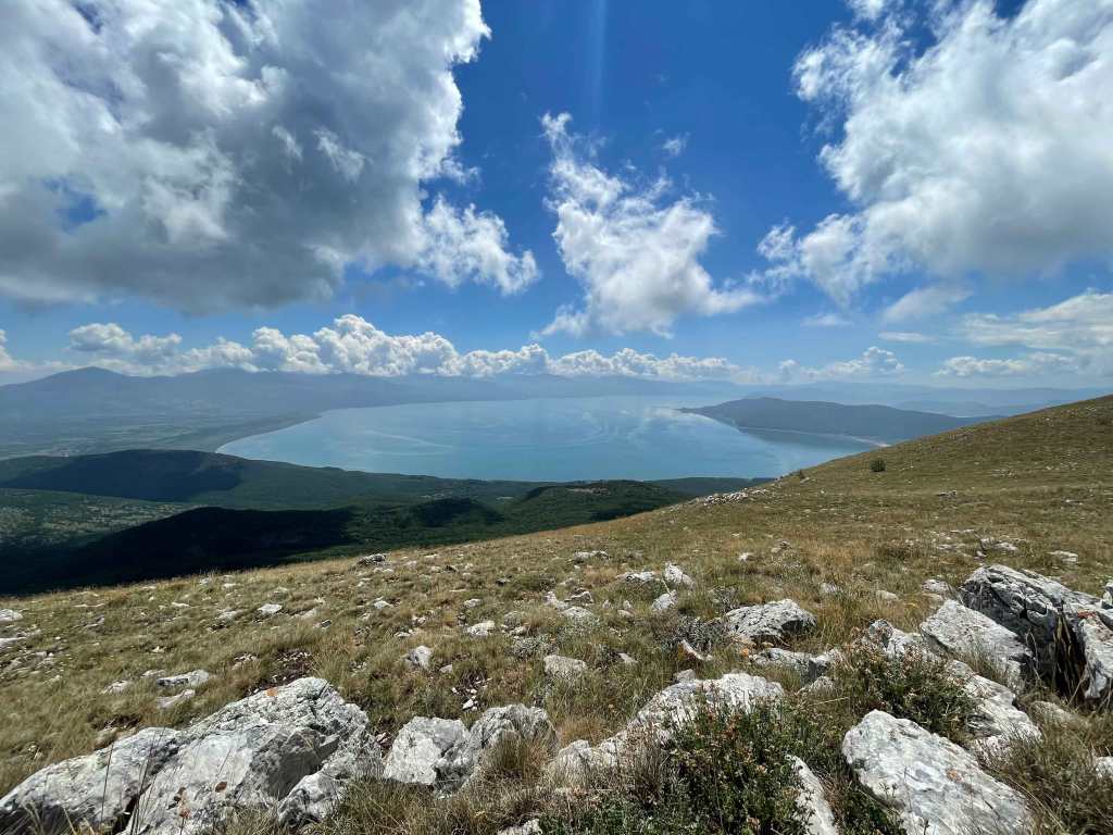
This hike offers great views of Lake Prespa
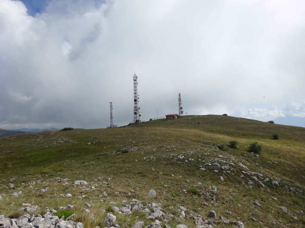
There are several antennas on the Tomoros peak.
Also there are many trenches from the first World War all over the place.
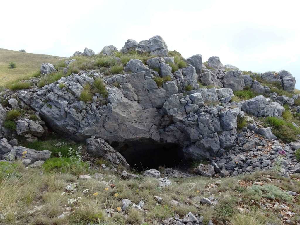
Cave 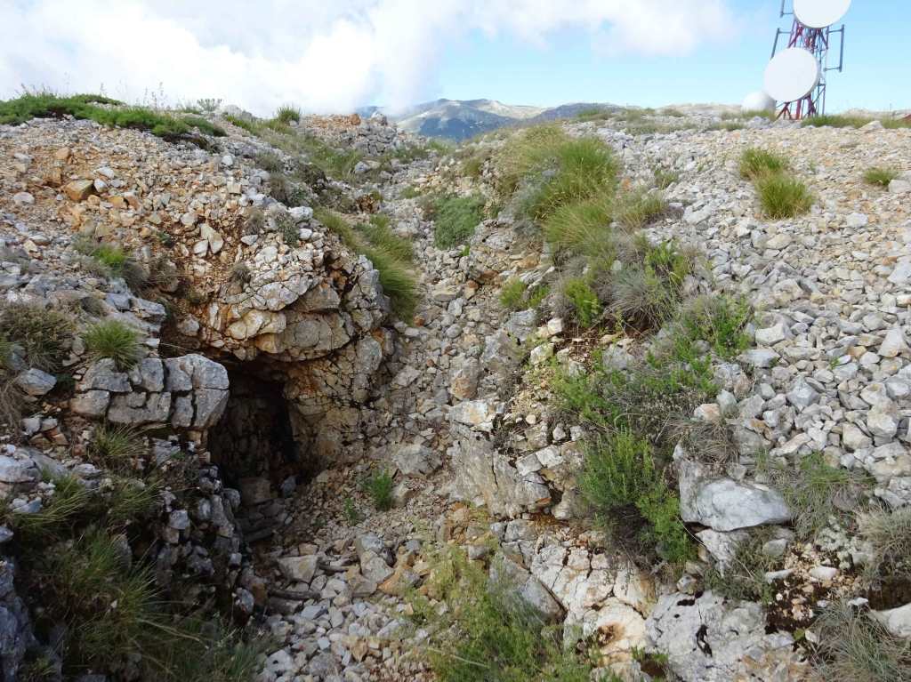
Cave
There are some small (man-made?) caves near the peak as well, indicated by the blue waypoints on the map.
The trail that we followed was downloaded from Wikiloc: https://www.wikiloc.com/hiking-trails/skijachki-tereni-tomoros-rezervoari-skijachki-tereni-70933846. The part where you leave the ridge and head west towards the dirt-road seemed a bit random but we tried to follow it as closely as possible.
Before you descend quite steeply towards the dirt road you’ll have to climb a couple of rocks which may be a bit tricky!
After the descent there are some ruins of what seemed to have been a water station or something.
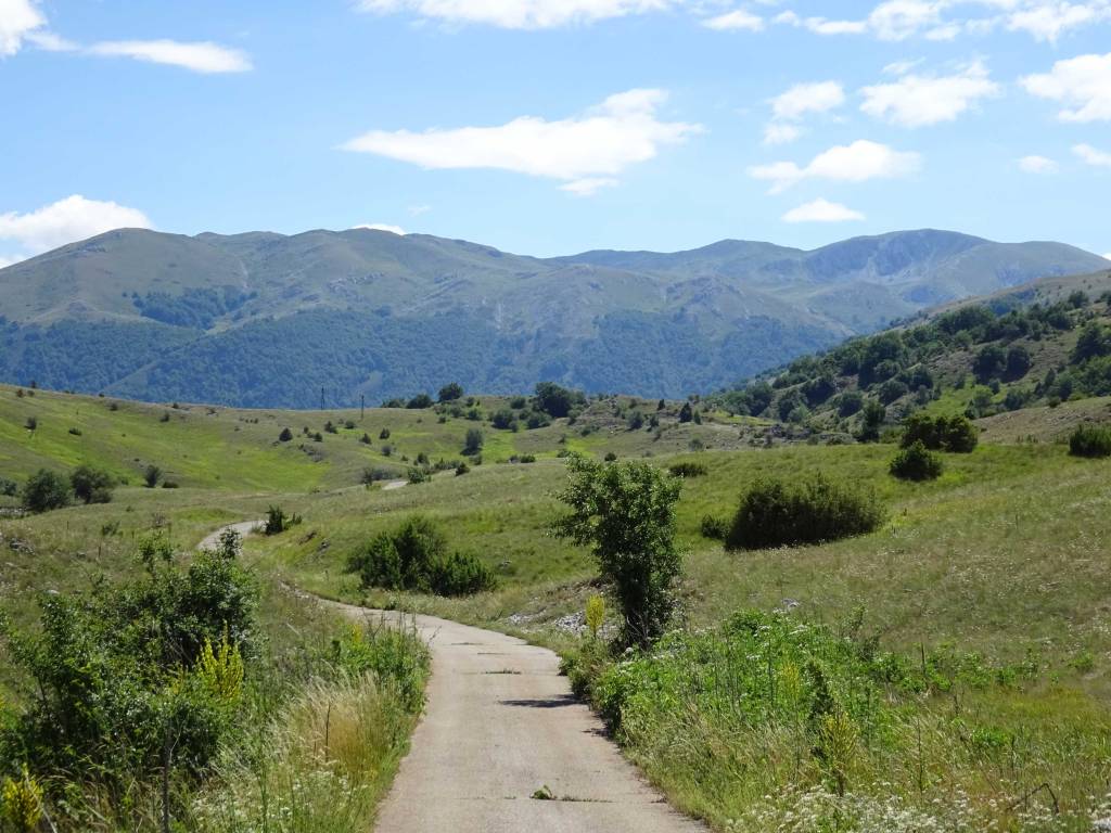
The last 4 km back to the starting point are on a dirt-road and asphalt road.
We really enjoyed this hike because of the nice views of Galicica National Park itself and lake Prespa. It gets 4 out of 5 starts from us!
You can view and download the GPS track of this hike here: https://www.wikiloc.com/hiking-trails/tomoros-peak-in-galicica-national-park-82589411
