The Kokino archeological site and megalithic observatory is located about 30 kilometers northeast of Kumanovo, near the villages Staro Nagoricane and Kokino.
To get there, take the exit to the Monastery of Prohor Pcinjski and Staro Nagoricane to the left on the road from Kumanovo to Kriva Palanka. Kokino is signposted from there and there is a parking with information panel below the rock formation.

Kokino is on the U.S. Space Organization NASA’s list of ancient observatories, together with e.g. Stonehenge in Great Britain. Not surprisingly, Kokino is also referred to as the Stonehenge of Macedonia. Artefacts found on the site have been dated to 1800 BC, so the site is more than 3800 years old. According to specialists, the site was used to follow the movements of sun and moon.
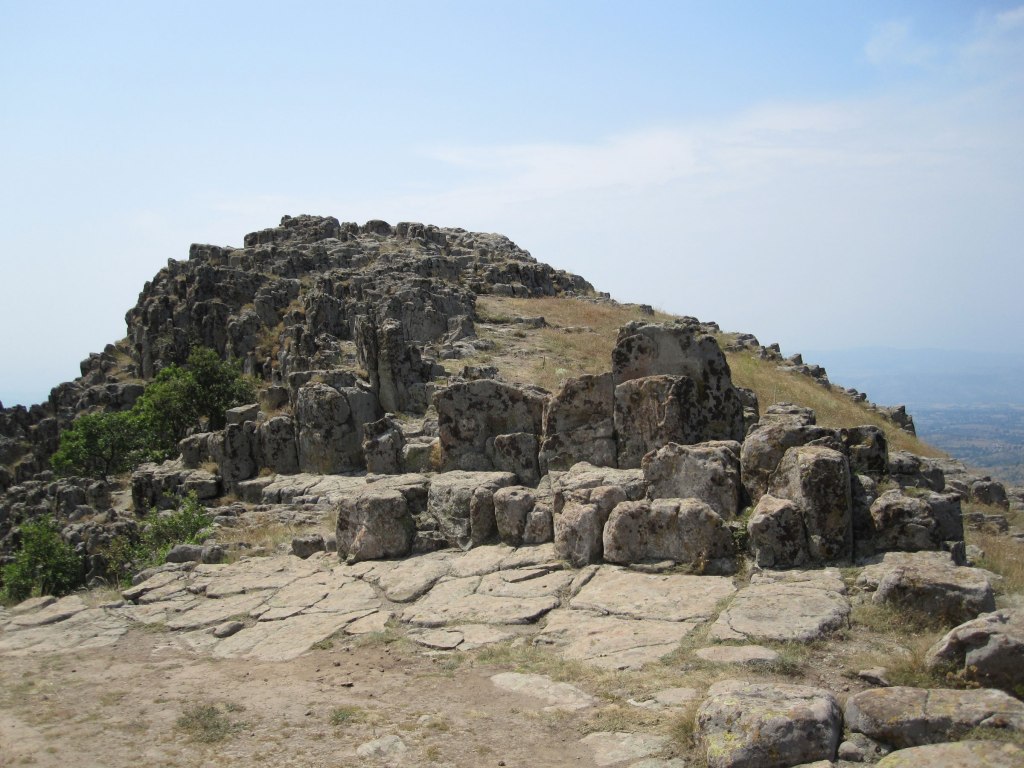
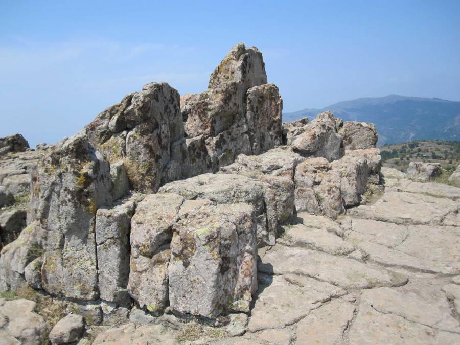
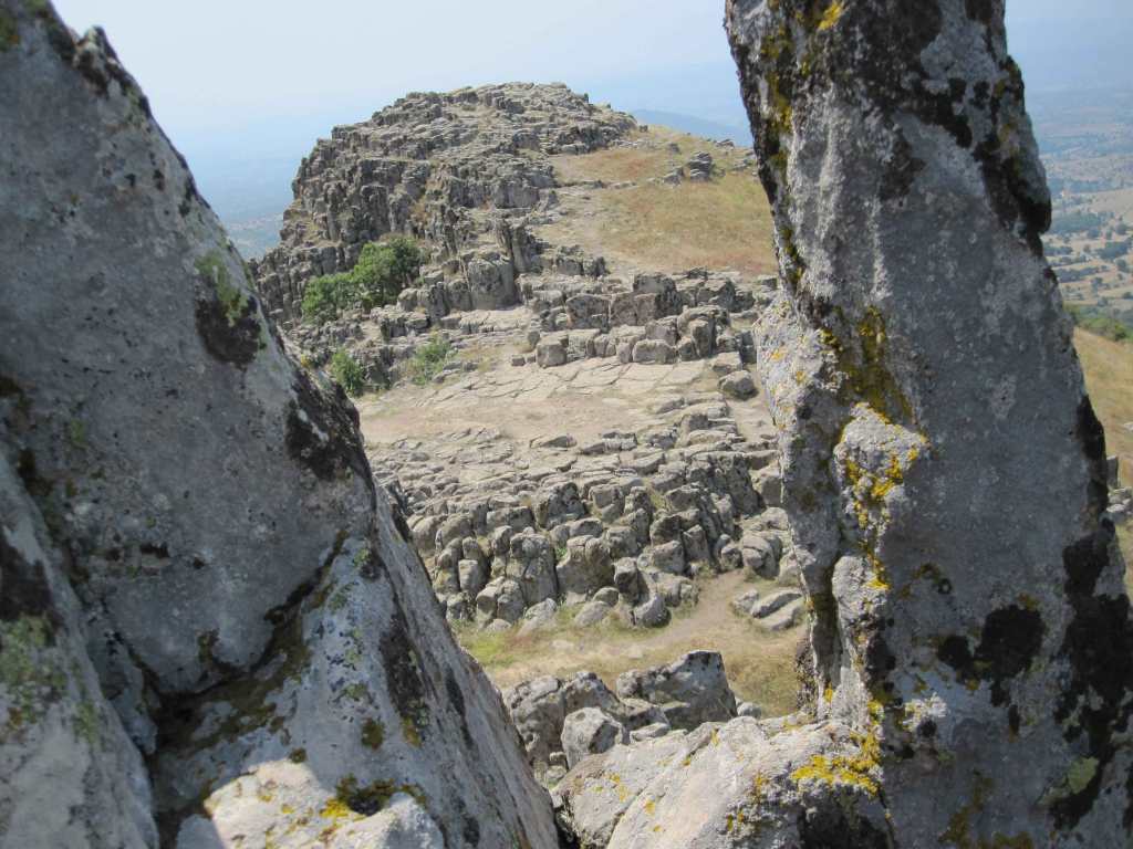
An obvious structure on the site is called “The Throne”, and resembles a big couch. This throne is faced to a rock formation in the east, over which the sun will rise. Certain (man-made?) stone markers in the rock formation are thought to mark the positions of the sun at the summer and winter solstice and spring and fall equinox.
Besides its function as an observatory, the site was likely used for ritual purposes as well. Figurine objects of humans and animals have been found here. Also ceramic vessels were found, and some of them are on display in the museum of Kumanovo.
When we arrived at the site, a man was sitting at the picnic table below the rock formation, and he was selling a small flyer with some information about the site (30 MKD, about 50 eurocents). Since he may not be there all the time, it is useful for you to get some information about Kokino before you go there. Especially information about how exactly the rock formation was used as an observatory is very useful, because you will probably not be able to determine the position of the solar markers by yourself. You can find a copy of the flyer below, or contact me and I will send it to you by email
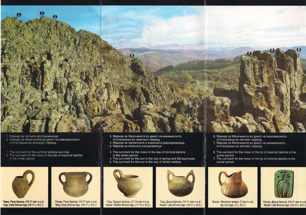
The arrows above the rock formation in the flyer indicate the markers that were used to study the sky. From left to right:
- Cut-mark for the moon in the day of maximal decline in the winter period
- Cut-mark for the summer solstice sun-rise
- Cut-mark for the moon in the day of minimal decline in the winter period
- Cut-mark for the sun in the day of spring and fall equinoxes
- Cut-mark for the moon in the day of minimal decline in the summer period
- Cut-mark for the sun in the day of winter solstice
- Cut-mark for the moon in the day of maximal decline in the summer period
I have copied the text on the flyer below

The archeological locality “Taticev kamen” occupies the greater part of the hill bearing the same name, which dominates the surrounding area, above the village of Kokino situated at its foot. It is connected with a road that runs between the villages of Arbnanasko and Dragomance, both of which belong to the municipality of Staro Nagoricane.
Archeological research, which started in 2001, revealed a lot of artifacts belonging to the Bronze Age. The finds dating from the Early Bronze Age (19th-17th century BC) and the Middle Bronze Age (17th-14th century BC) are not so numerous. The finds from the Late Bronze Age (14th-11th century BC) dominate numerically. The latest archeological research revealed traces of an Iron Age settlement (7th century BC) situated on the southern slope of the hill. This latest find showed that the locality was in use for more than 1200 years.
Taticev Kamen as a peak sanctuary
Some topographic characteristics of the locality (great visibility from the highest peak, which is accessible via a gently sloping path from the southern side of the hill) as well as the large amount of the archeological finds discovered within ritual structures and context, show that this locality was used as a peak sanctuary.
One of the rituals performed, was probably connected with the cult of fertility and the Great Goddess-Mother. During the ceremonies, vessels, which were probably full of offerings, were placed in the natural fissures of the rocks. After being deposited, the vessels were covered with earth and stones.
A second ritual was linked with the celebration of the sacred union between the celestial divinity, the Sun, and the Great Goddess Mother, personified as a rocky peak. This ritual was carried out on a particular day in the middle of the summer (today, that day coincides with the last day of July). On that day, the sun rose exactly behind the ritual cutting-mark and its rays, passing through the artificially made trench situated at a distance of about 20 m from the cutting mark, illuminated only one person amongst the participants in the ceremony, who sat on one of the stone thrones on the lower (western) platform of the locality. Both of the rituals were intended to produce fertility and the cyclic rejuvenation of nature.
Megalith Observatory
The ancient observatory of Kokino (named by the name of the village near the locality) is one of the most interesting features of this archeological locality. It occupies the highest part of the hill and includes cut-marks for characteristic sun and moon rises. The cut-marks of the sunrise on the days of the summer and winter solstices and of the spring and fall equinoxes can be seen from a specific area on the observatory.
The cut-markers of the minimal and maximal declination of the moonrise in the winter and in the summer, give the observatory a special importance.
The calendar that Kokino possessed was formed by marking the moonrises. It had a cycle of 19 years. Creating a calendar is a great accomplishment of the prehistoric inhabitants of this area, proof of good organization of the life and of their spiritual culture.

Whether or you understand and believe the role of this observatory or not, it is a cool rock formation to walk around, to enjoy the view, and to imagine the ancient civilization that once used this place.
When we visited, access to Kokino was still free. Nowadays (2025) it’s 100 denars (1.70 euros) for locals, 50 denars for children and 5 euros (!!) for foreigners.
