
There are three villages in the south-west of Macedonia called Konjsko: Gorno (Upper) Konjsko and Dolno (Lower) Konjsko at Lake Ohrid and Konjsko at Lake Prepa. While Gorno and Dolno Konsjko at Lake Ohrid are located close to each other, they are separated from Konjsko at Lake Prespa by the mountains of Galicica National Park.
Konsjko at Lake Prespa is the last village before the border with Albania, on the western shore of Lake Prespa. Dolno Konjsko lies directly at Lake Ohrid south of Ohrid, whiel Gorno Konjsko is situated in the hills overlooking Lake Ohrid.

This World War II Monument is next to the ruins of a school in Gorno Konsjko. The ruins remind of the battle of the Partisans against the Germans and the Italians. On June 9th 1943 the Partisans blew up the school building that was used by the Italian border patrol. The Partisans were members of the “Dame Gruev” group, named after a Macedonian freedom fighter against the Ottomans.

The church of St Mina is located on the local graveyard of Gorno Konjsko. Location: N41° 03′ 10.1″ E20° 48′ 46.1″.
Most houses in Gorno Konjsko are abandoned and in bad shape.
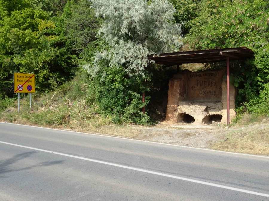
Just before you exit Dolno Konjsnko into the direction of Ohrid you can find this large Late Antique kiln for the production of ceramics, discovered in 1969 during construction works of a road leading from Ohrid to the Monastery of St Naum. Apart from the graffiti by hooligans the kiln is well preserved, located under a protective roof next to the modern road.
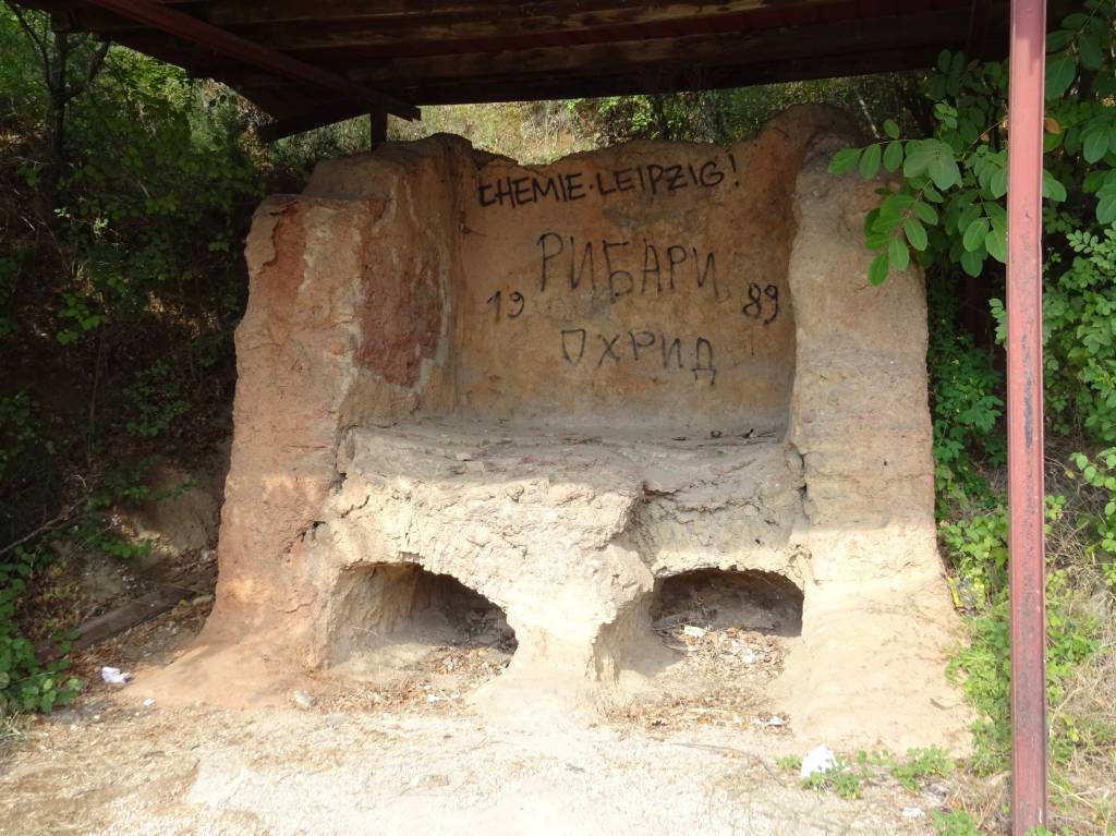
The kiln has a rectangular plan of side ca. 3 m and features two chambers. The preserved height is also about 3 m. Based on parallels from Bulgaria and Romania, it might be with a high probability dated to the 6th c. AD (!!!) and classed to the group of kilns producing bricks and roof tiles. It’s funny because I have passed this hidden gem several dozen times by car in the past, and I only noticed it after reading a scientific archaeological article (Source: Weissova, The Frontier Studies. Survey of the Northern Part of the Lake Ohrid Basin, Preliminary Report on the Season 2017, 2019, STUDIA HERCYNIA XXII/1, 99–133). Location: 41°03’53.7″N 20°48’05.3″E.
Several of the hikes that we did in Galicica National Park pass Konjsko, such as Velestovo-Konjsko-Elshani-Peshtani through Galicica National Park (14 km), Galicica National Park over the ridge (24 km) and Lagadin via Gorno Konjsko and Elshani (9 km).
