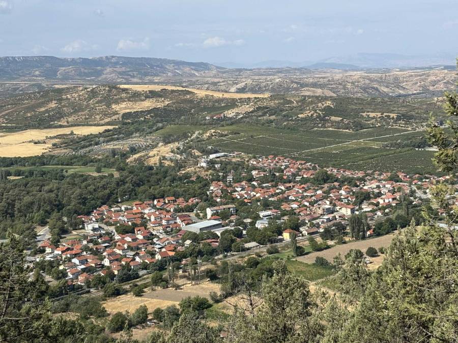
Demir Kapija is a village south-east of Negotino. It is famous because of the rock formations near the village, which are used by climbers. The river Vardar flows through a gorge between the mountains. Demir Kapija means “Iron Gate” and refers to the fact that the location was very good to defend; Foreign armies had to pass through the small gorge and were easily defeated. We visited Demir Kapija shortly in 2012 when we were staying in the Monastery of St George near Negotino. In 2025 we revisited and stayed for a couple of days in Asteris Apartments in Demir Kapija.
St Assumption of the Virgin Mary
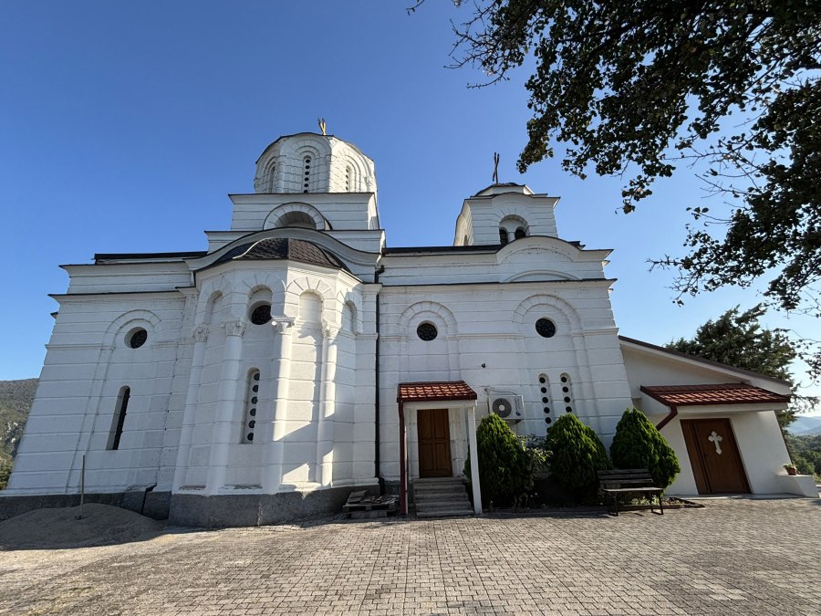
The Church St Uspenie na Bogorodica, also known as Church of St Assumption of the Virgin Mary or St Dormition of the Holy Mother of God is located on a hill in the west of Demir Kapija. The church is from 1937. Location: N41° 24′ 33.2″ E22° 14′ 12.3″
Museum of Demir Kapija
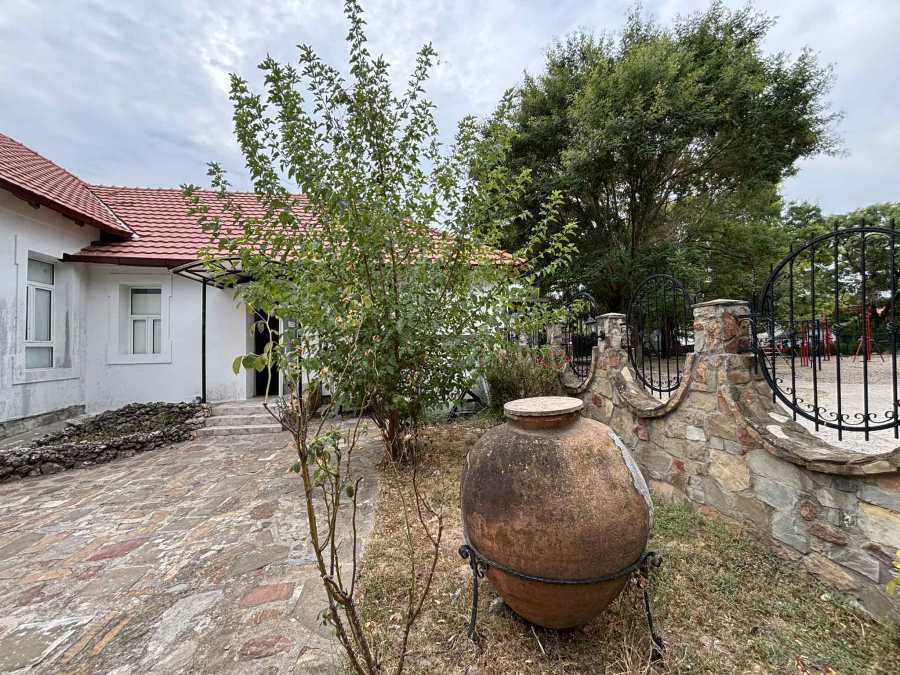
The Museum of Demir Kapija or Museum of Wine was a bit of a disappointment. It is very small and the collection is not very interesting. They were more interested in selling us expensive souvenirs and home-made rakija than in providing information about the archeological sites around Demir Kapija. Allegedly, the winner of the yearly rakija competition is allowed to sell its rakija through the museum. When I asked about the archeological site “Ramnishte“, where the ruins of an ancient fortress are, they told us that the site is prohibited to enter. Remarkable, on the square opposite to the museum, there is an information panel describing the hiking trail to this archeological site! Maybe the people in the museum want to prevent people from visiting the archeological sites to avoid wild diggers?
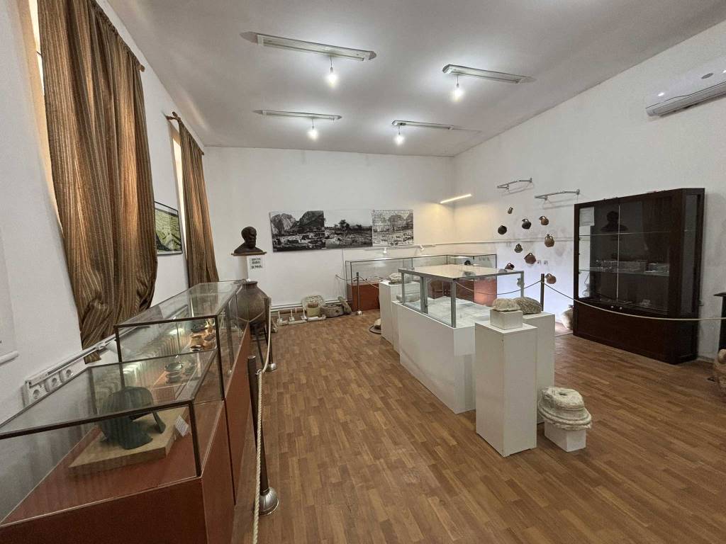
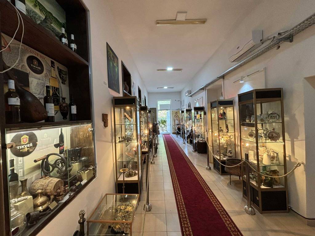
The pictures above basically summarize the whole museum. When asked about the location of the Gorno Zmejovec cave for which they had information flyers on display, nobody even knew about the existence of this cave! At least the museum was free, and I could not resist buying a liter of their rakija for 300 denars (5 euros). Location: N41° 24′ 30.9″ E22° 14′ 41.1″
Archeological sites
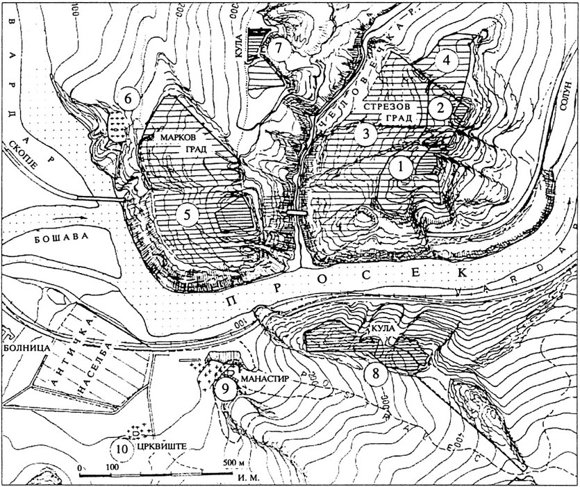
As a layman it’s a bit difficult to get a good overview of the archeological sites around Demir Kapija, so bear with me if not everything is 100% correct! The region is often referred to as “Prosek” or “Stenae” and consists of several individual archeological sites. The map above is taken from “Medieval cities and fortresses in Macedonia” by Ivan Mikulcic. See the links below for more detailed information about the individual sites.
We first visited the most impressive site, Markova Kula (#7), with very clear ruins of the tower and fortress. The hike to Markova Kula also passes some beautiful caves, named the Windows of Demir Kapija or Prozori Caves. This hike via the caves was relatively demanding, so if you are only interested in the archeological site it is probably better to visit the site of Markova Kula via the village of Koreshnica.

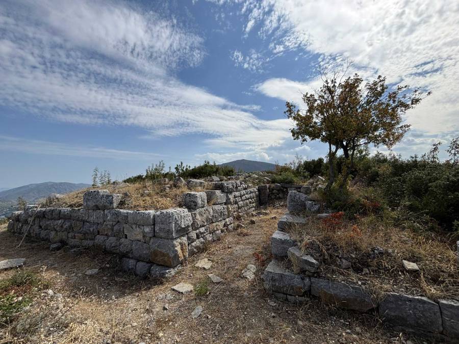
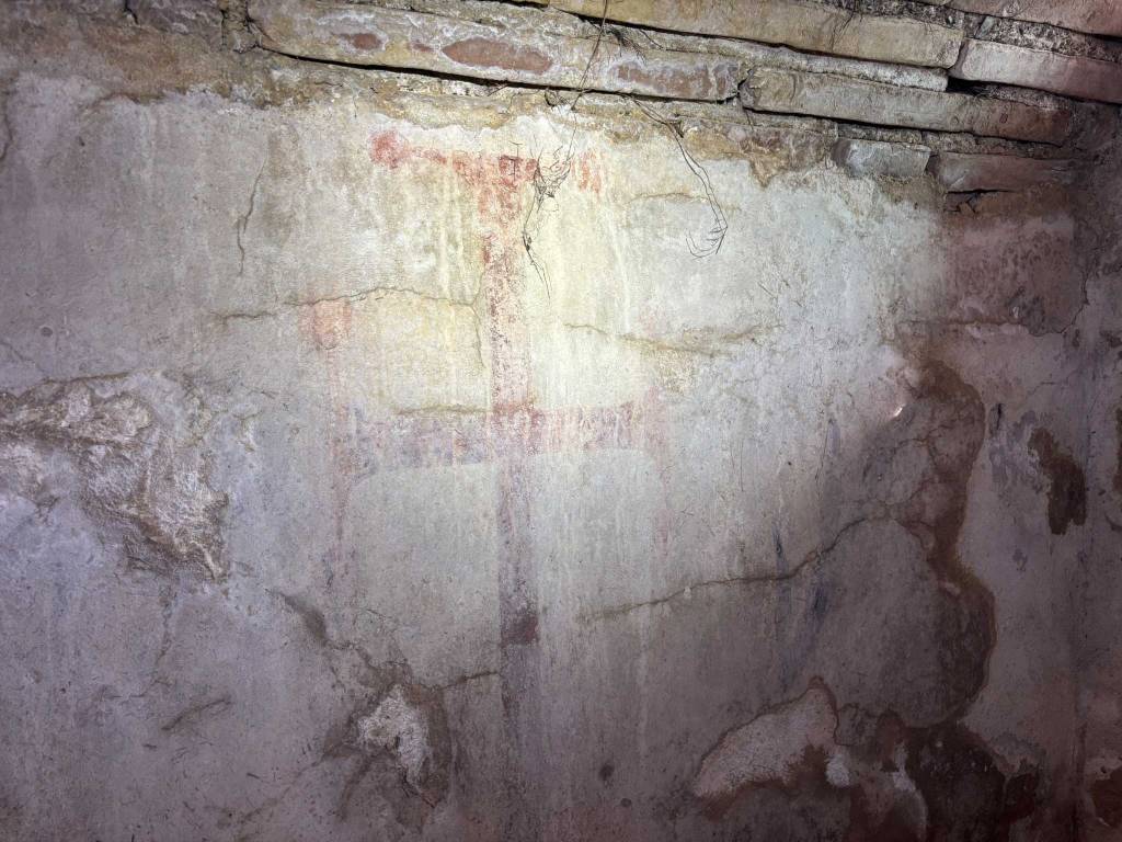
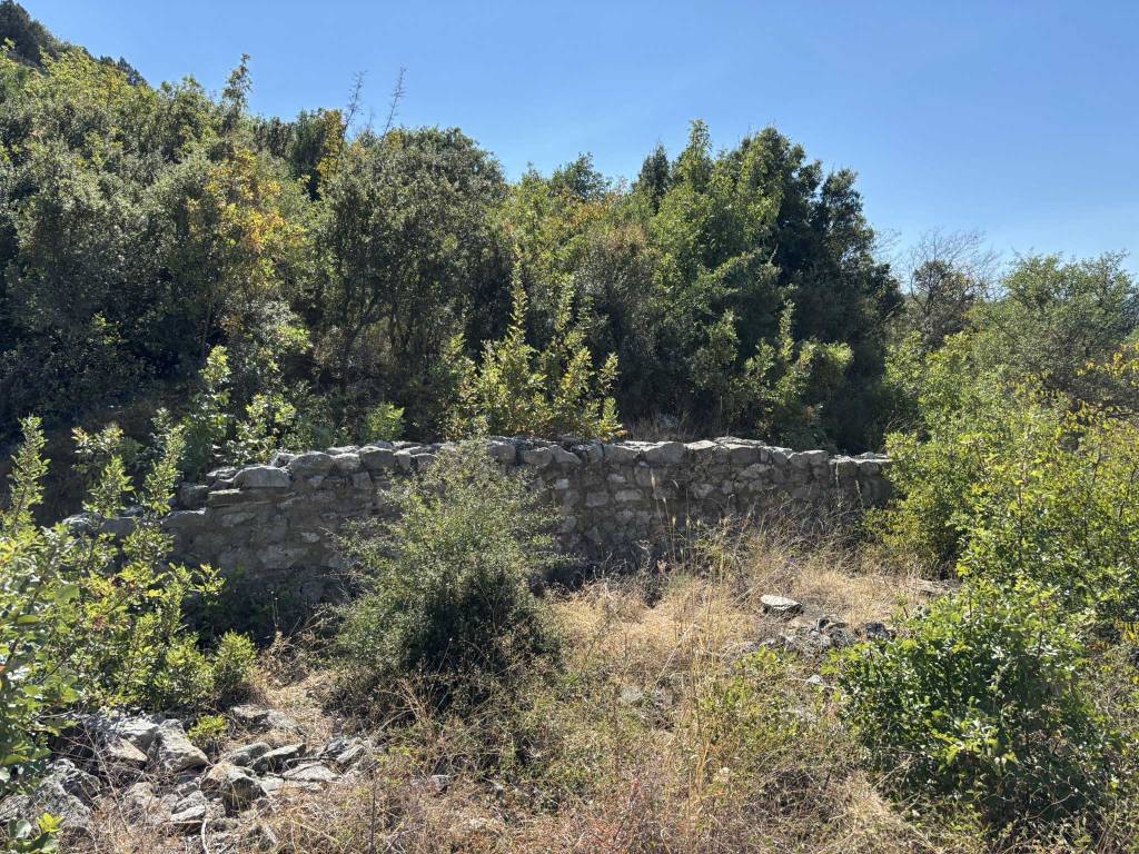
The Kale / Strezov Grad site (#1-4) was a big surprise, because besides the Zwinger Fortress we found the ruins of a basilica with an intact tomb. Even the painting in the tomb was preserved. It’s really amazing to find something like that out in the open, unprotected and accessible.

We also explored the sites with ruins of basilicas named Manastir/Monastery (#9) and Crkvishte/Church (#10) and combined this with a short hike to the Dolni Zmejovec (Lower Dragon) cave.
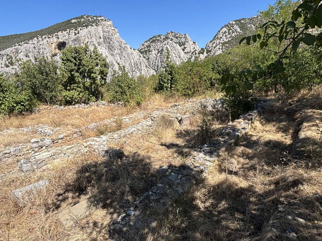
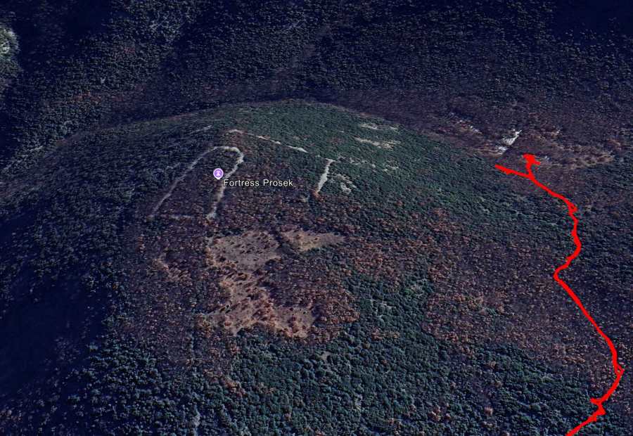
My quest to find the Ramnishte Fortress or Prosek Fortress on the hill overlooking Demir Kapija was less successful unfortunately. This site is not shown on the map above, but is about 1 km south of the Crkvishte and Manastir sites (#9 and #10). I got stuck in dense vegetation and could not find my way to the top of the hill where the Ramnishte Fortress is located. Hopefully better luck another time!
Black Walnut
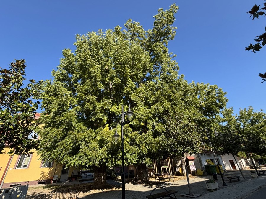
Opposite to the museum at the train station there are some black walnut trees. The information panel at the trees tells an interesting story:
The construction of the Thessaloniki–Skopje railway started in 1871. The section to Demir Kapija was opened in1873. The railway station in Demir Kapija was finished in 1875. The station also had an official space for the accommodation of the stationmaster and his family. The first stationmaster was Agostino Negroto, who after his arrival planted several trees, as was the custom at that time. He chose the black walnut (Juglans nigra) or Canadian walnut. It is the only known sample of this tree in Macedonia.

Under the trees there are several information panels describing hikes and sights in the area around Demir Kapija.
Hot Pools
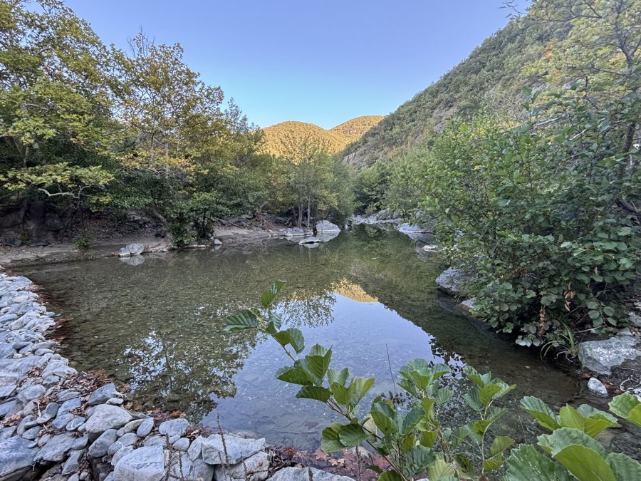
The Hot Pools, also named Warm Pools of the river Doshnitsa are located about 6 km from Demir Kapija, near the village Chiflik. The pools are formed by small stone dams in the river and heated up by the sun and surrounding rocks, not by geothermal activity as you might suspect. So they’re warm depending on the weather. We parked near the end of the asphalt road and walked to the pools. There are at least 5 of these warm pools along the trail, but we were just looking to relax and spend the afternoon at the first pool.
Macedonian Forest Office

In 2012 a temporary nation-wide ban to enter the forests was proclaimed due to forest fires. The fine of 3000 euros made it not very attractive to to ignore this ban! However, at the Macedonian Forest Office (Makedonski Sumi) it was possible to obtain personal and temporary permits for individuals, although the authorities in charge most of the times were not aware of the possibilities and exact rules. We obtained a permit for our hike from Demir Kapija to the village Koresnica without many problems from the local Forest Authorities in Demir Kapija. The people were very friendly, we were offered coffee and the permits were arranged swiftly. They did not speak English though. They also told us about the nearly Bela Voda Cave (White Water Cave) and arranged a local man (his name was Dejan) to take us there. The Macedonian Forest Office is right at the (north) town limit of Demir Kapija, surrounded by a green fence. Address: Marsal Tito bb Directions: N41.41410 E22.23784 Phone: +389(0)43366 236/703; Website: http://www.mkdsumi.com.mk
Bela Voda Cave
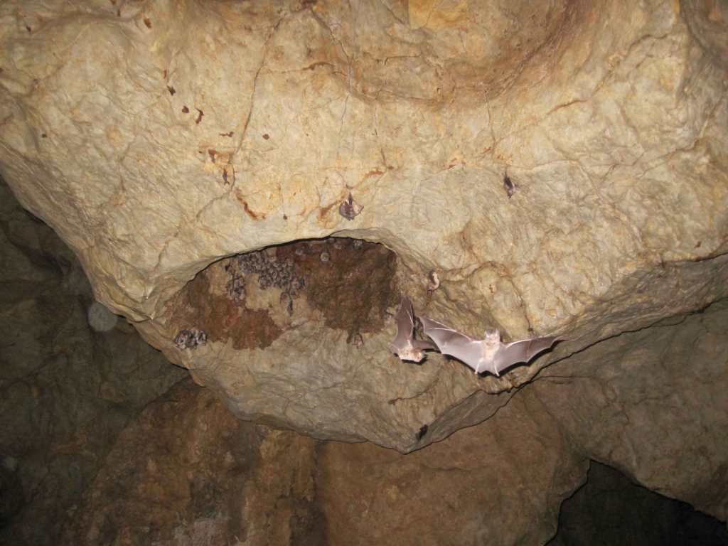
Our visit to the beautiful Bela Voda Cave was completely unexpected. We did not know about the cave until an employee of the Macedonian Forest Office told us about it. They arranged for a local guide called Dejan to take us there. It was a good thing that we had headlights with us, because there is no artificial light in the cave.


The entrance of the cave is a few hundred meters after the German tunnel from the first world war (see below). When Dejan showed us the entrance, we immediately got second thoughts about our visit! The entrance is very small, you have to crawl to a tiny hole to enter the cave. And what would await us further down the cave?? Dejan assured us that it soon would get better and that you even could easily walk in the cave. We took his word for it and crawled into the cave. And he was right, almost immediately after the entrance we could stand upright. The cave is very long, 955 meters! This is pretty impressive, although there are no spectacular stalagmites or stalactites. It’s the size that matters!

We could walk through most of the cave with minimal crawling. After maybe 600 meters we would have to crawl again through a very tiny space that was caused because part of the cave had collapsed during an earthquake, according to Dejan. We decided that this was a good point to return to the entrance!
The cave houses many bats, as can be seen on the picture. Just near the entrance there also a cute little frog that scared my girlfriend 🙂

Bela Voda is translated as White Water. Allegedly parts of the cave fill up with water after rainy periods. It is a good idea to travel light when you visit the cave, because backpacks will hinder you while crawling through the smaller parts. We had our backpacks with us but left them inside near the entrance of the cave, so they would not bother us. And take a good flashlight or headlight. There is at least one other cave in the neighborhood of Demir Kapija, but unfortunately we did not have time to visit it. I would advice to only enter this cave with a local guide. The people from the Macedonian Forest Office likely can help you find one. Directions: N41.40479 E22.26445
Prozori or Windows cave

We visited the Prozori or Windows of Demir Kapija Cave during the hike to the Markova Kula Fortress. The trail to the cave is a bit steep and good shoes and hiking sticks are recommended. There are several other smaller caves that you can visit during this hike.
Dolni Zmejovec Cave

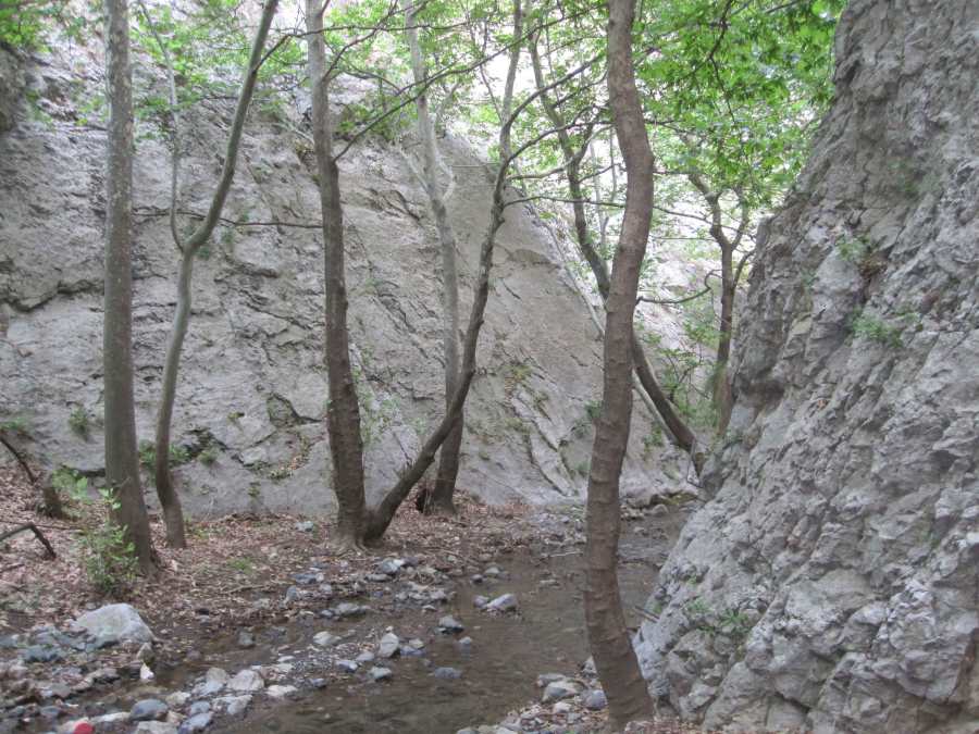
There allegedly are two caves named “Zmejovec” or Dragon near Demir Kapija: The Gorni (Upper) or Golem (Big) Zmejovec cave is rich in cave decorations and is considered an archeological site as well, because artefacts have been found in this cave dating back 2000 years. Unfortunately I did not succeed to find the location of the Gorni Zmejovec Cave. The Dolni (Lower) Zmejovec cave was easier to find. Unfortunately, this cave doesn’t have cave decorations and is not very deep. But it is on a nice location with good views and the visit can be combined with the archeological sites Manastir and Crkvishte.
Tunnel from First World War

This tunnel was build during the first world war by the Germans. The tunnel looks pretty impressive inside, the walls are very rough. Above the entrance it is written in the rocks: “Wilhelm II Deutscher Kaiser Konig von Preussen befahl seinen soldaten diese strasse zu bauen 1916”


Translated “Wilhelm II German emperor and king of Preussen ordered his soldiers to build this road in 1916”. Not far after the tunnel are the Bela Voda Cave and the Crksvishte and Manastir archeological sites. Directions: N 41.404221 E 22.258967
German Defense Tower from WWII

This remarkable tower next to the railroad likely is a German defense tower from the Second World War. The building is made out of red bricks with a swastika on the wall and a “V” underneath it. I believe it is locally known as “Kula” (Tower). Location: N41° 24′ 20.3″ E22° 14′ 56.8″
Klisura Cactus Valley

When you’re in Demir Kapija in the spring or summer, don’t miss the Cactus Valley in the nearby village Klisura. The Cactus “Valley” actually is located on a small hill. It is believed that the cacti originate from seeds left by migratory birds. However, it is also possible they were introduced by humans. There’s a 19th century church decicated to St Nikola as well in Klisura.
Demir Kapija to Koreshnica Hike
This hike is described in the Bradt Travel Guide Macedonia by Thammy Evans, second edition 2007. The hike starts at the parking place between the two tunnels of the M1/E-75 road near Demir Kapija. See here for detailed information about this hike.
