
The archeological site Antigona, also spelled Antigoneia, Antigone or Antigonia, is located on a hill at the northern entrance of Negotino. The site is on top of the hill that displays the name of the town “NEGOTINO” in big white stone letters. A huge advertisement for Tikves Winery marks the spot as well. Directions: N41.50329 E22.09934
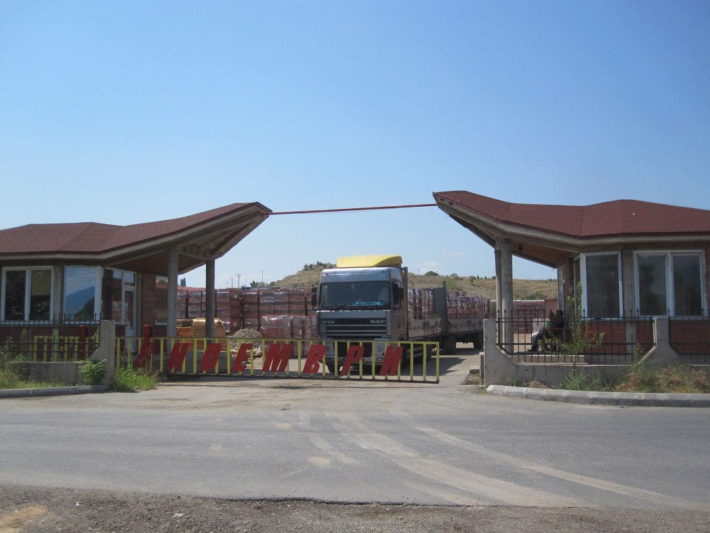
In order to reach the site, we asked permission to enter the premises of the brick factory “8 Noemvri” at the foot of the hill, as this seems to be the only way to access the hill.

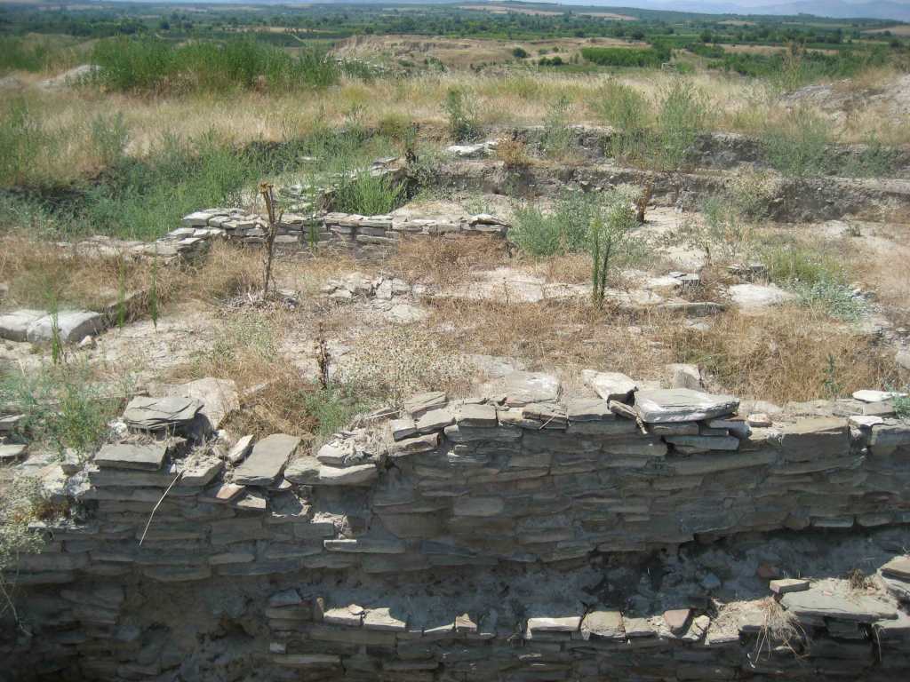
An interesting observation is that Ne-go-ti-no appears to be An-ti-go-ne spelled backwards. We were told that this name-change may have been done in order to mislead the Ottoman occupier (which apparently were not that smart if this is true :-). The site is thought to represent the ancient city founded by the Macedonian King Antigonus Gonat (277-240 BC). The ancient village was likely destroyed during the big earthquake that hit Macedonia in the 6th century. When we were there in 2012 the site was slightly overgrown with weeds and there actually was not much to see.
The following is interesting information about the site that I found on a program for students and volunteers who helped excavate the site in 2012 ( see http://media.leidenuniv.nl/legacy/antigoneia-programma.pdf).
The site is located on a high hill at the northern entrance of Negotino, with strategic position overlooking the valley of river Vardar and the wider area of Negotino ravine. On the flattened plateau remains of a defensive wall can be seen. They surround an area of about 3.5 hectares, yet numerous fragments of ceramics and other finds from various chronological periods are found not only on the plateau but in the nearest surrounding area as well, that give us different impression of the size of this ancient town.
From the sporadic excavation campaigns in the 90’s, and later in 2005-2007, we have knowledge of existence of several stratigraphic layers belonging to different chronological periods – from Classical to the Late Antique Period. According to the information from the earliest excavations on the site, test trenches at certain positions on the plateau have revealed remains even of earlier – prehistoric habitations.
It is very interesting that beside its size, strategic position in this region and chronology, the name of this ancient town remains unknown. Among the theories regarding its identification most popular is the one that relates this site to ancient Antigoneia – a town named by Macedonian king Antigon Gonatas, in the third century BC. Antigoneia on Axios is mentioned on the famous map Tabula Peuntingeriana, one of the most important ancient sources for the geography of the Balkans. On this map Antigoneia is located 12 Roman miles downstream from Stobi and 11 miles upstream from Stenai, and these distances correspond best to the position of Gradiste near Negotino.

Yet, there are different opinions about the location of Antigoneia. Papazoglou thought that the town could be located on Budur Ciflik or on the opposite hill Tremnik (Gradishte Czair). Kazarov and Vulic also thought that the town could be located on this hill. According to another theory Antigoneia was on the position of modern town Negotino but archaeological chance finds from Negotino belong mainly to the Roman times. This identification was rejected by prof. Mikulcic who surveyed the whole area in the 1980’s and has made the most cogently argued contribution to the problem so far. Mikulcic suggested that the town lay on the hill Gradishte. His strongest argument is the distance of Gradishte from Stobi and from Stenai (present Demir Kapija). They both correspond to the distances given in Tabula Peuntingeriana. The position of the hill on the left bank of river Vardar is additional fact that in support of this theory.

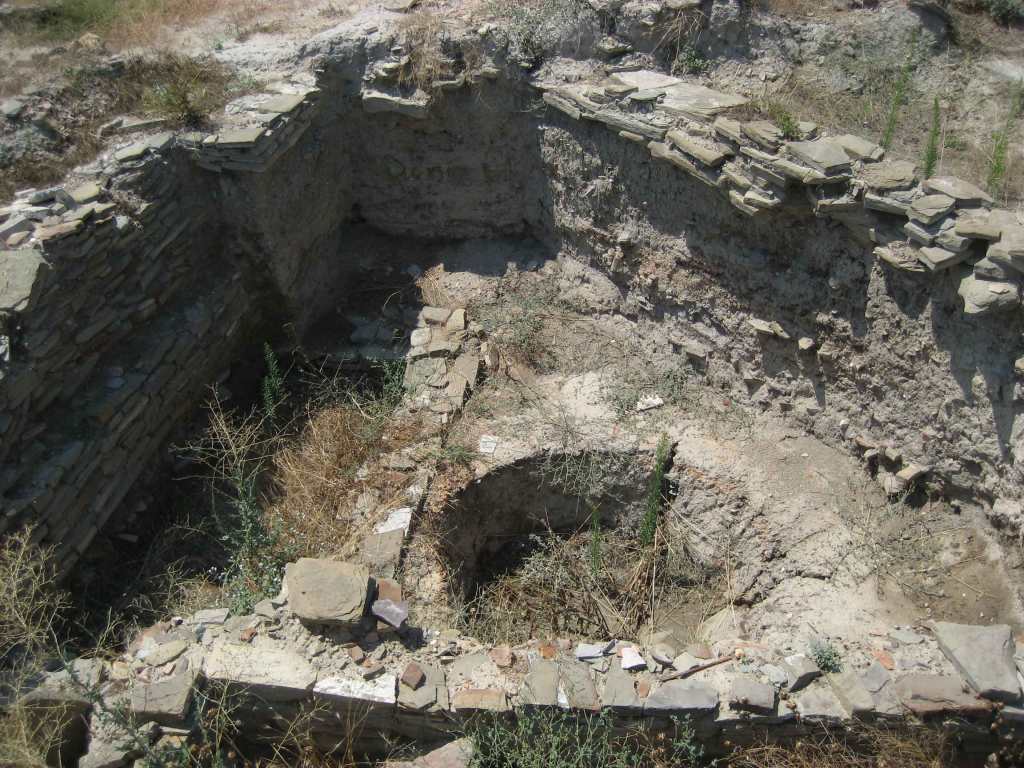
The “quest” for ancient Antigoneia is a never ending challenge. Since 2006, the excavations of the local museum in Negotino brought to light large part of the late roman fortification. On the lower terrace few trenches discovered part of ancient necropolis while on the upper plateau remains of buildings and streets attracted the attention of scientists and public. These finds were the reason for the start of an international long term excavation project at Gradishte, in 2009. Coordinated by the National Museum of Macedonia in Skopje and the local museum of Negotino “Institute for classical and oriental studies from Valencia” (IVECO) in Spain, Gdansk University from Poland the project aim is to determine the character of the settlement (civil, military, etc), its urban plan and chronology, and finally to possibly identify this doubtfully important ancient town. These excavations will also contribute to the promotion not only of the site but of the local region of Negotino Municipality, and the archaeology of the Republic of Macedonia as well.
